Download

1 / 14
140 likes | 396 Vues
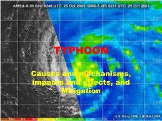
UPDATE 6 | TROPICAL CYCLONE UPDATE. Typhoon GLENDA ( Rammasun ). UPDATE 6 | TROPICAL CYCLONE UPDATE. Batanes. HABAGAT (Southwest Monsoon). Severe Tropical Storm GLENDA ( Rammasun ). Forecast to make landfall across Bicol tomorrow Storm may directly hit Metro Manila by Wednesday morning.

E N D
UPDATE 6 | TROPICAL CYCLONE UPDATE Typhoon GLENDA (Rammasun)
UPDATE 6 | TROPICAL CYCLONE UPDATE Batanes HABAGAT (Southwest Monsoon) Severe Tropical Storm GLENDA (Rammasun) • Forecast to make landfall across Bicol tomorrow • Storm may directly hit Metro Manila by Wednesday morning Red Area under Immediate Threat Philippine Area of Responsibility Wednesday AM Tuesday AM MondayPM Tuesday PM Unofficial Forecast Track and Cone of Uncertainty Area of 65kph winds JMA-Tokyo’ s Forecast Track Current Information (Based on 6 WestPac Agencies) 8 am today – 13.2°N, 130.5°E 680 km E of Virac, Catanduanes, PH Max Winds 105 kph gusting to 125 kph Moved West at 31 kph over last 6hrs Forecast to move West at 27-30 kph Public Storm Warning Signals SIGNAL #1 - Batanes Island Group Public Storm Warning Signals All LOWERED
TROPICAL DISTURBANCE WATCH Monday, 28 July 2014 Possible rain event (moderate to heavy) this weekend Storm Formation in the next 24 hours? LIKELY at 63% chance Philippine Area of Responsibility Disturbance WP32 (Invest 90W) [Tokyo minor TD, JTWC Formation Alert] 8 AM today – 11.9°N, 150.1°E 600 km East-Southeast of Guam, USA Moving West-Northwest slowly Forecast movement Disturbance 00D (Tropical Wave) Philippine Area of Responsibility Potential Track Area Agency Status JMA-Tokyo – Minor Tropical Depression KMA-Seoul – Tropical Depression CWB-Taipei – Tropical Depression PAGASA-Manila – Active LPA HKO-Hongkong – Low Pressure Area JTWC-Hawaii – L Forecast movement Disturbance WP28 (Invest 96W) [Tokyo, Thailand and Taipei minor TD] 8 AM today – 17.4°N, 133.7°E 1210 km East of Northern Luzon Moving Northwest slowly HABAGAT (Southwest Monsoon) Storm Formation in the next 24 hours? LIKELYat 62% chance Images Courtesy of US NRLMRY | Graphics made by ManilaTC TROPICAL DISTURBANCE WATCH | Storm formation in 24 hours? MEDIUM chance at 50% JMA-Tokyo upgrades to a Tropical Depression (<30kt)
SOUTHWEST MONSOON FORECAST Period ending Wednesday AM, 28 July 2014 Storm Formation in the next 24 hours? LIKELY at 65% chance Rainfall Probability Map for 24-48 hrs From Weather-Manila 48 hr forecast wind map with precipitable water Area of low wind shear Forecast movement 48 hr Rain accumulation From GFS model Disturbance WP30 (Invest 98W) has dissipated… Southwest Monsoon Disturbance 96W forecast to enhance the SW Monsoon as it tracks NW towards Southern Japan Images Courtesy of : Cameron Beccario’searthschool Tropical Tidbits Weather-Manila Notes: - JMA-Tokyo and CWB-Taiwan say system is a minor Tropical Depression - WP28 encountering moderate Wind Shear
Storm Formation in the next 24 hrs? LIKELY at 65% chance Storm Formation in the next 24 hrs? FAIR at 40% chance Upper-Level Low Forecast movement Forecast movement Monsoon Trough Clouds sheared by upper low Disturbance WP28 (Invest 96W) [Japan and Taiwan: minor TD] 8 AM today – 14.4°N, 134.5°E 1390 km East of Central Luzon Max winds 25 kts (45 kph) Drifting North at 7kph Disturbance WP31 (Invest 90W) 8 AM today – 14.4°N, 134.5°E 1000 km East of Guam USA Max winds 15 kts (25 kph) Moving North at 11 kph FOR GRAPHICS USE ONLY Daytime Sunday , 27 July 2014
TROPICAL DISTURBANCE WATCH Disturbance WP31 (Invest 90W) Storm Formation in the next 24 hours? LIKELY at 69% chance Area of high wind shear Guam, USA Area of low wind shear Forecast movement Disturbance WP28 (Invest 96W) 8 PM today – 12.0°N, 134.7°E 1090 km East of Northern Samar Max winds 25 kts (45 kph) Drifting North at 7 kph Disturbance WP30 (Invest 98W) has dissipated… Pohnpei Island Notes: JMA-Tokyo and CWB-Taiwan say system is a Minor Tropical Depression Image Courtesy of US Navy NRL NEXSAT | Graphics made by ManilaTC
MONSOON (Habagat) ADVISORY Wednesday, 11 June 2014 Tropical Depression ESTER (TC07) GFS model 48h rain until Friday PAGASA Gale Warning Area PAGASA LPA (08D) Moderate to Heavy Rain HABAGAT (Southwest Monsoon) • Current Monsoon Intensity • PAGASA LPA beginning to influence Habagat more than ESTER • Gale force winds (40-50 kph) across Northern Luzon • Winds of 20-40 kph across Western sections of Central and Southern Luzon Light to Moderate Rain • Image Credits: • Google Earth • Overlays from JMA (Satellite), Climate X (Radar), TRMM (3hr rain) • Rain forecast from Tropical Tidbits
2-day RAINFALL FORECAST (ECMWF Model) Tropical Depression CALOY (TC04/94W) Heavy to Intense -- NE Mindanao Moderate to Heavy -- East Visayas Image Courtesy of Ryan Maue
2-day RAINFALL FORECAST (GFS Model) Tropical Depression CALOY (TC04/94W) Images Courtesy of Tropical Tidbits, TRMM Rainfall Measurement
PAGASA-Manila STORM WARNING SIGNALS Tropical Depression CALOY (TC04/94W) Graphics by ManilaTC | Taken from PAGASA 5pm Warning
A METRO MANILA DIRECT HIT? Category 3 Typhoon GLENDA (Rammasun) WHAT TO EXPECT AT GLENDA’S TRACK Predicted Speed 18-24 kph - TYPHOON EYE is 35 km wide! (White Circle) - TYPHOON FORCE WINDS of OVER 120 kph : 90 km radius (Red) TYPHOON CONDITIONS – between 4 am to 6 am FRONT EYEWALL – between 5 am to 8 am EYE PASSAGE – between 7 am to 9 am BACK EYEWALL – between 8 am to 10 am END OF TYPHOON CONDITIONS – between 9 am to 11 am