Download
1 / 21
220 likes | 342 Vues
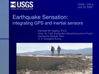
Integrating GPS with rotational and inertial sensors Early Warning & DamageMap. Kenneth W. Hudnut, Ph.D. Geophysicist USGS, Pasadena Measuring the Rotation Effects of Strong Ground Motion USGS, Pasadena 16 February 2006. San Andreas fault. 35 mm/yr slip rate; >70% of plate motion

E N D
Integrating GPS with rotationaland inertial sensorsEarly Warning & DamageMap Kenneth W. Hudnut, Ph.D. Geophysicist USGS, Pasadena Measuring the Rotation Effects of Strong Ground Motion USGS, Pasadena 16 February 2006
San Andreas fault • 35 mm/yr slip rate; • >70% of plate motion • 1685, 1857 eq’s • SoCal is now well ‘wired’ • Likely source of most future ‘Big Ones’ • Fault physics experiment • GPS/INS in near-field • ALSM & DG scan ‘net’ • Great place to test EEW • Build “zipper” arrays • Cholame - Simmler • Coachella Valley
GPS network infra- structure forms a foundation for real-time structural damage detection and response • Telemetry upgrades • Algorithm develop- ment and testing • Implementation
Sensor technology GPS Gyro Accelerometer position displacement velocity acceleration Frequency response
Gyros Proper transducers for the EEW job:borehole strain, tilt, strong motion, GPS, gyros? GPS Gyros Langbein & Bock (2003) Courtesy of John Langbein (USGS)
GPS/INS (RLG) inairborne imaging: • GPS aircraft trajectory relative to ground-based GPS array • INS (gyro) for aircraft attitude • Laser mirror and/or camera position and orientation very well known • New imaging capabilities (also for satellite imagery)
Sagnac Interferometer Designed to sleep for decades then wake up quickly and perform flawlessly for several minutes RLG’s & FOG’s
Gyros and MEMS with GPS • Stable gyro technology is costly but MEMS-gyro and FOG are lower cost and approaching accuracy Barbour & Schmidt, 1998
San Andreas - place two betsboth ~120 km from Los Angeles (LA) Coachella Valley segment is ~60 km to San Bernardino L A
Lone Juniper Ranch and Frazier Park High School Prototype GPS fault slip sensor; up to 10 Hz Spans the San Andreas fault near Gorman, California
GPS high-rate (1 Hz) analysis • Larson, Billich and Choi - see Ji et al. • Sidereal filtering (Larson, Choi) • Stacking (Billich) • Significant reduction in long-period drift • Compares well now with our static GPS displacements
Doubly-integrated seismic vs. GPS for Parkfield 2004 (co-located @ PHOB) Raw GPS solution in blue Filtered GPS in green Seismic in red (Boore) These show results prior to final GPS analysis step of stacking, shown previously
Simplifying assumptions… Sensor technology exists: Inertial BB seismic, accelerometers, gyros GPS - will keep improving Telemetry technology exists
San Andreas - instrument majorlifeline infrastructure crossings L A
Courtesy of Erdal Safak (USGS)
Factor Building at UCLAPrototype for DamageMap PI’s Erdal Safak, Monical Kohler and Paul Davis
Initial GPS Data from Factor Building Y RMSE = 5 cm X RMSE = 9 cm 100 times better than normal GPS accuracy (SPS now near PPS performance of 6-20 m @ 95% w/ S/A off) Available worldwide $1400/yr.
Summary • Future earthquake monitoring systems will allow faster and better response • Tools support rapid and accurate decision-making by emergency responders • Fault Slip Sensor and DamageMap concepts • Measure fault slip or structural damage directly - don’t need to know anything else - ‘quick & easy’ and simple, robust reliable design • obtain more accurate displacement observations, esp. at lifeline fault crossings • new instrumentation for dynamic and static displacement address deficiencies due to double-integration of accelerometer records • Same R&D effort as for DamageMap instrumentation - now under way with USGS Venture Capital and ANSS start-up funds, but major funding and long-term support for implementation has not yet been identified • We are far from being prepared for a Big One in California - it is time to “step it up” - use new technology, fix problems ahead of time
Ken Hudnut Dept. of the Interior - U. S. Geological Survey 525 South Wilson Ave. Pasadena, CA 91106 626-583-7232 hudnut@usgs.gov