Download
1 / 10
100 likes | 251 Vues
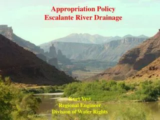
Feather River Drainage System. Prepared for NERDS 2006 Pamela Cantrell, Ph.D. To Increase Your Understanding…. These slides presents the BIG PICTURE of the Feather River You might want to print the previous slide and tape it in your field journal for reference in the field

E N D
Feather River Drainage System Prepared for NERDS 2006 Pamela Cantrell, Ph.D.
To Increase Your Understanding… • These slides presents the BIG PICTURE of the Feather River • You might want to print the previous slide and tape it in your field journal for reference in the field • Go through these slides with a map in front of you and trace the routes—the Portola map you received will help only for the Middle Fork of the Feather River—the site for our study
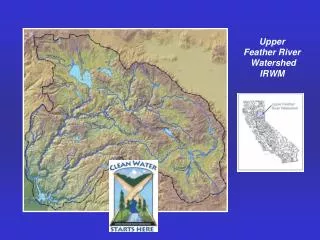
Facts About the Feather River • Principal tributary of the Sacramento River in Northern California • Drains part of the northern Sierra Nevada Mountains and a small portion of the middle part of the Sacramento Valley • Provides a water source for central and southern California through aqueducts in the Central Valley
General Description The river rises in three separate forks in the Sierra Nevada which unite as arms of the Lake Oroville reservoir in eastern Butte County. The combined stream flows generally south across the Sacramento Valley and joins the Sacramento River about 20 miles NNW of Sacramento
North Fork • Rises in several creeks south of Lassen Peak in NW Plumas County • Flows southeast through the Lake Almanor reservoir, then SW through the Sierra Nevada • Receives the East Branch North Fork from the east near Belden. • Flows SE into Butte County, becoming the northern arm of Lake Oroville.
East Branch of the North Fork • Headwaters in eastern Plumas County, south of Honey Lake, as Last Chance Creek (not the Little Last Chance that flows out of Frenchman’s Lake) • Flows westward through Plumas National Forest, through Indian Valley, becoming Indian Creek and the East Branch of the North Fork • Joins the North Fork near Belden
Middle Fork • Rises in SE Plumas County in the Sierra Valley SE of Beckwourth • Combines with the short North Branch (Grizzly Creek) and the Sierra Branch in an inverted delta • Flows NW through the Sierra Nevada, past Blairsden, then WSW through the Plumas National Forest • Becomes the middle arm of Lake Oroville
South Fork • Rises in the mountains along the Plumas-Sierra county line and flows WSW • Becomes the south arm of Lake Oroville
References • http://www.feather-river-crm.org/monitoring.html visit this site for the map shown on slide #2, monitoring information, and a brief history of the region • Wikipedia