Download
1 / 94
940 likes | 944 Vues
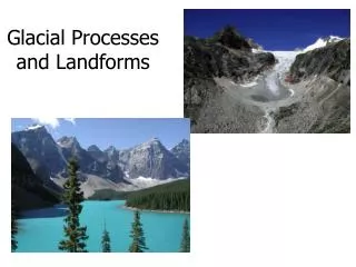
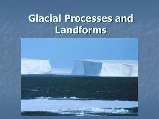
This chapter explores glacial landscapes, including glaciated valleys, drumlins, eskers, and ice-conditioned landforms. It also discusses the interaction of humans with icy landscapes and examines glacial superfloods, using the Altai Mountains in Southern Russia as an example.

E N D
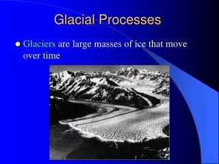
Sheets, caps, and rivers of ice flow over frozen landscapes; seasonal meltwater courses over landscapes at the edges of ice bodies. This chapter covers: • ice and where it is found • glaciated valleys and other landforms created by ice erosion • drumlins and other landforms created by ice deposition • eskers and other landforms created by meltwater • ice-conditioned landforms • humans and icy landscapes
Meltwater in action: glacial superfloodsThe Altai Mountains in southern Russia consist of huge intermontane basins and high mountain ranges, some over4,000 m. During the Pleistocene, the basins were filled by lakes wherever glaciers grew large enough to act as dams.Research in this remote area has revealed a fascinating geomorphic history (Rudoy 1998). The glacier-dammedlakes regularly burst out to generate glacial superfloods that have left behind exotic relief forms and deposits – giantcurrent ripple-marks, swells and terraces, spillways, outburst and oversplash gorges, dry waterfalls, and so on.Thesefeaturesare‘diluvial’inorigin,meaningtheywereproducedbyalargeflood.TheyarealliedtotheChanneledScabland
Plate 10.1Giant current ripples in the Kuray Basin, Altai Mountains, southern Siberia.(Photograph by Alexei N. Rudoy )
featuresof Washingtonstate,USA,whichwereproducedbycatastrophicoutburstsfromglaciallakeMissoula.Theoutburstsuperfloods discharged at a rate in excess of a million cubic metres per second, flowed at dozens of metres a second, andsome stood more than a hundred metres deep. The super-powerful diluvial waters changed the land surface in minutes,hours, and days. Diluvial accumulation, diluvial erosion, and diluvial evorsion were widespread. Diluvial accumulationbuilt up ramparts and terraces (some of which were made of deposits 240 m thick), diluvial berms (large-scale counterpartsof boulder-block ramparts and spits – ‘cobblestone pavements’ – on big modern rivers), and giant ripple-marks with wavelengths up to 200 m and heights up to 15 m (Plate 10.1). Some giant ripple-marks in the foothills of the Altai,between Platovo and Podgornoye, which lie 300 km from the site of the flood outbursts, point to a mean flood velocity of 16 m/s, a flood depth of 60 m, and a discharge of no less than 600,000 m • 3 • /s. Diluvial super-erosion led to the formationofdeepoutburstgorges,open-valleyspillways,anddiluvialvalleysandoversplashgorgeswherewatercouldnotbecontained withinthevalleyandplungedoverthelocalwatershed.Diluvialevorsion,whichoccurredbeneathmightywaterfalls,forcedout hollows in bedrock that today are dry or occupied by lakes.
GLACIAL ENVIRONMENTS • The totality of Earth’s frozen waters constitutes the • cryosphere • . The cryosphere consists of ice and snow, which is present in the atmosphere, in lakes and rivers,in oceans, on the land, and under the Earth’s surface(Figure 10.1). It constitutes less than 2 per cent of thetotal water in the hydrosphere, but glaciers and per-manent snow account for just over two-thirds of allfresh water (Table 10.1). At present, glaciers cover about10 per cent of the Earth’s land surface, and pack orsea ice coats about 7 per cent of the ocean surface (dur-ing winter conditions, when such ice is at its maximumextent). Most of the glacier ice is confined to polarlatitudes, with 99 per cent being found in Antarctica,Greenland, and the islands of the Arctic archipelago. At the height of the last glaciation, around 18,000 yearsago, ice covered some 32 per cent of the Earth’s landsurface. Continuous and discontinuous zones of perma-nently frozen ground underlie another 22 per cent of the Earth’s land surface, but volumetrically they accountfor less than 1 per cent of all fresh water (Table 10.1).
These permafrost zones contain ground ice and will bedealt with in the next chapter. Glaciers Glaciers may be classed according to their form and totheirrelationshiptounderlyingtopography(Sugdenand John 1976, 56). Two types of glacier are unconstrainedby topography: (1) ice sheets and ice caps, and (2) ice shelves..
Ice sheets, ice caps, and ice shelves • Ice sheets • and • ice caps • are essentially the same, the only difference being their size: ice caps are normally taken • Box 10.1 ANTARCTICA • Antarctica (Figure 10.2) is the fifth-largest continent,but the highest (with an average elevation exceeding2,000m, over twice that of Asia), the coldest, and the windiest. With an area of about 14,000,000 km • 2 • , it isbigger than Australia and the subcontinent of Europe.Ice and snow covers 13,720,000 km • 2 • of the continent,and just 280,000 km • 2 • , or about 2 per cent, is ice-free. With a very low snowfall, most of Antarctica is strictly a desert, with the ice sheet containing almost 70 percent of global fresh water and 90 per cent of global icereserves. Huge icebergs break off each year from thefloating ice shelves and half of the surrounding oceanfreezes over in winter, more than doubling the size of the continent.The Antarctic ice sheet is in places more than4,500 m thick. The ice lies in deep subglacial basinsand over high subglacial plateaux. The TransantarcticMountains separate the two main ice sheets or inland-sis of East Antarctica and West Antarctica. Theseice sheets have different characteristics. The East Antarctic ice sheet is similar to the ice sheet cov-ering Greenland in that they both cover landmassesto be less than 50,000 km • 2 • and ice sheets more than50,000 km • 2 • . They include • ice domes • , which are dome-like masses of ice, and • outlet glaciers • , which are glaciersradiatingfromanicedomeandcommonlylyinginsignif-icanttopographicdepressions. • Inlandsis • (aFrenchword)are the largest and most all-inclusive scale of glacier.They are complexes of related terrestrial ice sheets, icedomes,icecaps,andvalleyglaciers.Therearetwoinland-sis in Antarctica: the eastern inlandsis and the westerninlandsis (Box 10.1). The eastern inlandsis covers some10,350,000 km • 2 • and includes three domes – the ArgusDome,theTitanDome(closetotheSouthPole),andtheCirce Dome. The ice is some 4,776 m thick underthe Argus Dome. Many parts of this inlandsis attain alti-tudes in excess of 3,000 m. The Trans-Antarctic Chain
Box 10.1 ANTARCTICA • Antarctica (Figure 10.2) is the fifth-largest continent,but the highest (with an average elevation exceeding2,000m, over twice that of Asia), the coldest, and the windiest. With an area of about 14,000,000 km • 2 • , it isbigger than Australia and the subcontinent of Europe.Ice and snow covers 13,720,000 km • 2 • of the continent,and just 280,000 km • 2 • , or about 2 per cent, is ice-free. With a very low snowfall, most of Antarctica is strictly a desert, with the ice sheet containing almost 70 percent of global fresh water and 90 per cent of global icereserves. Huge icebergs break off each year from the
Box 10.1 Cont. floating ice shelves and half of the surrounding oceanfreezes over in winter, more than doubling the size of the continent.The Antarctic ice sheet is in places more than4,500 m thick. The ice lies in deep subglacial basinsand over high subglacial plateaux. The TransantarcticMountains separate the two main ice sheets or inland-sis of East Antarctica and West Antarctica. Theseice sheets have different characteristics. The East Antarctic ice sheet is similar to the ice sheet cov-ering Greenland in that they both cover landmasses
Figure 10.2 Antarctica. The dashed outer line denotes the 500-m bathymetric contour, dashed interior lines denoteice divides with domes D and saddles S, solid lines denote tidewater ice-sheet margins, hachured lines denote ice shelf calving margins, dotted lines denote ice shelf grounding lines, and black areas denote mountains above the ice sheet.Source: Adapted from Hugheset al . (1985)
Box 10.1 Cont. • and are frozen to the bedrock. Its ice ranges inthickness from approximately 2,000 to 4,000 metres.Terrestrial ice streams drain the edge of the East Antarcticainlandsis,whichcontainsseveraliceshelves,including the Amery Ice Shelf. Only the LambertGlacier runs deeply into the heart of the ice sheet.The West Antarctic inlandsis lies on a generally rugged bedrock floor, much of which lies below sea level. If the ice were to melt, this floor wouldrise through isostatic compensation. Apart from several islands, this area would remain below sealevel. In part owing to the ruggedness of the bedrock floor, the surface of the West Antarctic inlandsis hasan irregular topography. Floating ice shelves in pro-tected embayments, such as the Ronne Ice Shelf,fringe it. Marine ice controls the seaward drainage.The West Antarctica inlandsis is the world’s only remaining marine ice sheet. It is grounded over deepinterior subglacial basins, which helps to stop its collapsing.
separates the western inlandsis from the easterninlandsis. It covers some 1,970,000 km • 2 • , and the RossSea, the Weddell Sea, and the Antarctic Peninsulabound it.Ice at the base of an ice sheet is generally warmerthan ice at the cold surface, and in places it may be warm enough to melt. Meltwater so created lubricatesthe ice sheet, helping it to flow more speedily.The resultis fast-flowing currents – • ice streams • – in the ice sheet.Ice streams are characteristically hundreds of kilometreslong,tensofkilometreswide(withamaximumofaround50 km), and up to 2,000 m thick; some flow at speedsof over 1,000 m/yr (Colour Plate 11, inserted betweenpages 208 and 209).They account for about 10 per centoftheicevolumeinanyicesheet,butmostoftheiceleav-ing an ice sheet goes through them. Ice streams tend toformwithinanicesheetnearitsmargin,usuallyinplaces where water is present and ice flow converges strongly.
The nature of the bed material – hard rock or soft anddeformable sediments – is important in controlling theirvelocity. At ice stream edges, streams deformation causesice to recrystallize, so rendering it softer and concentrat-ingthedeformationintonarrowbandsorshearmargins.Crevasses, produced by rapid deformation, are com-mon in shear margins. The fastest-moving ice streamshave the heaviest crevassing. Terrestrial and marine icestreams exist. Terrestrial ice streams lie on a bed thatslopes uphill inland. Marine ice streams ground far-ther below sea level on a bed that slopes downhill intomarine subglacial basins. In Antarctica (Box 10.1), icestreams are the most dynamic part of the ice sheet,and drain most of the ice. Ice streams may play twomajor roles in the global climate systems. First, they determine the response of their parent ice sheet to cli-mate change. Second, they determine global sea level by regulating the amount of fresh water stored in the icesheets.
Ice divides separate ice moving down opposite flanksof an ice sheet, so partitioning the ice sheet into severalice drainage basins. Interior domes and saddles are highand low points along ice divides. The chief ice divideon Antarctica is Y-shaped, with a central dome – Dome Argus – at the centre of the Y and branching ice divesat each extremity, the longest passing near the SouthPole and extending into West Antarctica and the two
shorter extending into Wilkes Land and Queen MaudLand respectively (Figure 10.2). An • ice shelf • is a floating ice cap or part of an icesheet attached to a terrestrial glacier that supplies it withice. It is loosely constrained by the coastal configurationand it deforms under its own weight. Ice is less densethan water and, because near the coast ice sheets gener-ally rest on a bed below sea level, there comes a point where it begins to float. It floats in hydrostatic equilib-rium and either it stays attached to the ice sheet as anice shelf, or it breaks away (calves) as an iceberg. Beingafloat, ice shelves experience no friction under them, sothey tend to flow even more rapidly than ice streams,up to 3 km/year. Ice shelves fringe much of Antarctica(Box 10.1). The Ross and Ronne–Filchner ice shelveseach have areas greater than the British Isles. Antarcticice shelves comprise about 11 per cent of the Antarc-tic Ice Sheet and discharge most of its ice. They averageabout500mthick,comparedwithanaverageof2,000mfor grounded Antarctic ice. All current ice shelves in Antarcticas are probably floating leftovers of collapsedmarine portions of the larger grounded Antarctic IceSheet that existed at the height of the last glaciationaround 18,000 years ago.
Ice fields and other types of glacier Several types of glacier are constrained by topography including ice fields, niche glaciers, cirque glaciers, valley glaciers, and other small glaciers. • Ice fields • are roughly levelareasoficeinwhichunderlyingtopographycontrolsflow. Colour Plate 12 (inserted between pages 208 and209)showstheNorthPatagonianIceFieldandtheglaciallandformsassociatedwithit. • Mountainglaciers • forminhighmountainousregions,oftenflowingoutoficefieldsspanning several mountain peaks or a mountain range. • Hanging glaciers • , or • ice aprons • , cling to steep moun-tainsides.TheyarecommonintheAlps,wheretheyoftentrigger avalanches, owing to their association with steepslopes. • Niche glaciers • are very small, occupying gul-lies and hollows on north-facing slopes (in the northernhemisphere)andlookinglikelargesnowfields.Theymay developintoacirqueglacierunderfavourableconditions. • Cirque • or • corrie glaciers • are small ice masses occu-pying armchair-shaped bedrock hollows in mountains
Plate 10.2 Cirque glacier, Skoltbreen, Okstindan,northern Norway. Austre Okstindbreen, a crevassedglacier, is seen in the foreground.(Photograph by Mike Hambrey) Plate 10.3 Valley glacier – the Mer de Glace – in theFrench Alps.( Photograph by Mike Hambrey )
(Plate 10.2). • Valley glaciers • sit in rock valleys and areoverlooked byrockcliffs(Plate10.3; seealsoPlate10.4).They commonly begin as a cirque glacier or an ice sheet.Tributary valley glaciers may join large valley glaciers tocreate a valley-glacier network. • Piedmont glaciers • form where valley glaciers leave mountains and spread on to aflat land as large lobes of spreading ice, an example beingthe Malaspina Glacier, Alaska. • Tidewater glaciers • arevalley glaciers that flow into the sea, where they pro-duce many small icebergs that may pose a danger to shipping
Glacier mass balance • A • glacier mass balance • is an account of the inputs andoutputs of water occurring in a glacier over a speci-fied time, often a year or more. A glacier balance yearis the time between two consecutive summer surfaces, whereasummersurfaceisthedatewhentheglaciermassis lowest. Mass balance terms vary with time and may be defined seasonally. The winter season begins whenthe rate of ice gain ( • accumulation • ) exceeds the rate of ice loss ( • ablation • ), and the summer season begins whenthe ablation rate exceeds the accumulation rate. By thesedefinitions, the glacier balance year begins and ends inlate summer or autumn for most temperate and subpo-larregions.Mostaccumulationiscausedbysnowfall,but
contributions may come from rainfall freezing on the icesurface, the condensation and freezing of saturated air,the refreezing of meltwater and slush, and avalanchingfrom valley sides above the glacier. In temperate regions,ablationresultsmainlyfrommelting,butitisalsoaccom-plished by evaporation, sublimation, wind and streamerosion,andcalvingintolakesandthesea.InAntarctica,calving is nearly the sole mechanism of ice loss.Thechangesintheformofaglacierduringanequilib-rium balance year are shown in Figure 10.3. The upperpart of the glacier is a snow-covered accumulation zoneand the lower part is an ablation zone. The • firn line • isthe dividing line between the accumulation and ablationzones.Foraglacierthatisinequilibrium,thenetgainsof water in the accumulation zone will be matched by the
Plate 10.4 Glacial trough with valley glaciers at head, East Greenland.(Photograph by Mike Hambrey)
Figure 10.3Glacier mass balance: schematic changesin the geometry of a glacier during an equilibriumbudget year.Source:Adapted from Marcus (1969)
net losses of water in the ablation zone and the glacier will retain its overall shape and volume from year to year.If there is either a net gain or a net loss of water fromtheentireglacier,thenattendantchangesinglaciershapeandvolumeandinthepositionofthefirnlinewillresult.Mass balances may also be drawn up for continentalice sheets and ice caps. In an ice sheet, the accumu-lation zone lies in the central, elevated portion and issurrounded by a skirting ablation zone at lower eleva-tion. In Antarctica, the situation is more complicatedbecause some ice streams suffer net ablation in the aridinteriorandnetaccumulationnearertothewettercoasts.
Quaternary glaciations It is important to realize that the current distribution of ice is much smaller than its distribution during glacialstages over the last million years or so. Oxygen iso-tope data from deep-sea cores (and loess sequences) hasrevealed a sequence of alternating frigid conditions and warm interludes known as glacial and interglacial stages(Figure 10.4). The coldest conditions occurred at highlatitudes,buttheentireEarthseemstohavecooleddown, with snowlines lower than at present even in the tropics(Figure10.5).Palaeoglaciologydealswiththereconstruc-tion of these Quaternary, and older, ice sheets, mainly by analysingthenatureanddistributionofglaciallandforms(see Glasser and Bennett 2004).
Figure 10.4 Temperature changes over the last 750,000 years, showing alternating colder (glacial) and warmer(interglacial) stages.
Figure 10.5 Latitudinal cross-section of the highest summits and highest and lowest snowlines.Source:Adapted from Barry and Ives (1974)
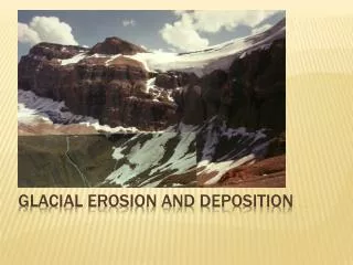
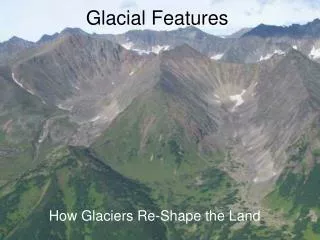
EROSIONAL GLACIAL LANDFORMS • Glaciersandicesheetsareveryeffectiveagentsoferosion.Large areas of lowland, including the Laurentian Shieldof North America, bear the scars of past ice movements.More spectacular are the effects of glacial erosion inmountainous terrain, where ice carries material wrestedfrom bedrock to lower-lying regions (Colour Plate 12,inserted between pages 208 and 209). A panoply of landforms is moulded by glacial ero-sion. One way of grouping these landforms is by thedominantformativeprocess:abrasion,abrasionandrock fracture combined, rock crushing, and erosion by glaciericeandfrostshattering(Table10.2).Noticethatabradedlandforms are ‘streamlined’, landforms resulting fromthe combined effects of abrasion and rock fracture arepartly streamlined, while the landforms resulting fromrock fracture are not streamlined. The remaining groupof landforms is residual, representing the ruins of an ele-vated mass of bedrock after abrasion, fracturing by ice,frost-shattering, and mass movements have operated.
Abrasional landforms • Glacial abrasion produces a range of streamlined land-forms that range in size from millimetres to thousandsof kilometres (Table 10.2). In sliding over obstacles, icetendstoabradetheup-icesideorstoss-sideandsmoothit.The down-ice side or leeside is subject to bedrock frac-ture, the loosening and displacement of rock fragments,and the entrainment of these fragments into the slidingglacier base. In consequence, the downstream surfacestend to be rough and are described as plucked andquarried. • Scoured regions • Thelargestabrasivefeatureisalow-amplitudebutirregu-lar relief produced by the • areal scouring • of large regionssuch as broad portions of the Laurentian Shield, North America.Scouredbedrockregionsusuallycompriseacol-lection of streamlined bedrock features, rock basins, andstoss and lee forms (see below and Colour Plate 12). InScotland,partsofthenorth-westHighlandswerescouredin this way to give • ‘knock and lochan’ topography • .
The ‘knocks’ are rocky knolls and the ‘lochans’ are lakes that lie in depressions. • Glacial troughs – glaciated valleys and fjords • Glacial troughs • are dramatic landforms (ColourPlate 13, inserted between pages 208 and 209;Plate 10.4). They are either eroded by valley glaciers ordevelop beneath ice sheets and ice caps where ice stream-ingoccurs.Mostglacialtroughshave,tovaryingdegrees,a U-shaped cross-section, and a very irregular long-profilewithshortandsteepsectionsalternatingwithlongand flat sections. The long, flat sections often containrock basins filled by lakes. In glacial troughs where a lineof basins holds lakes, the lakes are called • paternosterlakes • after their likeness to beads on a string (a rosary).The irregular long-profile appears to result from unevenover-deepening by the ice, probably in response to vari-ations in the resistance of bedrock rather than to any peculiarities of glacier flow.
There are two kinds of glacial trough: • glaciated val-leys • and • fjords • . A glaciated-valley floor lies above sealevel, while a fjord floor lies below sea level and is aglaciated valley that has been drowned by the sea. Inmostrespects,glaciatedvalleysandfjordsaresimilarland-forms. Indeed, a glaciated valley may pass into a fjord.Many fjords, and especially those in Norway, are deeperin their inner reaches because ice action was greatestthere. In their outer reaches, where the fjord opens intothesea,thereisoftenashallowsillorlip.TheSognefjord,Norway, is 200 km long and has a maximum depth of 1,308m.Atitsentrance,itisjust3kmwideandis160mdeep, and its excavation required the removal of about2,000 km • 3 • of rock (Andersen and Borns 1994). SkeltonInlet, Antarctica, is 1,933 m deep.Breached watersheds and hanging valleys are of thesameorderofsizeasglacialtroughs,butperhapsgenerally a little smaller. • Breached watersheds • occur where icefrom one glacier spills over to an adjacent one, erodingthe intervening col in the process. Indeed, the erodingmaydeepenthecoltosuchanextentthattheglacieritself is diverted. • Hanging valleys • are the vestiges of tributary glaciers that were less effective at eroding bedrock thanthe main trunk glacier, so that the tributary valley is cut
offsharplywhereitmeetsthesteepwallofthemainvalley (Colour Plate 13), often with a waterfall coursing overthe edge. • Domes and whalebacks • A variety of glacially abraded forms are less than about100 m in size. • Domes and whalebacks (rock drumlins,tadpole rocks,streamlined hills) form where flowingice encounters an obstruction and, unable to obliterateit, leaves an upstanding, rounded hillock. • Striated, polished, and grooved bedrock • Striated, polished, and grooved surfaces are all fashionedbyrockmaterialcarriedbyflowingice.Largeclasts(about1 cm or bigger) erode by scratching and create striationsand grooves. Finer material (less than a centimetre orso), and especially the silt fractions, erodes by polish-ing bedrock surfaces. • Striations • are finely cut, U-shapedgrooves or scratches, up to a metre long or more, scoredinto bedrock by the base of a sliding glacier. They comein a multiplicity of forms, some of which, such as rat-tails,indicatethedirectionoficeflow.Largestriationsarecalled • grooves • , which attain depths and widths of a few metres and lengths of a few hundred metres (Plate 10.5).Glacial valleys may be thought of as enormous grooves.Grooves form through glacial abrasion or the generation
Plate 10.5 Two-metre deep striated groove carved by theLaurentide ice sheet, Whitefish Falls, Ontario, Canada.(Photograph by Mike Hambrey)
of meltwater under pressure. Bedrock bearing a multi-tude of tiny scratches has a polished look. The finer isthe abrading material, the higher is the polish. Stria-tionsareequivocalevidenceoficeaction,especiallyinthegeological record, as such other processes as avalanchesand debris flows are capable of scratching bedrock. • Rock basins are depressions with diameters in the range sev-eral metres to hundreds of metres, carved into bedrock,commonlyfoundinassociationwithrochesmoutonnées.They form where rocks contain structural weaknessesexploitable by glacial erosion.
Plastically moulded forms • Some glaciated rock surfaces carry complex, smoothforms known as • plastically moulded forms • , or • p-forms • (Plates 10.6 and 10.7). The origin of these puzzling fea-tures is debatable. Possibilities are glacial abrasion, themotionofsaturatedtill(tillslurry)atthebottomorsidesof a glacier, and meltwater erosion, especially meltwaterunder high pressure beneath a glacier. If a meltwaterorigin is certain, then the features are • s-forms • . • Abrasion-cum-rock-fracture landforms • In combination, glacial abrasion and rock fracture pro-ducepartlystreamlinedlandformsthatrangeinsizefromabout 1 m to 10 km (Table 10.2).
Trough heads, valley steps, and riegels • Troughheads • (or • troughends • )and • valleysteps • aresim-ilar to roche moutonnées (see below) but larger. Troughheadsaresteepandrockyfacesthatmarkthelimitofover-deepening of glacial troughs.Their ‘plucked’ appearancesuggests that they may follow original breaks of sloperelated to hard rock outcrops. In sliding over the break of slope, the ice loses contact with the ground, creating acavityinwhichfreeze–thawprocessesaidthelooseningof blocks.Theicereconnectswiththegroundfurtherdownthe valley. Where another hard rock outcrop associated withanoriginalbreakofslopeismet,arockorvalleystepdevelops by a similar process. However, the formation of trough heads and rock steps is little researched and farfrom clear
Plate 10.6 Plastically moulded forms (p-forms) and striations on roche moutonnée near calving front of ColumbiaGlacier, Prince William Sound, Alaska.(Photograph by Mike Hambrey)
Plate 10.7 Subglacially formed p-forms and pothole, cut in Proterozoic schists, Loch Treig, Grampian Highlands,Scotland.(Photograph by Mike Hambrey)
A riegel is a rock barrier that sits across a valley, often where a band of hard rock outcrops. It may impounda lake. • Cirques • Cirques are typicallyarmchair-shapedhollowsthatformin mountainous terrain, though their form and size arevaried (Figure 10.6). The classical shape is a deep rock basin, with a steep headwall at its back and a residuallip or low bedrock rim at its front, and often contain-ing a lake.The lip is commonly buried under a terminalmoraine.Theypossessseverallocalnames,including • cor-rie • in England and Scotland and • cwm • in Wales. They form through the conjoint action of warm-based ice andabundant meltwater. Corries are commonly deemed tobeindisputableindicatorsofpastglacialactivity,andgeo-morphologists use them to reconstruct former regionalsnowlines (Box 10.2).
Stoss and lee forms • Roches moutonnées, flyggbergs, and crag-and-tail fea-tures are all asymmetrical, being streamlined on thestoss-side and ‘craggy’ on the leeside. They are theproductions of glacial abrasion and quarrying. • Rochesmoutonnées • are common in glacially eroded terrain.They are named after the wavy wigs (moutonnées) that were popular in Europe at the close of the eighteenthcentury (Embleton and King 1975a, 152). Roches mou-tonnées are probably small hills that existed before theice came and that were then modified by glacial action.They vary from a few tens to a few hundreds of metreslong, are best-developed in jointed crystalline rocks, andcover large areas (Plate 10.8; see also Plate 10.6). Ingeneral, they provide a good pointer to the directionof past ice flow if used in conjunction with striations,grooves, and other features. • Flyggbergs • are large rochesmoutonnées, more than 1,000 m long. • Crag-and-tailfeatures • are eroded on the rugged stoss-side (the crag)but sediment (till) is deposited in the smooth leeside.Slieve Gullion, County Down, Northern Ireland, is anexample: the core of a Tertiary volcano has a tail of glacial debris in its lee. Small crag-and-tail features occur where resistant grains or mineral crystals protect rock
from glacial abrasion. An example is found on slate inNorthWales,wherepyritecrystalshavesmalltailsofrock that indicate the orientation and direction of ice flow (Gray 1982), and on carbonate rocks in Arctic Canada, where limestone ridges less than 5 cm high and 25 cmlong form in the lee of more resistant chert nodules(England 1986). • Rock-crushed landforms • Small-scale, crescent-shaped features, ranging in sizefrom a few centimetres up to a couple of metres, occuron striated and polished rock surfaces. These featuresare the outcome of rock crushing by debris lodged atthe bottom of a glacier. They come in a variety of formsandincludelunatefractures,crescenticgouges,crescenticfractures, and chattermarks. • Lunate features • are frac-tures shaped like crescents with the concavity facing thedirection of ice flow. • Crescentic gouges • are crescent-shaped gouges, but unlike lunate features they face away from the direction of ice flow. Crescentic fractures aresimilar to crescentic gouges but are fractures rather thangouges. • Chattermarks • are also crescent-shaped. They are friction marks on bedrock formed as moving ice judders and are comparable to the rib-like markingssometimes left on wood and metal by cutting tools(Plate 10.9).
Residual landforms • Arêtes, cols, and horns • Inglaciatedmountains,abrasion,fracturingbyice,frost-shattering, and mass movements erode the mountainmass and in doing so sculpt a set of related landforms:arêtes, cols, and horns (Figure 10.6). These landformstend to survive as relict features long after the ice hasmelted. • Arêtes • areformedbytwoadjacentcirqueseatingaway at the intervening ridge until it becomes a knife-edge, serrated ridge. Frost shattering helps to give theridge its serrated appearance, upstanding pinnacles on which are called • gendarmes • (‘policemen’). The ridges,or arêtes, are sometimes breached in places by • cols • .If three or more cirques eat into a mountain mass from
Figure 10.6 The evolution of some alpine glacial landforms. (a) A landscape before an ice age. (b) The same landscapeduring an ice age, and (c) after an ice age.Source:After Trenhaile (1998, 128)
Box 10.2 CIRQUES • Cirques usually start as depressions excavated by streams, or as any hollow in which snow collects andaccumulates ( • nivation hollow • ). Snow tends to accu-mulate on the leeside of mountains, so cirques in theNorthern Hemisphere tend to face north and east.In the steep terrain of alpine regions, it is usual forcirques to show poor development and to slope out- wards. In less precipitous terrain, as in the EnglishLake District, they often have rock basins, possibly with a moraine at the • lip • , that frequently hold lakes( • tarns • ). Despite their variable form and size, the ratioof length to height (from the lip of a mature cirqueto the top of the • headwall • ) is surprisingly constant,and lies within the range 2.8:1 to 3.2:1 (Manley 1959). The largest known cirque is Walcott Cirque,Victoria Land, Antarctic, which is 16 km wide and3 km high. Some cirques have a composite character.ManyBritishmountainshave • cirques-within-cirques • .InCoireBà,oneofthelargestcirquesinBritain,whichlies on the east face of Black Mount, Scotland, sev-eral small cirques cut into the headwall of the maincirque. • Cirque staircases • occur. In Snowdon, Wales,CwmLlydawisanover-deepenedbasinwithatarnandsheer headwall. The headwall is breached partway upby Cwm Glaslyn, a smaller cirque, which also holds atarn. And above Cwm Glaslyn lies an incipient cirque justbelowthesummitofYWyddfa.Itisunclearifsuchstaircasesrepresent theinfluenceofdifferent snowlinesor the exploitation of several stream-cut hollows orgeological sites
Plate 10.8 Roche moutonnée, known as Lambert Dome, Yosemite, California, USA.(Photograph by Mike Hambrey)
Plate 10.9 Chattermarks on Cambrian quartzite, An Teallach, north-west Highlands, Scotland.(Photograph by Mike Hambrey)
different sides, a • pyramidal peak • or • horn • may eventu-ally form. The classic example is the Matterhorn on theSwiss–Italian border. • Nunataks • Nunataks are rock outcrops, ranging from less than akilometre to hundreds of kilometres in size, surroundedby ice. They include parts of mountains whereice has not formed, or entire mountain ranges,including the Transantarctic Mountains on Antarctica(see Figure 10.2), that have escaped ice formationeverywhere but their flanks. • DEPOSITIONAL GLACIAL LANDFORMS • Debris carried by ice is eventually dumped to producean array of landforms (Table 10.3). It is expedient togroup these landforms primarily according to their posi-tion in relation to the ice (supraglacial, subglacial, andmarginal) and secondarily according to their orienta-tion with respect to the direction of ice flow (parallel,transverse, and non-orientated