Download
1 / 12
120 likes | 452 Vues
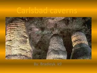
City of Carlsbad GIS. Karl von Schlieder, GIS Manager October 12, 2011. Background. 1991 to 2005 – in Community Development Since 2006 – now a division within IT Serve the GIS needs of all City departments Provide GIS services to outside entities on time & materials basis. GIS in Carlsbad.

E N D
City of Carlsbad GIS Karl von Schlieder, GIS Manager October 12, 2011
Background • 1991 to 2005 – in Community Development • Since 2006 – now a division within IT • Serve the GIS needs of all City departments • Provide GIS services to outside entities on time & materials basis
GIS in Carlsbad • Core GIS division in IT – 3 staff members • Public works inventory group in Transportation Dept. – 3 data entry techs • Planning & Econ Dev – low-level ArcView users (< 3 staff) • All other staff use GIS division services and intranet mapping applications
GIS Software • All Esri products: • ArcGIS for: Desktop, Server, Mobile • Rolta OnPoint mapping software • Intranet apps for general users, public works-oriented uses, DMS input, addressing • Internet app for zoning and general development information
Related Applications - Dependent • Hansen CMMS • Marshall GeoResults for Hansen • GBA Pavement Management system • Granite XP CCTV Pipeline Inspection system • Coming soon! Constituent Relationship Management (CRM) system
Related Applications - Linked • Permits Plus • Future: • Water utility billing • Business license
Funding for GIS • IT chargeback to all departments • Based on number of pcs/dept • Additional charge back amounts for dedicated COTS software maintenance, custom applications
Data Distribution • Currently we distribute all our non-proprietary data at no charge for data, charging only for labor to extract, format and deliver. • Done as response to Public Records Act requests
Current Projects • GIS strategic plan • Creating a standard address file • More internal OnPoint map services • Enhance internet e-zoning • Create lightweight Silverlight-based internet maps for individual departments • Embed GIS into CRM application
Current Issues • Outsourcing • What’s a commodity that can be sourced? • Internal cost vs. sourced cost • A continuum of services available • Managed Competition • IT (w/GIS) or GIS as separate entity? • Internal cost vs. competition • Where’s the value?