Download
1 / 7
70 likes | 200 Vues
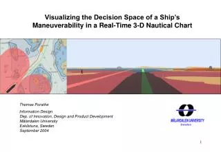
MONALISA HMI design 2014-03-11 Thomas Porathe Chalmers. The concept of routes and “safe haven”. R oute. Leg (strait segment between two waypoints) Contains a speed. Waypoint (geo-referenced anchor points for the route) Contain long, lat., ETA, turn radius, WOP. WP14, ETA 13.25.

E N D
MONALISA HMI design 2014-03-11 Thomas Porathe Chalmers
The concept of routes and “safe haven” Route Leg (strait segment between two waypoints) Contains a speed Waypoint (geo-referenced anchor points for the route) Contain long, lat., ETA, turn radius, WOP WP14, ETA 13.25 Cross Track Margin, channel width (dynamic) Green: agreed route. Speed advice: target speed to keep position in box. Green: speed within 0.2 knof target speed; yellow: 0.2-1.0 kn; red > 1 kn. (13.2 kn) = actual speed. Box dynamically positioned behind ship WP13, 12.58 Slot “Safe Haven” time slot visualizing the position where the ship must be to respect the ETAs of the route. Size of slot may vary in with depending on channel with, traffic density, cargo, manning, waters etc. Length of box may vary depending on how tight the time regime is. Green: inside box; yellow: part of ship outside box; red: ship outside box Target speed 13.4 kn (13.2 kn)
The conning display in the SAAB system COG 175.4° SOG 18.4 kn Lat 59° 15.794 N Long 17° 13.859 E Wind 124° 6.2 m/s ROT Route: Skag - Muga Next WP: WP 1 Course: 175° Dist. 23.4 NM WP 10 WP 9 • 0.5 • ° /min WP 8 WP 11 WP 0 WP 1 WP 2 WP 7 WP 3 STCC monitoring service Turn Sb 1 hr. 12 min. to 178 deg. Meet Tarnland on port, side in 23 min. WP 4 WP 5 WP 6 Send
The conning display in a standard ECDIS interface + 30 min 500 m 500 m WP 10 WP 9 WP 8 WP 11 - 30 min Target speed: 13.4 kn Present speed: (13.2 kn) WP 0 WP 1 STCC monitoring service Turn Sb 1 hr. 12 min. to 178 deg. Meet Tarnland on port, side in 23 min. WP 2 WP 7 WP 3 WP 4 WP 5 WP 6 Send
The conning display in a standard ECDIS interface + 30 min 500 m 500 m WP 10 WP 9 WP 8 WP 11 - 30 min WP 0 13.4 kn 13.2 kn WP 1 STCC monitoring service Turn Sb 1 hr. 12 min. to 178 deg. Meet Tarnland on port, side in 23 min. WP 2 WP 7 WP 3 WP 4 WP 5 WP 6 Send
The conning display in a tablett interface + 30 min + 30 min COG 175.4° SOG 13.2 kn Lat 59° 15.794 N Long 17° 13.859 E Wind 124° 6.2 m/s ROT Route: Skag - Muga Next WP: WP 1 Course: 175° Dist. 23.4 NM Target speed: 13.4 kn Present speed: (13.2 kn) 500 m 500 m 500 m 500 m • 0.5 • ° /min - 30 min - 30 min Target speed: 13.4 kn Present speed: (13.2 kn) SCC Sweden; VHF :ch. 66, Phone: +46 40 777 3333 STCC monitoring service Turn Sb 1 hr. 12 min. to 178 deg. Meet Tarnland on port, side in 23 min. SCC Sweden; VHF :ch. 66, Phone: +46 40 777 3333 STCC monitoring service Turn Sb 1 hr. 12 min. to 178 deg. Meet Tarnland on port, side in 23 min. Send Send
Inside – outside the box + 30 min + 60 min + 3 hrs. 500 m 500 m 1nm 1 nm 3nm 3nm - 30 min - 60 min - 3 hrs.