Download
1 / 27
270 likes | 520 Vues
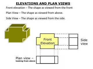
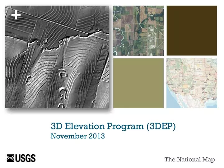
3D Elevation Program (3DEP) November 2013. The National Map. Terrestrial Elevation. National Elevation Dataset (NED). USGS – NED status August 2013. Lidar Improves Data Quality. 3.

E N D
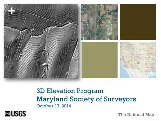
3D Elevation Program(3DEP) November 2013 The National Map
Terrestrial Elevation National Elevation Dataset (NED) USGS – NED status August 2013
Lidar Improves Data Quality 3 National Elevation Dataset (left). Example on right shows detailed agricultural practices that allow NRCS to provide better services to farmers with fewer field visits. Ten meter resolution Two meter resolution Courtesy of NRCS
National Enhanced Elevation Assessment Example Business Uses from NEEA study completed in 2012 Precision Farming Land Navigation and Safety Geologic Resources and Hazards Mitigation Natural Resource Conservation Infrastructure Management Flood Risk Mitigation
Terrestrial Elevation Annual Benefits if Business Needs could be met (results of NEEA study)
Data Quality Level Choices Bathymetric LiDAR requirements assessed for three Quality Levels to include Low, Standard and High. Standard Quality Level (3-5 meter post spacing; RMSEz ~ 20 cm) Note – USGS LiDAR base acquisition specification version 13 is for QL3 data
Terrestrial Elevation Recommended Program Initiative - 3DEP • High quality lidar in conterminous US and Hawaii, ifsar in Alaska • $146 million/year for 8 years • Benefit to cost – 4.7:1 • Total benefits - $690 million/year • Publically accessible • Partnership approach • New products and services • Lidar point cloud • 1 meter DEMs • Other derived data • Operational in January 2015 • Complete one cycle of data collection by 2023
CA NEEA activities • Survey: 24 responses representing 12 state agencies and 4 county governments • Aggregate into broader business areas • Workshop to reach consensus for highest quality need for each 1-degree cell to meet all agency needs
Flood Risk Management • Sea level rise • Regional hydrological processes • Levee integrity • Flood risk mapping
Wildfire Management, Planning, and Response • Fire behavior modeling • Damage assessment • Post-fire litigation • Estimated benefits: 16M
Coastal Zone management • Improved monitoring • Improved modeling--Climate, sediment transport, tsunami behavior • Restoration and fish passages
Infrastructure and Construction Management • Road, culvert, bridge design • Transportation planning: high speed rail • Hydraulic modeling
Forest Resource Management • Vegetation mapping • Habitat analysis • Change detection
River and Stream Resource Management • Water conveyance • Fish passage • NHD stewardship
Geologic Resource Assessment and Hazard Mitigation • Geologic mapping • Seismic, tsunami, landslide hazard mapping and zonation
2012 Inventory Update Data that “meet or partially meet” 3DEP specifications * Except Alaska where data meet 3DEP specifications at QL5 or better
2012 Inventory Analysis Data that meet or partially meet 3DEP specificationsare available or in progress for 26.4% of the nation (includes AK, HI, PR & VI) Bar chart depicts the amount of new data coverage that meets or partially meets 3DEP specifications by year since 2005 What Have We Learned So Far? • Of the data collected in 2012, 7% was repeat coverage; this equates to 0.4% of the nation’s area • Repeat coverage may include replacement of lower quality or older data, pre- and post-disaster coverage, collection for change detection, etc.
FY13, FY14 Program Funding Increases USGS – National Geospatial Program +$7.2M (Hurricane Sandy Supplemental) +$9M for 3DEP (FY14 President’s budget) +$750k for ecosystem data (FY14 President’s budget) +$1M for Alaska mapping initiative (FY14 President’s budget) +$300k for emergency response system improvements (Hurricane Sandy Supplemental) USGS – Coastal and Marine Geology Program +$0.55M for CoNED (Hurricane Sandy Supplemental) +$2M for coastal elevation (FY14 President’s budget) NPS +$500K for ifsar (FY14 President’s budget) NOAA +$10 M for coastal topobathylidar (Hurricane Sandy Supplemental) +$1.9M for GRAV-D to produce a new national vertical datum (Hurricane Sandy Supplemental) +$7.9 M for coastal topobathylidar data collection (FY14 President’s budget) +$3.0M for GRAV-D to produce a new national vertical datum (FY14 President’s budget) Multiple Federal Agencies +Alaska partnership funds $50M+ is spent across Federal programs annually 3DEP direct funding, and other increases supporting 3DEP goals
3DEP Acquisition Planning Revise the acquisition approach with input from the 3DEP Executive Forum and NDEP Establish a Broad Agency Announcement or other contract mechanism to streamline partnership development Work with state and local partners to facilitate move to new planning strategy Trial run of some steps (compiling agency requirements and plans against criteria) in FY14 Initiate 3 year planning in FY14 Implement new approach for FY15 (beginning in April, 2014) Next Steps for the Federal long-term program
Managed Workflow 21 Terrestrial Elevation Source Data and Product Management Modernization Derived Products Pre-generated and Staged or On Demand Planning • Legacy NED Data • 1/9 arc second DEMs • 1/3 arc second DEMs • 1, 2 arc second DEMs • Metadata Delivery Services Lidar Project Real-Time Access Via Web Service Outreach Hydro Flattened 1 meter DEMs 1/3, 1, 2 arc second Ifsar Project Legacy Projects– source DEMs, Lidar point cloud, and Metadata Coordination 5 meter DEMs Alaska Spot Elevation Legacy Hydro Flattened DEMs 1/9, 1/3, 1, 2 Arc second Contract • Future Products • Hydro Enforced 1 meter DEMs • Product TBD • Product TBD • Product TBD • Product TBD • Project Package • Source DEM • Lidar Point Cloud • Intensity Image • Breaklines • Metadata Delivery Via Download Contour Receive Hillshade QA/QC • Ifsar Project Package • Source DEM • DSM • Intensity Image • Breaklines • Metadata Create 3DEP Products Delivery Via Portable Media Accept • Managed Database • Staged products • Project-based DEMs • Lidar Point Clouds • IfsarDSMs • Metadata • Other Data Package • Deliverable • Deliverable • Metadata
3DEP Key Milestones Requirements and program recommendations – Complete Governance coordinated under NDEP Establish Executive Forum – In Progress 10M in the President’s fy14 budget Implementation plan – Final plan to be released early 2014 Issue new 3DEP data acquisition specifications – early 2014 Infrastructure and production systems modernization Lidar and ifsar products and services – In progress and on schedule for October, 2014 New 3DEP products and services – Planned for January, 2015
3DEP Acquisition Planning Areas with the highest net benefits as identified through the NEEA requirements study Areas included in a federal, state or regional partner acquisition plan Areas of no existing coverage Areas with existing coverage that do not meet Quality Level 3 specification Areas with coverage greater than 8-years old Areas with significant topographic change Areas subject to serious and significant hazards (earthquakes, landslides, volcanic activity, coastal flooding, sea level rise) Striving toward economies of scale: fewer but larger collections Prioritization Criteria
Next Steps for California • Identify lead state agency and interagency workinggroup • Continue to build inventory, repository, infrastructure • Refine state-agency requirements, add program costs and determine real $$ benefits to program • Roll that up to reflect needs and benefits across state agencies • Consider adding business needs from county/regional requirements (potential huge source of funding!) • Identify and align state sources of funding • Prioritize acquisition in a cost-effective fashion • All of this = An Elevation Plan for California
3DEP Resources NEEA Report 3DEP webpage USGS Fact Sheets NEEA at a glance 3D Elevation Program Resources in work State information sheets Journal articles http://nationalmap.gov/3DEP
Questions?? Pacific Region NGP staff: Carol Ostergren US Geological Survey Pacific Region National Geospatial Program 3020 State University Drive East, Suite 3005 Sacramento, CA 95819 916-278-9510 (office); 916-278-9546 (fax) costergren@usgs.gov Drew Decker USGS Geospatial Liaison for Pacific Region NSDI Partnership Office, U.S. Geological Survey 4165 Spruance Road, Suite 200 San Diego, CA 92101 619-225-6430 619-417-2879 cell 619-225-6101 fax ddecker@usgs.gov