Download
1 / 21
450 likes | 1.09k Vues
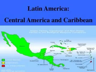
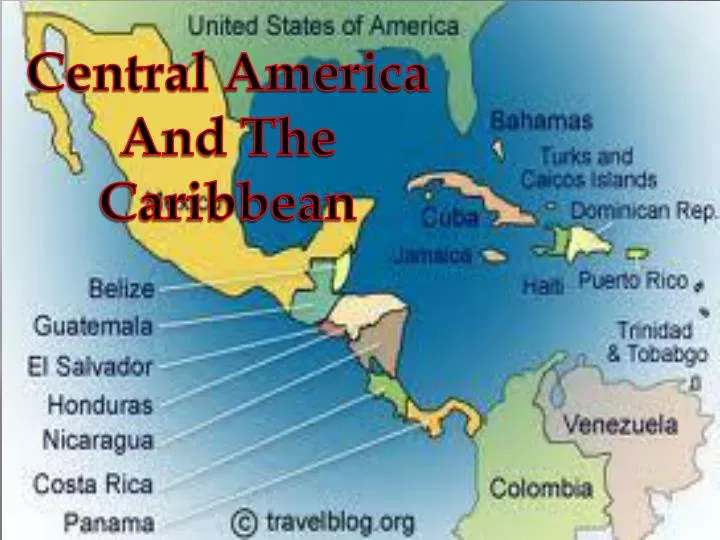
Central America And The Caribbean. The History of Central America. Early History AD 250–900: Maya built large cities with pyramids and temples. Maya descendents live in Guatemala and Belize. Early 1500s: Europeans controlled most of Central America. Britain: Belize and Nicaragua’s coast

E N D
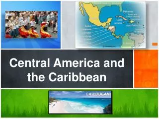
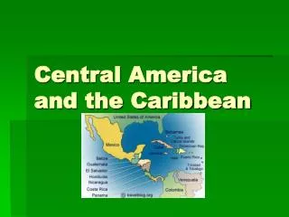
Central America And The Caribbean
The History of Central America Early History • AD 250–900: Maya built large cities with pyramids and temples. • Maya descendents live in Guatemala and Belize. • Early 1500s: Europeans controlled most of Central America. • Britain: Belize and Nicaragua’s coast • Spain: Large plantations of tobacco and sugarcane • Forced Indians and enslaved Africans to work in mines and plantations Independence • 1821: Independence from Spain • Remained joined as the United Provinces of Central America • 1838-1839: Costa Rica, Nicaragua, Honduras, El Salvador, and Guatamala separated. • 1903: Panama and Columbia separated. • 1981: Belize independence
The History of The Caribbean Islands • 1492: Christopher Columbus discovered the Caribbean islands, believing them to be the Indies. • The islands are now 13 independent countries. • These countries show the influence of the first European colonizers.
Isthmus – A narrow strip of land, with water on both sides, that connects two larger bodies of land
Central America’s Geography Three major landforms in Central America • Mountainous Core • Mountains run down the center of the area • Two climate zones in the core • Spring like year round temperatures (3,000 to 6,000 feet of elevation) • Cold climates above that • Caribbean lowlands • Eastern side of Central America • Tropical Wet climate • Pacific Coastal Plains • West side of Central America • Savanna Climate with grassland vegetation
Caribbean Islands Three groups of Islands in the Caribbean • Lesser Antilles • Volcanic Islands • Smaller islands in the southeastern part of the Caribbean • Greater Antilles • Also Volcanic Islands • Larger Islands such as Cuba, Jamaica, Haiti and Dominican Republic • Bahamas • Coral Islands • Made from the remains of dead sea animals
Bahamas Greater Antilles Lesser Antilles
People of Central America • Indians • Mayan empire spread throughout this area • Largest number live in Guatemala • Europeans and Mestizos • Largest European settlement today is in Costa Rica • Mestizos mostly live in El Salvador and Nicaragua • African Descent • Came over to work on the banana plantations and build the Panama Canal
People of the Caribbean • Colonialism • Europeans came to profit from the sugar trade • They brought Africans to be slaves • Mixture of races • Natives • Africans • Europeans (French, British, Danish and Dutch) • Mestizos
Culture of Central America and the Caribbean • Central American Culture • Mostly Spanish speaking • Roman Catholic • Most cultural traits are a result of Spanish Colonialism • Caribbean Culture • Culture is based on the Colonizing country • Large African influence as a result of the slave trade
Where do they live? • Caribbean • Caribbean islands are crowded • Most live in cities • Central America • Most are Farmers • Live in rural areas
Economy • Tourism • Agriculture • Sugar • Fruit • Informal economy • Street vendors, shoe shiners and many more • Drug trafficking • Levels of Society • Small group of wealthy (mostly descendents of Europeans) • Small middle class • Large lower class
Political Unrest In Central America • Causes • Shortage of available farmland • Unequal distribution of wealth • Government mainly serves the interest of the wealthy • Nicaragua • Contras Fighting against the Sandinista government that favored the wealthy • In 1990 a new president was elected for the first time.
Political Unrest In Central America • El Salvador • Wealthy land owners hired death squads to eliminate their political opponents • 1992 a peace agreement lead by the UN ended the war • Guatemala • In 1960 a civil war erupted against the militarily backed dictator • After the war the military was still a powerful force in the government • In 1993 Ramiro de Leon Carpio was elected by their congress and is a respected leader
Political Unrest In The Caribbean • Cuba • 1959 Fidel Castro lead a successful military revolution • He has Ruled ever since (Communist Government) • Haiti • 1994 the people overthrew the military dictator with the help of the U.S. • Haiti now has a democracy
Panama • The southernmost of the Central American nations • The Panama Canal bisects the isthmus at its narrowest and lowest point, allowing passage from the Caribbean Sea to the Pacific Ocean. • It is marked by a chain of mountains in the west, moderate hills in the interior, and a low range on the east coast. There are extensive forests in the fertile Caribbean area.
Panama Canal • The 48 mile-long (77 km) international waterway known as the Panama Canal allows ships to pass between the Atlantic Ocean and Pacific Ocean, saving about 8000 miles (12,875 km) from a journey around the southern tip of South America, Cape Horn. • A class of ships known as "Panamax,“ where built to the maximum capacity of the Panama canal and its locks.
Panama Canal • It takes approximately fifteen hours to traverse the canal through its three sets of locks (about half the time is spent waiting due to traffic). • Ships passing through the canal from the Atlantic Ocean to the Pacific Ocean actually move from the northwest to the southeast, due to the east-west orientation of the Isthmus of Panama.