Download
1 / 45
450 likes | 592 Vues
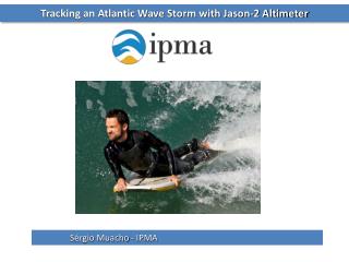
Tracking an Atlantic Wave Storm with Jason-2 Altimeter. Sérgio Muacho - IPMA. Tracking an Atlantic Wave Storm with Jason-2 Altimeter. Altimetry applications for oceans and seas:. Operational oceanography (waves and wind) Mean Sea Level Tides Ocean large-scale circulation

E N D
Tracking an Atlantic Wave Storm with Jason-2 Altimeter Sérgio Muacho - IPMA
Tracking an Atlantic Wave Storm with Jason-2 Altimeter Altimetry applications for oceans and seas: • Operational oceanography • (waves and wind) • Mean Sea Level • Tides • Ocean large-scale circulation • Ocean currents and eddies • Bathymetry • Tsunamis
Tracking an Atlantic Wave Storm with Jason-2 Altimeter Altimetry applications for oceans and seas: here we will focus on… • Operational oceanography • (waves and wind) • Mean Sea Level • Tides • Ocean large-scale circulation • Ocean currents and eddies • Bathymetry • Tsunamis
Tracking an Atlantic Wave Storm with Jason-2 Altimeter Do you know other applications of altimetry? Yes No
Tracking an Atlantic Wave Storm with Jason-2 Altimeter Do you know other applications of altimetry? Yes No - Ice (Ice sheets; Sea ice)- Climate (ENSO; NAO; Decadal oscillations)- Atmosphere (Cyclones; Rain)- Hydrology & land (Lake level; River level)
Tracking an Atlantic Wave Storm with Jason-2 Altimeter Chapter I: IntroductionJason-2 radar http://www.eumetsat.int/Home/Main/Satellites/Jason-2/MissionOverview/index.htm?l=en
Tracking an Atlantic Wave Storm with Jason-2 Altimeter Some considerations about altimetry: • Satellite does not measure individual waves… • Satellite beam is about 1-2 km minimum in diameter; • Measurements are averaged (over 1s, ~7km along the track) to remove noise.
Tracking an Atlantic Wave Storm with Jason-2 Altimeter The radar altimeter receives the reflected wave (echo), which varies in intensity over time. If sea surface is flat (a), the reflected wave's amplitude increases sharply from the moment the leading edge of the radar signal strikes the surface. In rough seas (b), the wave strikes the crest of one wave and then a series of other crests which cause the reflected wave's amplitude to increase more gradually. * Satellite Radar wave Radar wave as seen from above the surface Shape of the power as received back by the onboard radar We can derive ocean wave height from the information in this reflected wave: the slope of the curve representing its amplitude over time is proportional to wave height. * from http://www.altimetry.info/html/alti/principle/waveform/ocean_en.html
Tracking an Atlantic Wave Storm with Jason-2 Altimeter How do satellite altimeters measure ocean waves?
Tracking an Atlantic Wave Storm with Jason-2 Altimeter How do satellite altimeters measure ocean waves? • Over ocean surface, the echo waveform has a characteristic shape that can be described analytically (Brown model); • The edge slope is related to the significant wave height (SWH) power time
Tracking an Atlantic Wave Storm with Jason-2 Altimeter This is an ascending or descending orbit? Ascending Descending
Tracking an Atlantic Wave Storm with Jason-2 Altimeter Can we use altimetry data in an operation way? Yes No
Tracking an Atlantic Wave Storm with Jason-2 Altimeter Can we use altimetry data in an operation way? Yes No No, because the satellite goes over the same point every cycle (10 days at least, up to 35 days depending on the satellite)
Tracking an Atlantic Wave Storm with Jason-2 Altimeter Can we use altimetry data in an operation way? Yes No • In my opinion, yes…! • If a satellite goes over your region of interest (ROI), you can have data 2 hours after the measurements. • This is relevant in oceans and sea zones with a lack of observations (buoys), such as West Iberian coast and more off-shore areas.
Tracking an Atlantic Wave Storm with Jason-2 Altimeter The Atlantic wave storm (17 – 20 April 2012)
Wave storm life cycle: The early stages (synoptic conditions) Tracking an Atlantic Wave Storm with Jason-2 Altimeter Plot: surface wind >10 m/s Azores
Wave storm life cycle: The early stages (synoptic conditions) Tracking an Atlantic Wave Storm with Jason-2 Altimeter Plot: surface wind >10 m/s Azores Steady southwesterly flow with several cyclogenesis, some of them originate deep lows with very strong winds
Tracking an Atlantic Wave Storm with Jason-2 Altimeter Wave storm life cycle: The early stages (synoptic conditions) Omega Block between 14 and 20th april 2012 with some minor changes in position Azores B B A
Tracking an Atlantic Wave Storm with Jason-2 Altimeter Wave storm generation and propagation Adapted for http://www.co.fc.ul.pt/
Wave storm propagation (03UTC 17 April-12): model results (WAM/ECMWF) and Jason-2 Tracking an Atlantic Wave Storm with Jason-2 Altimeter
Wave storm propagation (17 and 18 Apr 2012): model results (WAM/ECMWF) Tracking an Atlantic Wave Storm with Jason-2 Altimeter
Approaching shore in Bay of Biscay and West Iberian coast (19 and 20 Apr 2012): model results (WAM/ECMWF) Tracking an Atlantic Wave Storm with Jason-2 Altimeter
Let’s track the storm… with Jason-2! Tracking an Atlantic Wave Storm with Jason-2 Altimeter
Jason-2 data and wave model forecast (03 UTC 17-Apr) Tracking an Atlantic Wave Storm with Jason-2 Altimeter
Jason-2 data and wave model forecast (03 UTC 17-Apr) Tracking an Atlantic Wave Storm with Jason-2 Altimeter
Tracking an Atlantic Wave Storm with Jason-2 Altimeter Jason-2 data and wave model forecast (03 UTC 18-Apr)
Tracking an Atlantic Wave Storm with Jason-2 Altimeter Jason-2 data and wave model forecast (03 UTC 18-Apr)
Tracking an Atlantic Wave Storm with Jason-2 Altimeter Jason-2 data and wave model forecast (18 UTC 18-Apr)
Tracking an Atlantic Wave Storm with Jason-2 Altimeter Jason-2 data and wave model forecast (21 UTC 18-Apr)
Tracking an Atlantic Wave Storm with Jason-2 Altimeter Jason-2 data and wave model forecast (06 UTC 19-Apr)
Tracking an Atlantic Wave Storm with Jason-2 Altimeter Important ideas: • We collect 5 passages during a three days period (17, 18 and 19 April 2012) in our ROI; • Jason-2 data is in good agreement with wave model and buoys (~2400 points with a mean difference of 3,5cm); • We can use altimetry information to supply the lack of buoys in off-shore areas (we can monitor sea conditions!).
Tracking an Atlantic Wave Storm with Jason-2 Altimeter Important ideas: • We collect 5 passages during a three days period (17, 18 and 19 April 2012) in our ROI; • Jason-2 data is in good agreement with wave model and buoys (~2400 points with a mean difference of 3,5cm); • We can use altimetry information to supply the lack of buoys in off-shore areas (we can monitor sea conditions!). • But…. It is difficult to track a storm only with the altimetry data: • Altimetry doesn’t give you an idea of sea conditions in all your ROI; • Miss important information for marine forecasters, such as wave direction.
Tracking an Atlantic Wave Storm with Jason-2 Altimeter Jason-2 data against buoys data in West Iberian coast
Tracking an Atlantic Wave Storm with Jason-2 Altimeter Jason-2 data and wave model forecast (03 UTC 18-Apr) º
Tracking an Atlantic Wave Storm with Jason-2 Altimeter Jason-2 data against buoys data ~1,4m 02h45m, 18-Apr º
Tracking an Atlantic Wave Storm with Jason-2 Altimeter Jason-2 data and wave model forecast (18 UTC 18-Apr) º
Tracking an Atlantic Wave Storm with Jason-2 Altimeter Jason-2 data against buoys data º ~7,8m 17h17m, 18-Apr
Tracking an Atlantic Wave Storm with Jason-2 Altimeter Additional issues:
Tracking an Atlantic Wave Storm with Jason-2 Altimeter Jason-2near costal regions (e.g., NW Iberian coast)
Tracking an Atlantic Wave Storm with Jason-2 Altimeter Jason-2near islands (e.g., Azores) North swell: Wave refraction is well represented by altimetry
Tracking an Atlantic Wave Storm with Jason-2 Altimeter Update – Atlantic ePort !
Tracking an Atlantic Wave Storm with Jason-2 Altimeter Atlantic ePort (http://eumetrain.org) Archive: 10 April 2012 onwards
Tracking an Atlantic Wave Storm with Jason-2 Altimeter Acknowledges Portuguese Hydrographical Institute (www.hidrografico.pt) Spanish Hydrographical Institute (www.puertos.es)
Tracking an Atlantic Wave Storm with Jason-2 Altimeter - Thankyou! -