Download
1 / 18
180 likes | 311 Vues
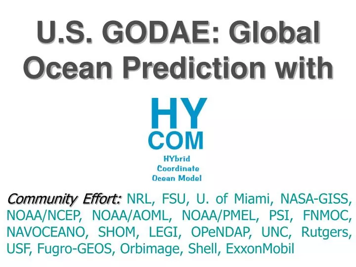
U.S. GODAE: Global Ocean Prediction with. Community Effort: NRL, FSU, U. of Miami, NASA-GISS, NOAA/NCEP, NOAA/AOML, NOAA/PMEL, PSI, FNMOC, NAVOCEANO, SHOM, LEGI, OPeNDAP, UNC, Rutgers, USF, Fugro-GEOS, Orbimage, Shell, ExxonMobil. Global Ocean Data Assimilation Experiment (GODAE). The vision:

E N D
U.S. GODAE: Global Ocean Prediction with Community Effort:NRL, FSU, U. of Miami, NASA-GISS, NOAA/NCEP, NOAA/AOML, NOAA/PMEL, PSI, FNMOC, NAVOCEANO, SHOM, LEGI, OPeNDAP, UNC, Rutgers, USF, Fugro-GEOS, Orbimage, Shell, ExxonMobil
Global Ocean Data Assimilation Experiment (GODAE) The vision: "A global system of observations, communications, modeling and assimilation, that will deliver regular, comprehensive information on the state of the oceans in a way that will promote and engender wide utility and availability of this resource for maximum benefit to society."
GODAE Modeling/Assimilation Centers • Australia : (BLUELINK): Regional Australian seas to Global Ocean • Japan : N. Pacific to Global Ocean • US (HYCOM-US and ECCO projects): N. Atlantic to Global Ocean • Europe (Mersea/MyOcean Consortium) • Italy (MFS) : Mediterranean Sea • France (MERCATOR) : N. Atlantic and Mediterranean Sea to Global Ocean • Norway (TOPAZ) : North Atlantic to Arctic • UK (FOAM) : N. Atlantic / Global ocean
Objectives and Goals • A broad partnership of institutions that collaborate in developing and demonstrating the performance and application of eddy-resolving, real-time global and basin-scale ocean prediction systems using HYCOM. • Transition for operational use by the U.S. Navy at NAVOCEANO (2008) and by NOAA at NCEP (N. Atlantic - 2007).
Objectives and Goals • Strong participation of the coastal ocean modeling community in using and evaluating boundary conditions from the global and basin-scale ocean modeling prediction systems • Efficient data distribution (100 Terabytes Storage Area Network) The data are available to the community at large within 24 hours via Live Access Server (LAS), ftp, and OPeNDAP at http://www.hycom.org
density front associated with sharp topographic feature (cannot be easily resolved with fixed z- or sigma- coordinates) Isopycnals over shelf region Yellow Sea flow reversal with depth Snapshot on14 October East China Sea Yellow Sea z-levels and sigma-levels over shelf and in mixed layer Snapshot on12 April The hybrid coordinate in HYCOM is one that isisopycnalin the open, stratified ocean, but smoothly reverts to aterrain-following coordinate in shallow coastal regions, and topressurecoordinate in the mixed layer and/or unstratified seas 1/25° East Asian Seas HYCOM (nested inside 1/6° Pacific HYCOM) North-south velocity cross-section along 124.5°E, upper 400 m blue=westward flow red=eastward flow
Present nowcast/forecast systems 1/12º Atlantic near real-time system - Running once a week since July 2002 - Assimilation: gridded surface observations only - 10 day hindcast, 14 day forecast 1/12º Global real time system - Running daily since December 2006 - Assimilation: NCODA - 5 day hindcast, 5 day forecast 1/25º Gulf of Mexico real time system - Running daily since November 2006 - Assimilation: NCODA - 5 day hindcast, 7 day forecast
Global HYCOM configuration • Horizontal grid: 1/12° equatorial resolution • 4500 x 3298 grid points, ~6.5 km spacing on average, ~3.5 km at pole, 5 m minimum depth • Mercator 79°S to 47°N, then Arctic dipole patch • 32 σ2* vertical coordinate surfaces: • KPP mixed layer model • Thermodynamic sea-ice model (soon to be PIPS/CICE) • Surface forcing: wind stress, wind speed, thermal forcing, precipitation, weak relaxation to climatological SSS • Monthly river runoff (986 rivers) • Initialized from January climatology (GDEM3) T and S 216,000 CPU hrs/model year on 784 IBM Power 4+ CPUs 7.2 TB/model year for daily 3-D output
Data Assimilation via NCODA (Cummings et al.) Ocean obs Sequential Incremental Update CycleAnalysis-Forecast-Analysis SST: GAC/LAC MCSST, GOES, Ship, Buoy Profile: XBT, CTD, T & S profiling Floats (ARGO), Fixed Buoy, Drifting Buoy Altimeter SSHA SSM/I Sea Ice Ocean data QC Innovations Ocean data Analysis 3D MVOI & Cooper-Haines Increments Ocean model HYCOM Forecast Fields Prediction Errors First Guess MVOI - simultaneous analysis 5 ocean variables temperature, salinity, pressure, velocity (u,v)
Overall increase in variability - largest changes occur in the western boundary currents
Eddy Kinetic Energy Comparison EKE at ~700 m in the Gulf Stream Observations from Schmitz (1996) NCOM - 2004 HYCOM - 2004
10 20 30 0 10 20 30 0 10 20 30 Forecast verification statistics from .08 global HYCOM 1.0 0.9 0.8 0.7 World Ocean NW Arabian Sea and Gulf of Oman Gulf Stream Median SSH anomaly correlation 1.0 0.9 0.8 0.7 Equatorial Pacific Kuroshio Gulf of Mexico 0.6 0 Forecast length (days) 4 Forecasts included in statistics
Product evaluation • Assessment of the outputs by comparison to independent observations • Comparison with other GODAE products (i.e. MERSEA collaboration) • Strong involvement of coastal ocean modeling groups to use and evaluate boundary conditions provided by the global and basin HYCOM real time prediction system outputs
West Florida Shelf Modeling Barth et al. (USF) WFS ROMS SST and surface velocity is shown inside the dashed line and outside of this area is the North Atlantic HYCOM. Warm water is detached from the Loop Current and transported northward as mesoscale eddies and filaments.
Adding tidal capability to global HYCOM Collaboration with Brian Arbic (U. Texas) HYCOM with 8-component tide vs tide gauge HYCOM RMS errors for M2 tide vs satellite altimetry .72 resolution .08 resolution .72 HYCOM tide model tide gauge Example with typical error: 89.6% of variance explained 0 5 10 15 20 25 RMS error = 6.7 cm RMS error = 9.9 cm Average RMS error over all 102 pelagic tide guages = 12.3 cm
Future Directions • 1/25 global HYCOM prediction system with tides and wetting and drying • More advanced data assimilation • Nested coastal ocean prediction with grid resolution < 1 km • Range dependent acoustic prediction • Coupled atmosphere – ocean prediction • Bio – geo – chemical – optical and tracer/contaminant prediction • Ecosystem analysis and prediction • Earth system prediction: coupled atmosphere-ocean-ice-land