Download
1 / 22
250 likes | 469 Vues
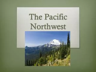
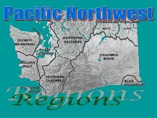
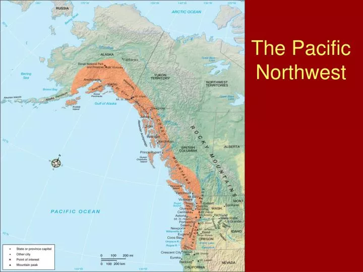
The Pacific Northwest. Physical Geography. Topography The Coast Ranges-Oregon and Washington Reach elevations of 4,000 feet Responsible for the rain shadow effect Further inland, rugged Cascades Extend north into British Columbia Merge with the Insular Mountains = Coast Mountains.

E N D
Physical Geography • Topography • The Coast Ranges-Oregon and Washington • Reach elevations of 4,000 feet • Responsible for the rain shadow effect • Further inland, rugged Cascades • Extend north into British Columbia • Merge with the Insular Mountains = Coast Mountains
Physical Geography • Mt. McKinley: the region's northern extremity • 20,320 feet in elevation • The St. Elias Mountains in Canada are the world's highest coastal mountains • Mt. Logan = 19,700 feet!
Physical Geography • Climate • Heaviest annual precipitation on continent! • Average precipitation >75 inches/year • West = ~150 inches/year • Parts of Vancouver Island ~ 230 inches/year • Winter precipitation > summer • Microclimates, but Maritime (Cfb & Cfc) dominate
Historical Settlement • Native Americans • Pre-European population = large • Based on a simple hunting and gathering economy • Large concentrations along the coast and coastal valleys • The Puyallups are one of the few remaining tribes
Historical Settlement • Early Europeans • Russians 1st! • Initially during late 1700s; Mainly fur-trading posts • 1846: US/Canadian boundary @ 49 North • Post 1846 • Alaska purchased from Russia (1867) for $7.2 million • Railroads • Asian • Latinos
Primary Sector Activities • Most crops grown for local markets • Production areas: Willamette Valley, Puget Sound Lowlands, Yakima and Wenatchee Valley, Hill Country Willamette River and Valley
Forestry • British Columbia = 45% of Canada's timber • CA, OR, WA = ~50% of US timber • First major industry, but not nationally important until the early 1900s • “Selective cutting,” “shelterwood cutting,” and “clear cutting” • Redwood National Park, 1960s, for preservationists • Japan = major market
Power and Dams • High precipitation and rugged topography = great hydroelectric potential • Rivers in OR & WA = > 40% of the US’s hydroelectric potential • Columbia River dam: greatest power generating potential • Grand Coulee = largest • Cheap power attracts heavy power-using industries to the region • No dams are permitted in Hell’s Canyon (along Snake River gorge)
Tertiary & Quaternary Sectors • Services, tourism, and high-technology industry buttress Primary & Secondary sectors • Microsoft • Starbucks • Boeing • Places in the Pacific Northwest • Vancouver, BC • Seattle, WA • Portland, OR • Alaska • Next lecture!
Seattle, WA from Space Needle Portland, OR and Mt. Hood Vancouver, BC
Readings & Resource • Anderson, Kay J. 1987. “The Idea of Chinatown: The Power of Place and Institutional Practice in the Making of a Racial Category,” Annals of the Association of American Geographers 77: 580–598. • A great sense of place article based in Western Canada’s largest city. • Ley, David. 1999. “Myths and Meanings of Immigration and the Metropolis,” Canadian Geographer 43:2–18. • David does a brilliant job assessing and analyzing immigration as only a geographer could. • Presentation: David Fronander, Biogeographer. Salmon and the Pacific Northwest.
Discussion Given its relative isolation from the rest of the country, how does the Pacific Northwest continue to thrive? Is this an exclusive behavior? How does Oregon’s motto, Alis Volat Propiis (She Flies with Her Own Wings) reflect the region’s sense of place?
Related Books • Ashbaugh, James G., ed. 1997. The Pacific Northwest: Geographical Perspectives. Dubuque, Iowa: Kendall Hunt Publishing Company. • Meinig, D.W. 1968. The Great Columbian Plain: A Historical Geography, 1805–1910. Seattle: University of Washington Press. • Regional geography doesn’t get much better than Meinig.
WebSources • Earthquake and Geologic Hazard Information: • Oregon and Washington http://www.pnsn.org/welcome.html • Alaska http://www.aeic.alaska.edu/Seis/recenteqs/ • Interactive Real-time Earthquakes! http://www.lerdorf.com/php/ymap/yquakes.php • Cascadia Times Newspaper http://www.times.org/aboutct.htm • Pacific Northwest Outdoor Recreation http://www.nps.gov/ccso/oric.htm • City of Vancouver, Canada http://vancouver.ca/