Download
1 / 26
280 likes | 460 Vues
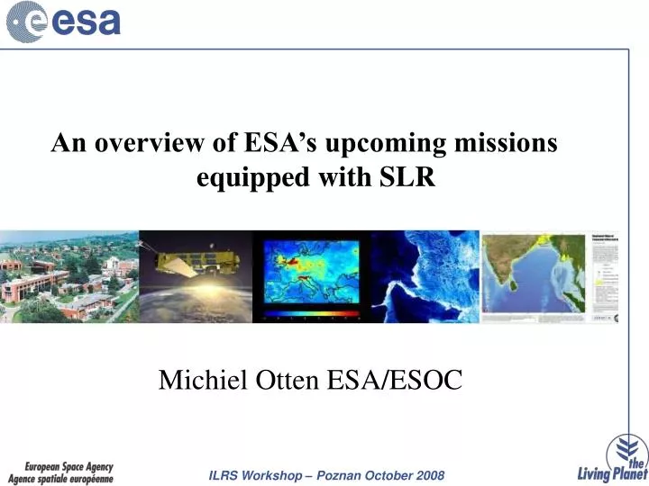
An overview of ESA’s upcoming missions equipped with SLR. Michiel Otten ESA/ESOC. Introduction. Short Overview of ESA’s Earth Observation Programme: The Living Planet. ESA’s missions with satellite laser reflector: ERS-2 & Envisat GOCE (2008) Proba-2 (2009) CryoSat-2 (2009)

E N D
An overview of ESA’s upcoming missions equipped with SLR Michiel Otten ESA/ESOC
Introduction • Short Overview of ESA’s Earth Observation Programme: The Living Planet. • ESA’s missions with satellite laser reflector: • ERS-2 & Envisat • GOCE (2008) • Proba-2 (2009) • CryoSat-2 (2009) • Swarm (2011) • Sentinel-3 (2012/14) • Galileo (2014) } CryoSat Type Laser Reflector
ERS-2 ENVISAT GOCE AEOLUS CRYOSAT-2 EARTHCARE SEOSAT SENTINELS SMOS P/L SWARM Earth Observation Missions
1990 2000 2010 2020 Meteo in cooperation with EUMETSAT METEOSAT Second GenerationMSG-1, -2, -3 METEOSATM-1, 2, 3, 4, 5, 6, 7 Science METOP-1, -2, -3 Cryosat 2 to better understand the Earth (Polar Ice Monitoring) (Gravity and Ocean Circulation Explorer) GOCE ADM/Aeolus (global wind profiles) Earth Explorers SMOS (Soil moisture) (Earth’s magnetic field) (clouds, aerosols) SWARM EarthCARE ERS-1, -2 Applications Services ENVISAT ESA Sentinels satellites + National missions (Pleiades, TerraSAR, Cosmo-Skymed,..) to initiate long term monitoring systems & services GMES Third-Party Missions: European access to non-ESA missionsALOS, SPOT-4, Landsat, MODIS, SeaWifs, Scisat ... European users
2007 2008 2009 2010 2011 2012 2013 2014 ERS-2 approved mission 3-years extension Envisat approved mission 3-years extension New orbital parameters Approved DOSTAG recommendations ERS-2 / ENVISAT The current spacecraft status allows to further extend the operations of both missions by 3-years in order to respond to the user communities demand, i.e. until 2011 for ERS-2 and until 2013 for Envisat. The Envisat 3-years extension requests a modification of the orbital parameters in 2010 as the on-board hydrazine will be almost completely consumed by 2010.
. End of phase E3 (i.e. nominal mission): (56 kg ± 15 kg remaining fuel) ~ October 2010 How to extend Envisat satellite lifetime beyond 2010 ? Extension scenario . Altitude change: -17.4 km (~34 kg needed fuel) • . Phase E4 (i.e. “extended” mission): (22 kg ± 15 kg available fuel) • . Repeat cycle: 30 days / 431 orbits • . Orbit control: altitude only, inclination drift • . MLST variation: first, 22:00 to 22:10, then 22:10 to 21:50 • . Artemis availability expected up to 2013 . End of phase E4: ~ mid 2014 (00 kg ± 15 kg remaining fuel)
GOCE (2008) GOCE(Gravity field and steady state Ocean Circulation Explorer) • First Earth Explorer Core Mission of ESA’s Living Planet Programme • First ESA Mission dedicated to the exploration of the Earth gravity field
GOCE (2008) GOCE– Many “firsts” • GOCE is very challenging being a first in many ways: • First flying a three axis Gravity Gradiometer and a Drag Free Attitude Control System at low (295 km) orbit altitude with no mechanical moving parts and active drag free control.
GOCE (2008) GOCEMission Objectives • Determine the Earth’s gravity field with an accuracy of 1 mgal (i.e. 1 millionth of the Earth Gravity) • Determine the geoid (i.e. the equipotential surface for a hypothetical ocean at rest ) with a radial accuracy of 1 to 2 cm • Achieve this at length scales down to 100 km
Proba-2 (2009) Proba-2, currently under development and due for launch in the second quarter of 2009, is the second in ESA’s series of small, low-cost satellites that are being used to validate new spacecraft technologies while also carrying scientific instruments. Proba-2 Spacecraft The Mauna Kea volcano, Hawaii, seen by PROBA-1’s CHRIS instrument.
Proba-2 (2009) • Technology demonstrations • Some of the spacecraft infrastructure technologies are: • New type of lithium-ion battery • Advanced data and power management system • Combined carbon-fibre and aluminium structural panels • New models of reaction wheels • The passenger technologies are: • Digital Sun-sensor • Dual-frequency GPS receiver • New star-tracker development being test-flown before use on the BepiColombo mission • Very high precision flux-gate magnetometer • Experimental solar panel with a solar flux concentrator • Xenon gas propulsion system using resistojet thrusters and a solid-state nitrogen gas generator to pressurise the propellant tanks • Exploration micro-camera (X-CAM)
Proba-2 (2009) Science payload Four experiments are being flown: two for solar observations and two for space weather measurements. The solar observations will be performed by a Lyman-Alpha radiometer (LYRA) and an extreme-ultraviolet telescope using new active pixel sensor (APS) technology - the Sun Watcher using AP-sensors and image Processing (SWAP) experiment. LYRA will monitor four bands in a very wide ultraviolet spectrum while SWAP will make measurements of the solar corona in a very narrow band. The space weather experiments are Dual Segmented Langmuir Probes (DSLP) and a thermal plasma measurement unit (TPMU). DSLP will measure electron density and temperature in the background plasma of the Earth’s magnetosphere. TPMU will measure ion densities and composition.
CryoSat-2 (2009) ESA’s Ice Mission CryoSat's icy mission is dedicated to monitoring precise changes in the thickness of polar ice sheets and floating sea ice over a 3-year period. The observations made over the lifetime of this mission aim to determine whether or not the Earth's ice masses are actually thinning due to a changing climate.
CryoSat-2 (2009) SIRAL (SAR/Interferometric Radar Altimeter) Because of its operations in SAR and Interferometric modes, the altimeter on CryoSat is called SIRAL, short for 'SAR Interferometric Radar Altimeter'. It is complementary to the laser altimeter on the ICESat mission. ICESat will provide very accurate results over the ice sheets, but only when they are cloud-free.
CryoSat-2 (2009) Laser Retroreflector DORIS Antenna SIRAL Orbit LEO,non Sun-synchronous Repeat cycle: 369 days (30 day sub-cycle) Mean altitude: 717 km Inclination: 92°
LRR • The retroreflector for GOCE, Proba-2 and CryoSat-2 array is based on the CryoSat-1 design and has seven corner cubes. The retro-reflectors were manufactured by the Russian Scientific Research Institute for Precision Instruments. • Detailed specification on the LRR can be found on the ILRS website. • Daily CPF predictions for GOCE provided by ESA/ESOC. But if needed frequency of predictions will be increased.
LRR Reflector Specifications: Number of reflectors 7 Effective optical aperture of individual reflectors Ø 28.2 mm Distance between input face plane and the prism vertex 19.1 mm Height of center-of-mass above ground plane 19.8 mm Height of input plane center of central reflector 48 mm Height of input plane center of lateral reflectors 28.5 mm Radial offset of input plane center of lateral reflectors 45.5 mm Tilt angle of lateral reflectors relative to central reflector 57.5° Field of view 130° Reference point Center of base plane Range correction relative to reference point 19±6 mm
The objectives of the Swarm constellation are: - to provide the best-ever survey of the Earth’s geomagnetic field and its variation in time - to use these data to gain new insight into the Earth’s interior and climate. Swarm (2011) Courtesy GeoForschungsZentrum Potsdam GFZ Courtesy EADS, Astrium www.esa.int/livingplanet/swarm
Swarm - LRR The array of the LRR shall be formed by four cube corner prisms mounted in a compact frame. This design ensures that only one prism is contributing to the signal in general, except for some cases (near culmination of the satellites for instance) where the signals of two prisms are interfering. However because of the small dimensions of the array the signature cannot be resolved by present SLR systems. This was experimentally verified by laser ranging to the LRRs of CHAMP, GRACE and TerraSAR-X (which are identical in design) by the 4th generation SLR system in Graz, Austria. Vertex length 28 mm Clear aperture of the front face 38 mm Dihedral angle offset -3.8” (smaller than 90 deg) Radius of curvature of the front face +500 m (convex) Index of refraction @ 532nm 1.461 Nominal separation of the far field maxima 24” Nominal width of the far field peaks (20% intensity of max.) 10”
Sentinel – 3 (2012/2014) Mission duration A series of satellites, each designed for a lifetime of 7 years, shall be launched to provide an operational service over 15 to 20 years. Furthermore, two satellites shall operate at any time to fulfil the mission requirements. Sentinel-3 is one element of the overall GMES system providing 2 days global coverage earth observation data for sea and land applications with real-time products delivery in less than 3 hours.
Sentinel - 3 Operational oceanography & global land applications Acquire data to feed ocean/atmosphere models and to derive global land products and services. • Sea/land colour data, in continuation of Envisat/Meris. • Sea/land surface temperature, in continuation of Envisat/AATSR. • Sea surface and land ice topography, in continuation of Envisat altimetry. • Along-track SAR for coastal zones, in-land water and sea ice topography. • Vegetation products by synergy between optical instruments. Mission orbit Type: Frozen, sun-synchronous low earth orbit Repeat cycle: 27 days (14+7/27 orbits per day). Average altitude: 814.5km over geoid Mean solar time: 10h00 at descending node. Inclination: 98.65o Launcher: VEGA/Kourou (Eurockot/Plesetzk backup) A virtually cloudless image of Madagascar, by Envisat's MERIS on 21 May 2006.
Sentinel - 3 OLCI: Ocean and Land Color instrument Swath: 1270km, with 5 tilted cameras Spatial sampling: 300m @ SSP Spectrum: 21 bands [400-1020]nm Radiometric accuracy: 2% absolute, 0.1% relative SRAL:Synthetic Radar Altimeter Operation frequency: dual C and Ku bands Pulse Repetition Frequency (PRF):1923.87 Hz Radar measurement modes: LRM and SAR Tracking modes: Closed-loop and Open-loop Total range error: 3cm SLSTR: Sea and Land Surface Temperature Radiometer Swath: 180rpm dual view scan, 750km (nadir) and 1675km (backwards) Spatial sampling: 500m (VIS, SWIR) Spectrum: 9 bands [0.55-12]um Noise equivalent dT: 50mK (TIR) POD: Precise Orbit Determination (support to the whole payload) Ground processing of GPS data with enhancement through Laser Retro-Reflector and DORIS Final accuracy: 3cm
GIOVE /Galileo The final constellation will consist of 27 operational spacecraft equipped with identical Laser Retro-Reflectors (LRR). The satellites will be evenly distributed over 3 orbit planes, in a 27/3/1 Walker constellation. That means that the R.A. of ascending nodes of the three planes are separated by 120º and the spacecraft in each plane are separated by 40º in-plane. The orbit is the same as for the GIOVE spacecraft, i.e. a 10-day ground-track repeat orbit with 17 revolutions and an inclination of 56º. Orbit: Semi-major axis: 29601 km Eccentricity: 0.002 Inclination: 56º Argument of perigee: 0º (TBC) RA of ascending node: 0º, 120º, 240º (TBC)
I would like to thank the following people for providing input:Daniel Navarro-Reyes, Pierre Femenias, Pierrik Vuilleumier, Rune Floberhagen, Mark Drinkwater, Roger Haagman and Berthyl Duesmann