Download
1 / 21
300 likes | 772 Vues
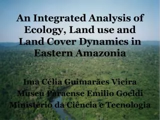
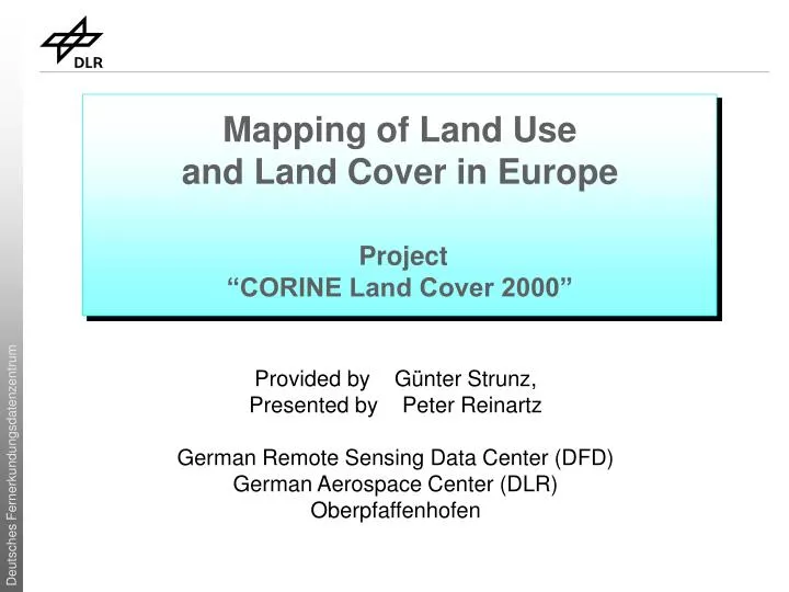
Mapping of Land Use and Land Cover in Europe Project “CORINE Land Cover 2000”. Provided by Günter Strunz, Presented by Peter Reinartz German Remote Sensing Data Center (DFD) German Aerospace Center (DLR) Oberpfaffenhofen. Introduction. „Land Cover“ versus „Land Use“ Land Cover:

E N D
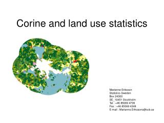
Mapping of Land Use and Land Cover in Europe Project“CORINE Land Cover 2000” Provided by Günter Strunz, Presented by Peter Reinartz German Remote Sensing Data Center (DFD) German Aerospace Center (DLR) Oberpfaffenhofen
Introduction „Land Cover“ versus „Land Use“ • Land Cover: • Physical coverage of the surface • Main categories: • Vegetation areas • Bare soil • Solid surfaces (e.g. buildings) • Water • Land Use: • Description related to the function of the land (socio-economic use), e.g. • Residential, industrial areas • Areas used for agriculture or forestry used areas • Leisure areas • Protected areas
CORINE Land Cover • CORINE Program: • Co-ordination of Information on the Environment (CORINE) • Implemented by the European Commission from 1985 to 1990 • Information system on the state of the European environment • Development of nomenclatures and methodologies, agreed at EU level • Responsibility for CORINE databases (and their updates): European Environment Agency (EEA) • CORINE Land Cover (CLC): • Largest of the CORINE databases • CLC1990 inventory, Update CLC2000, In progress CLC2006 • Key reference data sets for environmental analysis and assessment • Mainly for the European level, but also at national levels
CORINE Land Cover - Basic Specifications • Mapping scale: 1:100 000 • Mapping accuracy: at least 100 m for national and European products • Minimum mapping unit: 25 ha (for inventory) • Areas smaller than 25 ha are allowed in the national land cover database, but should be aggregated/generalized in the European database • Minimum width of linear features: 100 m Areas (min. 25 ha) Linear Structures (min. 100 m)
CORINE Land Cover - Basic Specifications Further requirements for the updating of CLC for the year 2000: • Minimum mapping unit for changes: 5 ha • Generate an up-to-date CLC database • for the land cover of the year 2000 and • land cover changes between the 1990s and 2000 • Reference year 2000, with ± 1 year • Geometric accuracy: • image data: 25 m • land cover data: 100 m • Thematic accuracy: at least 90 % • Updating frequency: every 10 year, now becoming shorter: 5-6 years
Landsat TM / 1989-1992 Landsat ETM+ / 1999-2001 CLC 2000 CLC 1990 Change Cover CORINE Land Cover - Basic Specifications • Additional reference data: • Topographic maps • Thematic maps • Aerial images + +
CORINE Land Cover - Nomenclature • CLC nomenclature is hierarchical and distinguishes • 5 classes at the first level, • 15 classes at the second level and • 44 classes at the third level • CLC nomenclature has been developed in order to map the whole European countries • CLC nomenclature is harmonized and agreed upon by all participating countries • Use of the CLC nomenclature with 44 classes at three hierarchical levels is mandatory • Additional national levels can be mapped but should be aggregated to level 3 for the European data integration
CLC2000 IMAGE2000 Decentralised activity based on national CLC databases Centralised activity based on Landsat-7 ETM CORINE Land Cover 2000 • CLC2000 project consist of 2 main components: • IMAGE2000: covering all activities related to satellite image acquisition, ortho-rectification and production of European and national image mosaics • CLC2000: covering all activities related to detection and interpretation of land cover changes, including training and correction of CLC90
CORINE Land Cover 2000 – Participating Countries • Co-funding mechanism between European Commission and each participating country (50% / 50%) • 29 countries of Europe participated CLC2000 • EU25 • Bulgaria, Croatia, Liechtenstein and Romania • plus • Serbia-Montenegro, Turkey, Norway, Iceland, Switzerland, ..
CORINE Land Cover 2000 – Quality control • Quality assurance and quality control: • Geometric and thematic quality checks • Verification: • Verification sessions by the European Technical team • To assist the national teams in producing CLC2000 database and to assure a homogenous implementation across Europe. • Discussing specific problems occurring during the production, correcting databases if necessary and thereby assuring a harmonized European CLC database • Provide the EEA with information on overall quality of work performed by the countries
CORINE Land Cover 2000 – Europ. data integration • Data integration: • Delivered national data were produced in national systems of all participating countries • Each national Coordinate Reference System (CRS) definition must be known precisely, together with its geometric relationship to a standard system • Transformation from the national reference system into the European reference system ETRS89 • Validation of the European CLC2000 • LUCAS data (Land Use and land Cover Area frame Sampling) was used for the validation of CLC2000 • Field surveys and landscape photos
CORINE Land Cover 2000 – Project in Germany • Lead of the national project in Germany: Federal Environmental Agency (UBA) • DLR-DFD was contracted for the implementation of CLC2000 in Germany • DLR-DFD‘s role: management, coordination, quality control and overall responsibility for CLC2000 in Germany • Subcontracting of companies for the CLC interpretation • Project duration: 2001 - 2004
CLC 2000: Data availability via Internet CORINE Land Cover 2000 – Project in Germany • Since December 2004 CLC2000 for Germany is available • Data ordering on Internet • Data delivery via DVD or FTP transfer • Complete data set for Germany (vector and raster data) www.corine.dfd.dlr.de
CORINE Land Cover 2000 – References • Websites: • European CLC2000 Webpage and data portal (EEA) • http://terrestrial.eionet.eu.int/CLC2000 • http://dataservice.eea.eu.int/dataservice • European IMAGE2000 Webpage and data portal (JRC) • http://www.ec-gis.org/clc • http://image2000.jrc.it • CLC2000 in Germany (UBA, DLR) • http://corine.dfd.dlr.de • Publications: • Bossard, M., J. Feranec, J. Otahel, 2000: CORINE Land Cover Technical Guide – Addendum 2000, Technical report No 40. Copenhagen, EEA, May 2000, http://terrestrial.eionet.eea.int • Büttner G, J. Feranec, G. Jaffrain, L. Mari, G. Maucha, T. Soukup, 2004: The European CORINE Land Cover 2000 Project, ISPRS Symposium, Istanbul, Turkey, July 12-23, 2004 • EEA-ETC/TE, JRC, 2002: CORINE Land Cover update: I&CLC2000 Project Technical Guidelines • Nunes de Lima, M.V. (Ed.), 2005: IMAGE 2000 and CLC 2000 Products and Methods