Download
1 / 48
480 likes | 495 Vues
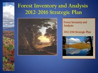
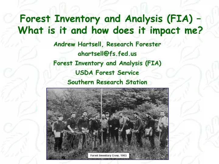
Forest Inventory and Analysis (FIA) – What is it and how does it impact me?. Andrew Hartsell, Research Forester ahartsell@fs.fed.us Forest Inventory and Analysis (FIA) USDA Forest Service Southern Research Station. Presentation Goals/Outline. What is Forest Inventory & Analysis?

E N D
Forest Inventory and Analysis (FIA) – What is it and how does it impact me? Andrew Hartsell, Research Forester ahartsell@fs.fed.us Forest Inventory and Analysis (FIA) USDA Forest Service Southern Research Station
Presentation Goals/Outline • What is Forest Inventory & Analysis? • The history of FIA • Why should we inventory forests? • So how does this impact me? • How do we do what we do? • How is the FIA data used and distributed? • Forest statistics for Mississippi
What is FIA? • FIA stands for Forest Inventory and Analysis. • It is a science and research program operated by the USDA Forest Service • Simple definition – “The Nation’s Forest Census”
The FIA program collects strategic (state or multi-county level) data on the: • Status, • Trends, and • Resource conditions, including forest health for ALL forest lands in a consistent fashion across the US
History • 1876 – Congress assigned a Special Agent under USDA to assess state of Nation’s forests • 1877 – USDA publishes report on forest conditions • 1905 – US Forest Service is created and Gifford Pinchot is named the Nation’s first Chief Forester • 1912 – FS Chief Graves identifies principles and guidelines for timber surveys • 1928 – McSweeney-McNary Act establishes Forest Survey • 1931 – Forest inventory begins in the southern US in MS • 1938 – Field work and reports for MI, WI, and MN are completed in the northeast • 1958 – USDA Timber Resource Review published; first national level report • 1967 – USDA publishes “Forest Survey Handbook” (4809.11) • 1998 – Agriculture Research, Extension, and Education Reform Act (Farm Bill) passed
Why? • Forest inventory and monitoring systems provide reliable baseline information that reveals how forests are changing over time and informs decisions about the future of forest resources. • The system that you design and implement depends on the size of area you are interested in making decisions.
At the stand or woodlot level, helps a forest landowner: • Know the health of the forests on their property. • Find out how much timber is available for sale. • Aid in estate planning and property sales. • Compute insurance claims after wildfire and other extreme weather events.
At the landscape level, helps land managers and policymakers: • Make policy decisions about resource management at the multi-county, state, and/or regional level. • Prepare and adapt for future fire conditions, climate change, and/or insect/disease threats. • Inform economic development decisions. • Assess wildlife habitat suitability. • Understand the implications of land use changes.
How does FIA help local landowners? • State and local government agencies use FIA data to attract business to their states and to assess forest damage after major disasters • Industries use FIA to locate their operations (mill locations), plan their harvesting zones, and use data for their own research and public relations. • Congress, universities, and NGOs use FIA data for a host of purposes such as climate change, detecting land use changes, alterations in habitat, funding, public relations, support for other scientific studies, etc.
How do we do what we do? • The nation is divided into four areas: Southern, Northern, Intermountain, and Pacific Northwest. • Each region manages four separate programs that fall under the FIA umbrella: FIA field plots, Timber Products Output (TPO), Forest Health, and Landowner Survey questionnaires.
FIA Zones of Responsibilities PNW has responsibility for other Pacific Islands SRS has responsibility for PR and US VI
Field crews and plots • Majority of time and resources are allocated to collecting tree and plot data by field crews • What most people associate with FIA • Longest history • Follows the same guidelines across all regions and is laid out with a nationally consistent grid, plot design, data collection, and processing systems
Measurements on all FIA Plots • Basic tree measurements – species, size, condition, number/type of defects, etc. • Plot descriptions – forest type, ownership, general size class, etc. • Area descriptions – slope, elevation, location (coordinates and political descriptions), etc.
Measurements on all FIA Plots • Plots are revisited every 5-10 years. • The same information is then collected. • Changes in volume and land-use along with growth, removal and mortality rates can be computed from this data.
Field crew composition • Historically (pre 2000) mostly federal with help from individual states • Today most data collection is performed by state personnel • National FIA provides training and quality testing and assurance
Timber Products Output (TPO) • A smaller division within FIA. • Data is based on questionnaires sent out to primary wood using mills. • Asks: What kind of wood (species-HW/SW), where are they getting it from, and what are they turning it into. • Differs from field plots but the two compliment each other • This information is frequently utilized by states and timber related industries
Landowner Survey • Led by the northern research station • Southern scientist assist the regional survey • Survey sent to all landowners that FIA plots exist • Questions pertain to landowner demographics, management strategies, and attitudes
So how does this impact me? • Be aware that state and federal field crews are out in the woods and you may encounter them • You have the right to refuse access to your land • If you have a plot you will also receive a landowner survey • You are not obligated to respond
So how does this impact me? • However, your participation will help everyone understand what is happening to our nations forests • This benefits both local, regional, and national interests • Your identity is safe • Continue to use and manage your lands as you normally would – Pretend the plot is not there!
FIA Data Use Examples Rapid Assessment of Hurricane Damage Courtesy of Dennis Jacobs and Joe McCollum, SRS FIA
FIA Data Use Examples Total live basal area Based on gradient nearest neighbor and imputation of FIA plot data Courtesy of Ty Wilson, NRS FIA
FIA Data Use Examples Acres of Private Landowners and Number of Private Landowners by Year National Woodland Owners Survey (NWOS) Results Courtesy of Brett Butler, NRS FIA
FIA Data Use Examples Timber Production in Louisiana, 1937 through 2009
FIA Data Use Examples Yadkin-Peedee Watershed
FIA Data Use Examples 2020 Dominant Land Use
FIA Data Use Examples 2060 Dominant Land Use
FIA Online and Data Distribution Presence • SRS FIA website for accessing information regarding the SRS FIA Program - http://srsfia2.fs.fed.us/ • National FIA website for accessing information regarding National FIA Program - http://www.fia.fs.fed.us/ • SRS website for SRS publications including FIA publications - http://www.srs.fs.usda.gov/index.php • On-line FIA data query tools - http://www.fia.fs.fed.us/tools-data/index.php
What do we know about MS forests? Timberland area in MS over time
What do we know about MS forests? Total standing volume (cubic feet) of all live trees and average annual removals (cubic feet) in Mississippi, 2014. Average annual removals Standing live volume
What do we know about TN forests? Average annual removals (cubic feet) of all live trees and average annual removals (cubic feet) in Mississippi, 2014. Volume (billion cubic feet) Average annual removals Average annual growth
What do we know about MS forests? Species list (top 20) - MS, 2014
What do we know about MS forests? Primary Wood-using Mill Employment by Survey Unit, in Mississippi, 2005-2011 1 2 3 4 5
What do we know about MS forests? National Woodland Owner Survey http://apps.fs.fed.us/fia/nwos/tablemaker.jsp
What do we know about MS forests? National Woodland Owner Survey http://apps.fs.fed.us/fia/nwos/tablemaker.jsp
How many oak trees are present in MS and how much is grown & removed each year?
How many oak trees are present in MS and how much is removed?
How many oak trees are present in MS and how much is removed?
How many oak trees are present in MS and how much is removed?
How many oak trees are present in MS and how much is removed?
How many oak trees are present in MS and how much is removed?
How many oak trees are present in MS and how much is removed?
Southern FIA Program Goal Faster, better, and more comprehensive coverage of all southern U.S. forest information needs!
Questions? Maurice Day, Jack Wagner, Ed Lawson, Dick Smith – FOREST SURVEY - Iron Mountain, MI, 1934 Dick Smith – FOREST SURVEY - Iron Mountain, MI, 1934