Download
1 / 12
120 likes | 276 Vues
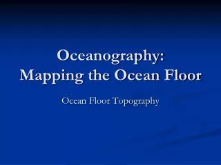
Mapping the Global Ocean Eddy Field Using a Wide Swath Altimeter Lee-Lueng Fu Jet Propulsion Laboratory California Institute of Technology Raffaele Ferrari Massachusetts Institute of Technology.

E N D
Mapping the Global Ocean Eddy Field Using a Wide Swath Altimeter Lee-Lueng Fu Jet Propulsion Laboratory California Institute of Technology Raffaele Ferrari Massachusetts Institute of Technology
A snapshot of ocean eddies from merged Jason/Envisat data provided by CLS (the best existing data) de-correlation scale 200 km
The ocean’s kinetic energy resides in scales not well resolved by a nadir-looking altimeter ground tracks of Jason (thick) and T/P (thin) Tandem Mission 100 km 10 km 100 km scale eddies 100 km
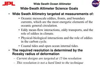
The importance of oceanic submesoscales: About 50% of the vertical motion in the world’s oceans responsible for heat and CO2 uptake takes place at the submesoscales
Estimating the vertical velocity of the upper ocean from SSH measurement Simulated W by an OGCM Reconstructed W from SSH 100 km Contours are relative vorticity P. Klein (IFREMER)
The oceanic submesoscales have not been well observed submesoscale
Radar Interferometry was successfully demonstrated by JPL’s Shuttle Radar Topography Mission (SRTM) 60m 5-10 m accuracy
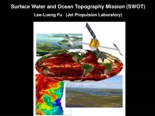
Surface Water and Ocean Topography Mission (SWOT) • 10 m mast • Ka Band (35 GHz) • 3.5 deg look angle • 120 km swath • 22-day global coverage • 2 obs/22days at the equator • > 3 obs/22days at latitudes > 50 deg • > 6 obs/22days at latitudes > 65 deg
Anticipated SWOT Performance Space time sampling Model simulated vorticity 100 km Simulated SWOT observations WSOA SWOT R. Leben/U. Colorado
Summary • SAR interferometry offers a promising approach to mapping the global ocean eddy variability down to 10 km scale. • Oceanic submesoscales are important for the kinetic energy of ocean circulation as well as the vertical transfer of heat, nutrients, and carbon to the deep ocean. • The SWOT Mission is under development for addressing both oceanographic and hydrologic objectives. • Please come to the Town Hall meeting tonight at 6:15 pm, Moscone West, Room 2018 for more information on SWOT.