Download
1 / 42
430 likes | 607 Vues
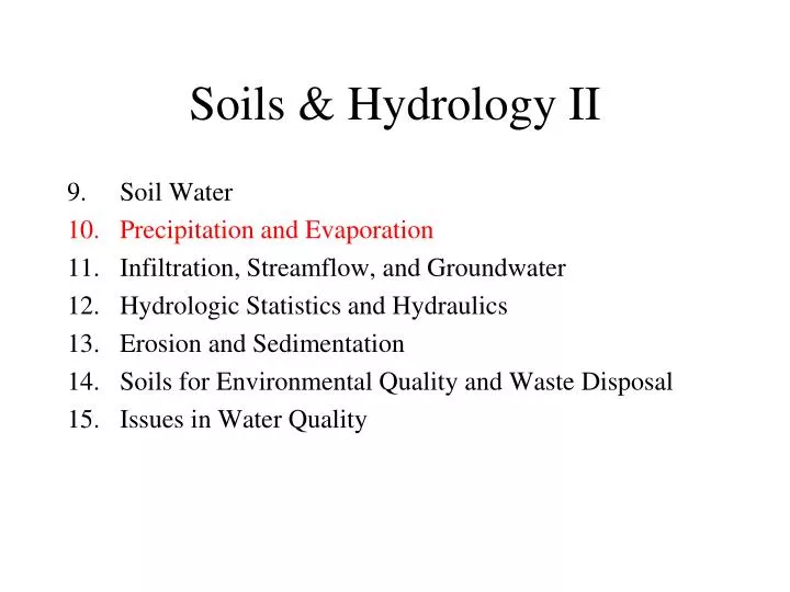
Soils & Hydrology II. Soil Water Precipitation and Evaporation Infiltration, Streamflow, and Groundwater Hydrologic Statistics and Hydraulics Erosion and Sedimentation Soils for Environmental Quality and Waste Disposal Issues in Water Quality. arid: < 10”/year semi-arid: 10 - 20”/yr

E N D
Soils & Hydrology II • Soil Water • Precipitation and Evaporation • Infiltration, Streamflow, and Groundwater • Hydrologic Statistics and Hydraulics • Erosion and Sedimentation • Soils for Environmental Quality and Waste Disposal • Issues in Water Quality
arid: < 10”/year semi-arid: 10 - 20”/yr humid: 20 - 60”/yr moist: > 60”/yr
Causes of Air Movement - Solar energy doesn’t heat Planet Earth uniformly - Air rises near the Equator and Polar Fronts - Air sinks near the Horse Latitudes and Poles These result in “Hadley cells”
Sensible Heat: heat used to raise temperature Latent Heat of Fusion: heat used to melt ice Latent Heat of Vaporization: heat used to evaporate water Absolute Humidity: mass of water vapor in a unit volume of air (mg/L) Relative Humidity: ratio of actual vapor pressure to saturation vapor pressure • Vapor Pressure: partial pressure of water vapor(mb) • Saturation Vapor Pressure: maximum vapor pressure (mb) Dewpoint Temperature: temperature at which the air is saturated, RH=100%
Dewpoint Temperature • The temperature to which a parcel of air with a given vapor pressure has to be cooled in order to reach saturation. • Air warmer than the dewpoint, RH < 100% • Air cooler than dewpoint, RH > 100%, causes clouds and rain! • Saturation Vapor Pressure • The pressure is like a tea kettle, the more water in the air, the higher the pressure • The saturation vapor pressure is the maximum amount of water that can be held • Warm air holds more water than cold air • Example: • Actual vapor pressure = 17.1 mb • Air temp = 30°C • Saturated vapor pressure = 42.6 mb • Relative Humidity = 17.1 / 42.6 = 40% • Dewpoint = 15°C • mb = millibar, a unit of pressure
Lapse Rate: Change in temperature with altitude • Dry air lapse rate: • Holds for a clear, cloudless day. • Air cools because the pressure drops with altitude • This can be blamed on the ideal gas law: P V = n R T • Wet air lapse rate: • Holds for cloudy conditions. • Wet air does not cool as quickly as dry air because water vapor gives off heat as it condenses, just like water absorbs heat when it evaporates. • Average, or environmental, lapse rate: • The actual change in temperature with altitude. • The average rate is more typical for partly cloudy conditions. Dry air: 1°C / 100 m 5.5°F / 1000 ft Wet air: 0.50°C / 100 m 2.7°F / 1000 ft Average: 0.65°C / 100 m 3.5°F / 1000 ft
Lapse Rate Examples • If the temperature in Athens is 40°F on a relatively dry fall day, what is the likely temperature at an elevation 2000 feet higher in the Georgia mountains? • Use the dry adiabatic lapse rate of 5.5°F/1000 feet. • For an elevation that is 2000 ft higher, this gives a temperature that is 11°F cooler, or 29°F. • If the temperature in Athens is 90°F on a humid summer day, what is the likely temperature at 2000 feet in the Georgia mountains? • Use the wet adiabatic lapse rate of 2.7°F per 1000 ft. • This gives a temperature that is 5.4°F cooler, or 84.6°F. • What does the temperature in Athens have to be on a rainy day for there to be snow falling at an elevation of 2000 feet in the Georgia mountains? • Use the wet adiabatic lapse rate • This gives 32°F + 5.4°F = 37.4°F
You now have a great job in Tucson, Arizona (elev = 2000’). • Unfortunately, it’s often 110°F during the summer. • You see Mt. Lemmon, which rises to 9,000 feet right outside of town. • What is the temperature at the summit on a clear, dry, summer day? • During the winter, find the temperature at the ski lodge if the temperature in Tucson is 50°F. • Why is the wet lapse rate less than the dry rate? • As wet air rises, the atmosphere becomes saturated and the relative humidity reaches 100%. • To cool further requires that the atmosphere release some of it's moisture as precipitation - rain if the air is above freezing, snow or ice if it’s below freezing. • The condensation of water releases heat - just as evaporation cools. • This release of heat warms the air slightly, so the air does not cool as fast as dry air would.
Why Does it Rain? • Air is forced to rise (reasons described below!) • Rising air cools because the ideal gas law says that the temperature falls when the air pressure decreases. • The air cools at the dry lapse rate until it reaches its dewpoint. • Once the air reaches its dewpoint, the relative humidity reaches 100%, and clouds form. • As the air continues to rise, the air cools at the wet lapse rate, causing precipitation to form because the colder air can not hold the excess moisture. • The condensing water generates heat, causing the air to warm slightly, so that the wet air lapse rate is less than the dry rate. • The excess heat generated by the condensing water causes the air to rise faster (because warmer air rises through colder air).
Raingages Thiessen Polygons • Used to estimate watershed precipitation • Individual raingages are assigned the area closest to them • The area is found by: • drawing lines between gages • bisecting the lines and drawing perpendiculars • the volume of runoff is the depth for the gage times the area.
Types of Precipitation Events • Frontal • when a cold air mass collides with a warm air mass. • At least one of the air masses must be maritime. • Convective • when moist, warm (maritime tropical) air heats near the ground surface, it warms, rises, cools, and releases its moisture as rain, hail, etc. • Orographic • when moist (maritime) air is forced upward over mountains, it cools, releasing its moisture as rain or snow. • Cyclones (hurricanes) • when a self-sustaining (non frontal) low pressure system develops in the tropics. • Mesoscale Convective Complex • Mid-latitude storm complex covers large area, but does not persist • Lake Effect Storms • Downwind of warm lake, lake evaporation increases rain and snow
Types of Air Masses • Fronts occur at the boundary of air masses • The types of air masses are:
Frontal Storms Cold Front
Orographic Precipitation Rain Shadow
Mesoscale Convective Complex • Occurs over a large area • Persists for many hours, then dies away • Not long-lived like a front or hurricane • Associated with heavy rains and flooding • Affects Midwest and sometimes Georgia
Return Period,Tr = 1 / P • A 100-yr flood has a 1% probability each year • P = 1/ Tr = 1/100 = 0.01 = 1%, • A 10-yr flood has a 10% probability • P = 1/ Tr = 1/10 = 0.10 = 10% • A median flood has a 50% probability, Tr = 2 years • Tr = 1/P = 1 / 0.5 = 2 yrs • An average flood happens every 2.5 years or so. Seasonal Distribution of Temperature and Rainfall
Evapotranspiration • Evaporation from soil & water surfaces: • Loss of water to the atmosphere by abiotic processes • Large if soil is moist and there’s no mulch or leaf cover! • Transpiration through plant tissue: • Loss of water to the atmosphere by biotic processes • Plant Factors: Leaf area, root depth, plant type. Pumping of water through roots to leaves through stomata • Soil Factors: Plant Available Water • Interception: • Precipitation falling on plant surfaces that then evaporates • About 10-20% of total precip for hardwoods, more in pines
Evaporation, a function of: • wind speed • vapor pressure deficit (VPD) • The VPD is how dry it is, a large deficit means the air is dry • VPD = es - ea = es ( 1 - RH ) • RH = ea / es is the relative humidity • ea is the actual vapor pressure • es is saturated (maximum) vapor pressure, f(temp) Seattle, WA = 30”/yr Massachussetts = 35”/yr Minnesota = 30 to 45”/yr Pennsylvania = 40”/yr Rocky Mountains = 45”/yr North Georgia = 55”/yr Los Angeles, CA = 60”/yr East Texas = 70 to 80”/yr Tucson, Arizona = 95”/yr West Texas = 100 to 120”/yr Imperial Valley, CA = 120”/yr
Potential Evapotranspiration, PET • The maximum possible transpiration by plants with unlimited soil moisture. • We usually take a percentage (e.g., 70%) of pan evaporation to estimate PET. • Actual Evapotranspiration, AET • The actual amount of evapotranspiration loss per time for given area • Depends on the type of plant, stage of growth, soil moisture, and climatic variables. • AET is less than PET • If no moisture in soil, then plants run out of water • Plant responds by • wilting • twisting the petiole so leaves are perpendicular to sun • flutter to help dissipate heat • close their leaves • Pan has plenty of water, soil doesn’t!
AET Equation • AET = Kc · Ks · PET • AET is actual evapotranspiration • PET is potential (max) evapotranspiration • From evaporation pans or models • Kc is a crop factor - changes with time • See next slide • Ks is a soil factor - changes with soil moisture • Ks = F / S, where • F is how much water in soil • S is how much water the soil can hold
Soil Factor • We use a very simple approach: • Ks = F / S • S is the Maximum Available Water • F is the Actual Available Water • This means: • If F = S then Ks = 1 and AET = PET • If F = 0 then Ks = 0 and AET = 0 • We calculate the soil storage using: • F = P - (Q + AET)
Water Budget Procedure • Find the initial water storage in the root zone • set equal to the field capacity, F(1) = S • appropriate in the spring after soaking rains • Calculate the soil factor • Ks = F / S • Calculate the AET = Kc Ks PET • Subtract AET from the soil storage, F' = F - AET • If rainfall, then add, F'' = F' + P • Subtract drainage and runoff if soil is too wet • if F'' > S, then Q = F'' - S, and F''' = S • Carry over soil moisture to next day • say from end of day 1 to beginning of day 2 • F(2) = F'''(1)
Depth of rooting zone: Ds = 20 cm Bulk density: BD = 1.70 g/cm3 Field capacity: FC = 0.20 Wilting point: WP = 0.08 Crop factor: Kc = 0.8 Soil factor: Ks = F / S AET = Kc Ks PET = 0.8 (F / S) PET PET: Given in table Max water content: S = [FC - WP] ·BD ·Ds = [0.20 - 0.08]·1.70·20 = 4.1 cm Initial water content: F(1) = S Precipitation: Given in table
Irrigation Scheduling Procedure • Find 25% of the maximum available water: • F* = 0.25 S = 0.25 · 4.1 cm = 1.02 cm • Irrigate when F falls below F*: • F < 1.02 cm on Day 9. • Determine how much water to add to bring rooting depth back to FC: • I = S - F = 4.10 - 0.97 = 3.13 cm • Determine how long to irrigate: • t= 3.13 cm / 1 cm/hr = 3.13 hours
Water Budget Approach • ET = P - R - I • P is precipitation • R is runoff • I is interception • Mature Hardwoods: P = 150, R = 70, I = 18, ET = 62 cm/yr • White Pines: P = 150, R = 52, I = 36, ET = 62 cm/yr
Paired Watershed Studies: Select two watersheds of approximate equal size, shape and aspect. Monitor streamflow for several years and find the correlation between the two. Hold one watershed as the control, and alter the second watershed, in this case by converting to grass. Monitor the change in streamflow and compare to what would have happened if the watershed had not been treated.
Effect of Sun Angle Effect of Shelterbelt Harvesting