Download
1 / 20
220 likes | 558 Vues
a) Surface levelling for addition of altimetry to a planimetric map . heights of detailed points are determined, positions of these points have already been measured, a planimetric plan is needed technical levelling with a lot of intermediate sights (detailed points) is usedintermediate sights ?

E N D
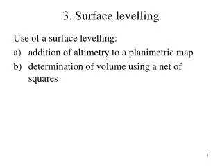
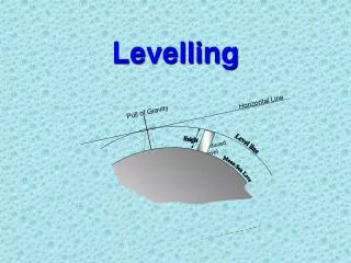
1. 3. Surface levelling Use of a surface levelling:
addition of altimetry to a planimetric map
determination of volume using a net of squares 1
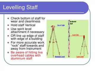
2. a) Surface levelling for addition of altimetry to a planimetric map heights of detailed points are determined, positions of these points have already been measured,
a planimetric plan is needed
technical levelling with a lot of intermediate sights (detailed points) is used
intermediate sights � a levelling rod is set on the ground (no footplate) 2
3. Surface levelling 3
4. b) Surface levelling for determination of volume using a net of squares determination of volume using a net of squares is usually used for a ground smoothing
net of squares is set out in the field (e.g. 10 x 10 m) and points are measured by surface levelling
earthwork is calculated using differences between the planned and the measured heights of the points 4
5. Underground connection by a tape a special use of direct levelling from the center between the rods
it is used for a determination of heights in excavations or mines (the height of point A is known, the height of point B is determined) 5
6. HB = HA ? z1 � (z2 � p1) � p2 = HA ? z1 ? p1 � z2 � p2 6
7. Barometric levelling atmospheric (barometric) pressure decreases in dependence on the elevation. When there is a change of the elevation about +11 m, the atmospheric pressure descents about 1 mm Hg = 1 torr.
principle of the method = measurement of atmospheric pressure
a height difference between two points is determined using measured difference of atmospheric pressure, atmospheric temperature and thermal expansion coefficient of air (mathematical formulas for calculation have been derived)
accuracy is about 1 m, advantage � rapidity of the measurement 7
8. instruments for measurement of atmospheric pressure are called aneroids
Techniques:
1. measurement with 2 instruments and 2 observers
The first aneroid is at the base point whose elevation is known and atmospheric pressure and temperature are measured at particular moments. The second aneroid is compared with the first one at the base point and then is placed at points whose elevations are measured.
2. measurement with 1 instrument
Atmospheric pressure and temperature are measured at the base point and at determined points step by step. This technique is less accurate. 8
9. Hydrostatic levelling Principle = physical law of communicating vessels.
The vessels are connected with a hose-pipe and they are placed at the points whose height difference is measured.
According to the Bernoulli�s theorem:
p1 + ?1 . g . h1 = p2 + ?2 . g . h2 ,
where p1, p2 � atmospheric pressures in vessels,
?1, ?2 � densities of liquids in vessels,
h1, h2 � relative heights of liquids in vessels,
g � acceleration of gravity.
If p1 = p2 and ?1 = ?2, heights of liquid surface in vessels create joint contour surface. 9
10. Improvised level � the simplest instrument 10
11. ?HAB = a � b
improvised levels are mostly used for a measurement of small height differences (cm) in interiors
accuracy is 3 � 5 mm, range depends on the length of the hose-pipe (about 10 m) 11
12. Hydrostatic altimeters more sophisticated construction
some requirements have to by fulfilled (e.g. special stabilization for suspension of vessels, an indicating needle is used for measurement of liquid level)
instruments are used for precise measurement of buildings deformations � baseplates, inspection galleries of dams, nuclear power stations
accuracy is about 0,1�mm 12
13. Trigonometric method 13
14. A theodolite is placed at the point A whose elevation is HA. Height of the instrument vp is measured with a tape or a folding rule. Zenith angle z to a target (e.g. prism), which is placed at the point B and its height is vc, is measured. A distance between the points A and B can be determined:
using a baseline on the terrain
by direct measurement with a total station
14
15. 1. Baseline on the terrain The horizontal angles ? and ? are measured at the points A and P, the horizontal distance b is measured by a tape: 15
16. 2. measurement of the slope distance (or the height difference) with a total station 16
17. The formulas for calculation of the elevation of point B have to be completed with an Earth curvature correction (see lecture 6) and a correction for vertical refraction.
If height differences are determined with accuracy about cm, the Earth curvature correction should be introduced to the calculation for distances longer than 300 m and the correction for vertical refraction should be introduced for distances longer than 1000 m. 17
18. Vertical refraction a sighting beam is refracted on contact surfaces of air layers over the Earth. The angle of refraction depends on layers� densities. The real trajectory of the beam is called curve of refraction and its shape is similar to an arc.
curve of refraction shape (its radius R) depends on so called coefficient of refraction which is determined using various physical and mathematical methods. 18
19. refraction (its vertical component) affects measured zenith angles (see trigonometric method).
Arm of the zenith angle is a tangent line to the curve of refraction and it is pointed at B2 instead of B. Difference q2 = ?B2B? has to be taken from the calculated height. Formulas for calculation of q2 have been derived, the difference q2 depends on the distance between points A and B and on the coefficient of refraction. 19
20. 20