Download
1 / 30
300 likes | 385 Vues
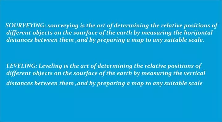
SOURVEYING: sourveying is the art of determining the relative positions of different objects on the sourface of the earth by measuring the horijontal distances between them ,and by preparing a map to any suitable scale.

E N D
SOURVEYING: sourveying is the art of determining the relative positions of different objects on the sourface of the earth by measuring the horijontal distances between them ,and by preparing a map to any suitable scale. LEVELING: Leveling is the art of determining the relative positions of different objects on the sourface of the earth by measuring the vertical distances between them ,and by preparing a map to any suitable scale
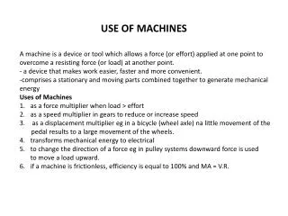
USE OF SOURVEYING 1. To prepare a topographical map ,, which shows the hills,valleys,rivers,villages,towns etc 2. To prepare a cadastral map which shows the fields and other properties. 3. To prepare an engineering map which shows the railwayes,roads,cannel etc. 4. To prepare a military map which is very important for the defence of any country. 5. To prepare a contour map which shows the best possible route for railwayes,roads,etc. 6. To prepare a geological map which shows the under ground resources 7. To prepare an archological map which shows the ancient relics
Classification Of Sourveying Primary classification 1. Plane sourveying:Planesourveying is done when the area is lass then 250 square km. 2. Geodeticsoueveying:Geodeticsoueveying is done when the area is larger then 250 square km.
Classification Of Sourveying Secondary Classification A.BASED ON INUSTRUMENT 1.Chain sourvey 2.Compass sourvey 3.Plane table sourvey 4.Theodolite sourvey 5.Photo graphic sourvey B.BASED ON METHOD 1.Tringulation sourvey 2.Travers sourvey C.BASED ON OBJECT 1.Geological sourvey 2.Mine sourvey 4.Arcological sourvey D.BASED ON NATURE OF FIELD 1.Land sourvey 2.Marine sourvey 3.Astronomical sourvey
Genaral Principle Of Surveying 1.TO work from the whole to the part. 2.TO locate a new station by at least two measurements ( linear and angular) from fixed reference points.
METHOD OF LINNEAR MEASURMENT 1.By steeping 2.By passometer 3.By speedometer 4.By chaining 5.By pedometer
RANGING ROD Ranging road RANGING ROD Ranging rod is a rod which is used for ranging a line.Genarally it is made by timber, bamboo,etc.Thecolour of the rod is alternative red and white,so that it can be visible from long distance.The lower end of the rod is provided with an iron shoe Metalic shoe
TYPE OF CHAIN ENGINEERING CHAIN:The chain is 100ft long. Number of links is 100 . And each link is 1ft long. GANDER CHAIN:The chain is 100ft long. Number of links is 100 . And each link is 1ft long METRIC CHAIN:The chain is long about 5,10,30 ft and length of per link is 25cm REVENUE CHAIN: The chain is long about 33 ft and length of per link is 33/16 ft
CHAIN ADVANTAGES 1.The can read easily and quickly 2.The can be easily repaired in the field CHAIN DISADVANTAGES 1.They take too much time to open and fold 2.The chain sags excessively STEEL ADVANTAGES 1.They sags slightly 2.They are very easy to open and fold STEEL DISADVANTAGES 1.They can not read easily and quickly 2.They can not be easily repaired in the field.
Arrows are made of tempered steel wire of diameter 4mm. One end of the arrow is bent into a ring of diameter 50mm and the other end is pointed. Its overall length is 400mm .Arrows are used for counting the number of chains while neasuring the chain line. ARROWS Arrow
INUSTRUMENT FOR CHAINING a.Chain or Tape b.Pegs c.Offsets rod d.Plumb bob e.Arrows f.Ranging rods
RANGING The process of establisingentermediat points on a straight line betweeen two ends points is knowen as ranging. There are two kinds of ranging. 1.DIRECT RANGING 2.INDIRECT RANGING
The process of establisingentermediat points on a straight line betweeen two ends points by direct observation is knowen as DIRECT ranging. DIRECT RANGING: A B C Let A and B are two ends points The two points are intervisible. Here B is a entermediat point which is establish by the direct observation of point A and point B. so it is a direct ranging
The process of establisingentermediat points on a straight line betweeen two ends points by indirect observation is knowen as INDIRECT ranging. INDIRECT RANGING C D B A LET A and B are two ends points. These are not intervisible. Here intermediat points C and D are establising by indirect Ranging.so it is a example of indirect ranging
Leader: The chain man at the forward end of the chain, who drages the chain forward, is known as leader Follower: The chain man at the rear end of the chain,who holds the zero end of the chain at the station, is known as follower.
METHOD OF CHAINING ON SLOPING GROUND DIRECT METHOD: this method is applied when the slope of ground is very steep. INDIRECT METHOD: this method is applied when the slope of ground is very long
In this method the slop of the ground is first found out by using clinometer.Hypotenusal allowance than made for each tape length.Let µ is the slope of ground.AB = AB1=20m=100 links AC=AB secµ B1C= AC-AB1 = AB secµ-100 =100 ( secµ-1) HYPOTENUSAL ALLOWANCE C B1 µ A B
OBSTACLE IN CHAINING 1.When chaining is obostracted but vision is free. 2.When chaining and vision are both obostracted. 3.When chaining is free but vision is obostracted.
When chaining is obostracted but vision is free. Souch problem arises when pond or river come across the chain line.The situation is tackled by fllowingwayes. CASE ONE When pond come across the chain line.The case is solve by fllowingwayes. F E POND A B D C FIG-A Suppose A and B is a chain line.The two points C and D is selected on it on the two opposite site of the pond.Equalparpendiculars EC and FD is erected on the points C and D. The distance EF is measured. Here CD=EF
When chaining is obostracted but vision is free. Souch problem arises when pond or river come across the chain line.The situation is tackled by fllowingwayes. CASE ONE When pond come across the chain line.The case is solve by fllowingwayes. E POND B A D C FIG-B Suppose A and B is a chain line.The two points C and D is selected on it on the two opposite site of the pond.Equalparpendiculars EC is erected on the points C. IN CED here ED2 –CE2 CD=
When chaining is obostracted but vision is free. Souch problem arises when pond or river come across the chain line.The situation is tackled by fllowingwayes CASE TWO When RIVER come across the chain line.The case is solve by fllowingwayes. B B Souppoes AB is the chain line and C,D are the two ends points of the river .At the point of C, CE is erected and bisected at the point of F.A parpenticular EG is erected at the point of E .Points D,F,G should be at same straghit.Here EG is measured and we found here that EG=CD D …………………………………………………………….. …………………………………………………………….. …………………………………………………………….. RIVER C E F A G FIG;A
When chaining is obostracted but vision is free. Souch problem arises when pond or river come across the chain line.The situation is tackled by fllowingwayes B CASE TWO When RIVER come across the chain line.The case is solve by fllowingwayes. Souppoes AB is the chain line and E,D are the two ends points of the river .At the point of D, DF is erected.Aparpenticular CG is erected at the point of C .Points E,F,G should be at same straghit. In the EDF and FGH E …………………………………………………………….. …………………………………………………………….. …………………………………………………………….. RIVER F D DF • DE HF HG C H G A FIG:B
D1 C1 F1 E1 Chaining and vision both are obstacled Souch problem is arise when building is come across in chain line.The situation is tackled by fllowing ways. Suppose AB is a chain line .two points C and D are selected at one site of the building .Equal parpenticular CC1 and DD1 is erected.C1D1 is extended until the building is crossed. On the extended line two points E1 and F1 are selected .Then parpendicular EE1 and FF1 is erected souch a way that EE1=FF1=CC1=DD1 HERE E1D1=ED E1D1 is measured anf it is equal to required distance ED BUILDING B A C D E F
WHEN CHAINING IS FREE BUT VISION IS OBOSTRACTED Souch problem arises when a rising ground or a jungle area interruptsthe chain line CASE ONE:The two end stations may be visible from some intermediat points on the rising ground .Here chaining is done by steeping method. CASE TWO:The two ends points are not visible from intermsdiat points when a jungle come across on the chain line. The case is solve by the fllowing way. jungle E1 C1 D1 P R B A C D E T Let AB is the actual chain line ,can not visible because of jungle.Let the chain line extenet up to R . A point P is selected on the chain line.And a random line PT is taken . Points C,d,E are taken on the chain line.Theparpendicular CC1 meet with the piont C1. The parpendicular DD1 and EE1 meet the point D1 and E1 .Now the distanes PC,PD,PE,CC1 is measured.from triangle PCC1 and PDD1, DD1 is measured.And from traingular PCC1 and PEE1,EE1 is measured.DISTANCE PE1=√(PE₂+EE12)
N Whole circle bearing In tis system the magnetic bearing of line is measured clockwise from north point up to the line. E W S
N Reduced Bearing In this system the magnetic bearing of a line is measured clockwise from north or south towards east or west E W S
A DETERMINE THE HIGHT OF A OBJECT F D D G C E B
Representative Fraction Distance on drawing of object RF = ---------------------------------------------------- Corresponding actual distance of object
ERRORS OF CHAINING 1.Erroures length of chain or tape 2.Bad ranging 3.Careless holding and marking 4.Bad straighting 5.None horizentaly 6.Sag in chain 7.Variation in temperature 8.Variation in pull 9.Personal mistakes A .Displacement of arrows B .Miss counting chain length C .Miss reading D .Error lo0king