Download
1 / 39
390 likes | 527 Vues
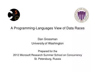
Data Sharing and the ROI from Broad Use of Digital Parcel Map Data Emerging Issues—Carson 4 Dennis Klein, Boundary Solutions, Inc, CEO Keith Johnson, Amador County (CA); GIS Coordinator José Crummett, El Dorado County (CA); GIS Manager Session Chair: George Donatello, CMS, TEAM Consulting.

E N D
Data Sharing and the ROI from Broad Use of Digital Parcel Map Data • Emerging Issues—Carson 4 • Dennis Klein, Boundary Solutions, Inc, CEO Keith Johnson, Amador County (CA); GIS CoordinatorJosé Crummett, El Dorado County (CA); GIS ManagerSession Chair: George Donatello, CMS, TEAM Consulting
Correlation between Broad Use of Digital Parcel Maps and Accelerated Property Tax Revenue Growth Dennis H. Klein AICP PEBoundary Solutions, Inc,Mill Valley, CA PH: 415 381 1750www.boundarysolutions.com
Mission Statement… Will unconstrained sharing of digital cadastral databases stimulate the economy?
Methodology… Boundary Solutions retained a qualified professional to guide the study’s analytical approach… Dr. Larry A. Rosenthal, JD PhD, Director of UC Berkeley's Program on Housing and Urban Policy Adjunct professor at the Goldman School of Public Policy
Methodology… OBSERVATION PHILOSOPHY… Experienced Train of Events is the great standard by which we all regulate our conduct. David Hume, Enquiry Concerning Human Understanding: 1748
Methodology… • Step 1.Annual Report data was gathered from over 15 state web sites from 2001 - 2006 including… • - Total Assessed Value of all Parcels. - Total Tax Levy from all Parcels.
STEP 1. Sample Data Listing Total Assessed Values All Counties
STEP 1. Sample Data Listings Total Tax Levy All Counties
STEP 2. Select counties known to be • sharing digital parcel map data. • Separated into Two Groups… • Public Records Act (PRA) Compliant Counties • (Prompt acquisition at cost of reproduction) • Data Acquisition Fee: < $250 and no significant use constraints. SAMPLE SIZE: 322 Counties (OPEN RECORDS). • PRA Noncompliant Counties • Data Acquisition Fee: > $250 • and/orsignificantly constrained use. • SAMPLE SIZE:113 Counties (CLOSED RECORDS).
STEP 3. Determined Total Assessed Value % Growth Per year 322 Open Record Counties
STEP 4. Compare Percent Growth PRA Compliant vs. PRA Noncompliant Counties TOTAL ASSESSED VALUE CHANGE PER YEAR FOR ALL PARCELS IN AVERAGE COUNTY 322 COUNTIES CHARGING < $250 COMPARED TO 113 COUNTIES CHARGING > $250
STEP 5. Compare Total Assessed Value Growth in $ for PRA Compliant vs. PRA Noncompliant Counties
STEP 6. Sensitivity Analysis $1,000 Acquisition Fee PRA Noncompliant Break Point
STEP 6. Sensitivity Analysis $0.005/Parcel Acquisition Fee PRA Noncompliant Break Point
STEP 6. Sensitivity Analysis $0.02/Parcel Acquisition Fee PRA Noncompliant Break Point
STEP 6. Compare Total Tax Levy PRA Compliant vs. PRA Noncompliant Counties Similarly the same calculations were applied to the growth rate in the total county tax levies during the same time period. It was found that, arguably, tax levy increases of the average PRA compliant county, from 2002 to 2006, is $12 million higher than the average noncompliant county by the fifth year.
Implications to a Large Cost Recovery County Wayne County, MI$167 Million Missed Property Tax Levy in 5th year alone.
FINDING: Robust Correlation between Broad Use and Accelerated Property Tax Base Growth vs. Closed Record Counties. These findings intended to be used by Assessor and/or GIS Coordinator at budget time to attain needed funding from general fund to best maintain and improve the VERY digital parcel maps that are causing this increased tax base growth.”
FINDING: Time Period First Five Years Many USA Counties had a Digital Parcel Map to Share for the First Time. According to BSI’s National ParcelMap Data Portal MetaData database, tax base growth nosed up, arguably, due, in part, to ever broader use of the digital parcel layer.
Same Findings May Apply to Counties with NO MAP. Counties with NO MAP are like closed record counties; neither enjoys broad use due to a lack of data availability. Establishment of a broadly used digital parcel map for five years or so will arguably yield comparable accelerated property tax revenue growth enough to easily pay back the initial map production and ongoing maintenance costs.
But Why do Open Records Spawn so much more Tax Base Growth than Closed Records Counties? Four Possible “Mechanisms” causing Accelerated Tax Base Growth. 1. Improved Real Estate Information Operations 2. Attraction of Highly Capitalized Economic Development 3. Long-term Improvement in the Built Environment 4. Reduced Insurance Premiums
Possible Mechanism 1 Improved Real Estate Information Operations Open records spawns broad use among everyone involved real estate from major banks to the smallest individual broker. When this transition from quill pen to digital data models enables everyone to do their jobs better, Increased local confidence enhances the area’s desirability. Location location… Leads to higher valuations Subsequent increased property tax levies.
Possible Mechanism 2 Attraction of Highly Capitalized Economic Development Developers/investors in Hong Cong to Prague to the county next door, looking for “dream dirt” prefer to take their chances in the light of day than to muck about in a dark room. Hence, Highly capitalized “green” investment is drawn to open records jurisdictions where everyone can see everything vs. closed record jurisdictions which are “invisible”.
Possible Mechanism 3 Long-term Improvement in the Built Environment What gets built is very much a function of local politics, permitting processes and available information. No change in first two are suggested or expected. However, there is a recent fundamental change in the third factor: Digital parcel layers are adding a vital spatial dimension to the analyze/plan/design/build process that optimizes what gets built more than before. Only broad use enables ubiquitous improvement in decision making processes. All these more optimized decisions.. Turn into a more attractive built environment, Hence, location Hence, higher property valuation and property tax levies.
Possible Mechanism 4 • Reduced Insurance Premiums • The increased accuracy of risk assessment by replacing a buffered point with a boundary expected to enable a 12 – 15% reduction in premium price by eliminating the underwriting need to cover only guessing. Since… • Insurance is not subject to sales tax. • Consumer goods purchased with insurance savings are. • Increased sales tax revenues follow.
Conclusions… Regardless of reasons why, open record counties have been realizing greater property tax base growth than closed record counties during the first five years of wide use of digital parcel maps.
Conclusions… Regardless of reasons why, open record counties have been realizing greater property tax base growth than closed record counties during the first five years of wide use of digital parcel maps. Revisit Prior Presentations forReasons Why…
RECAP: Amador County “Precedent does not yet exist to discuss specific relationship between open records and tax revenues in Amador County. However… availability of open records gives Amador a positive and helpful image, contributing to its attractiveness as a community in which to work, build and live.”
RECAP: Amador CountyHow might open records help our Amador County’s tax revenues? • Creates a more business-friendly environmentPresents County in a welcoming lightInspires developers to say “Let’s work with these folks”
RECAP: Eldorado County Private Sector Advantages All use the same base map for project reviews. Constraints can be identified ahead of time. Hazards and risks can be mitigated. Improved impact notification.
RECAP: El Dorado CountyCommunity/NGO Advantages Developers and conservancies can work together. Impacts and mitigation measures identified up front. Improves community and neighborhood management of cultural resources.
RECAP: El Dorado County Improved government trust. Improved government efficiency. Improved data accuracy. Improved government transparency.
RECAP: Boundary Solutions Inc. Open Records is a “symptom” of transparent government, a style of governance that tries to serve all interested parties equally. Rather than catering only to the economically advantaged, transparent government encourages participation by all possible players from the most to the least well off.
RECAP: Boundary Solutions Inc. End game of “Opaque Government” (closed records)… A few preferred interests prosper while all the others are sidelined, discouraged from even trying. Fewer projects of lower quality get implemented, throttling tax base growth.
RECAP: Boundary Solutions Inc. End game of transparent government (open records)… All interests having an equal opportunity to compete in the market place leads to far more economic development projects of higher quality, pushing up the tax base.
RECAP: Boundary Solutions Inc. SO… TRANSPARENCY appears to be self rewarding. Arguably, closed record counties that go open records will most likely enjoy a bump in their tax base as well as an attendant change in “style” that leads to adjustments of long standing protocols to make them more favorable to a vibrant local economy.
NEXT STEPS… “For years BSI has been promoting the tax-revenue benefits of open records, and these preliminary findings are quite impressive. It does appear there may be substantial differences in property tax-base growth, depending upon the extent of access to digital parcel records by all sectors. The industry, as well as federal, state, and local government officials, should stay tuned to BSI's continuing research in this area.”. Dr. Larry A. Rosenthal, JD PhD, Director of UC Berkeley's Program on Housing and Urban Policy Adjunct professor at the Goldman School of Public Policy CONSULTANT TO BSI
NEXT STEPS… Increase sample to all jurisdictions sharing their digital parcel layer with industry. Apply further economic analysis to qualify these findings. Analyze Sales Tax Revenue Impacts (insurance, utilities). Tax base impactdue to private sector geoservers broadening use. Respond to more suggestions by… IAAO members IAAO Workshop Members: Parcel Data to Protect and Rebuild Communities Parcel GIS Managers/Coordinators
NEXT STEPS… Respond to suggestions by… IAAO members IAAO Workshop Members: Parcel Data to Protect and Rebuild Communities Parcel GIS Managers/Coordinators