Download
1 / 16
160 likes | 291 Vues
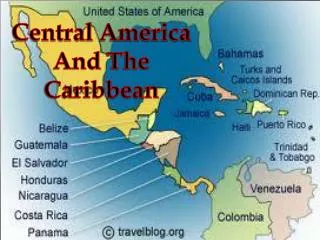
Data Rescue and Use: WMO Region IV North and Central America and the Caribbean. Nancy Westcott, Atmospheric Sciences Researcher Midwestern Regional Climate Center Illinois State Water Survey, Prairie Research Institute University of Illinois. WMO CCl Task Team on Data Rescue,

E N D
Data Rescue and Use: WMO Region IV North and Central America and the Caribbean Nancy Westcott, Atmospheric Sciences Researcher Midwestern Regional Climate Center Illinois State Water Survey, Prairie Research Institute University of Illinois WMO CCl Task Team on Data Rescue, 21 November 2012, Accra Ghana
Outline • NOAAs NCDC – National Climate Data Center • NCDC • CDMP program status • Crowdsourcing • NCDC and CICS (Cooperative Institute for Climate and Satellites) • Essential Climate Variables • Paleoclimate research • International Collaboration • State Climatologist example
National Climate Data Center (NCDC) • Responsible for acquisition, archive and dissemination services for climate and environmental data • Includes: • Stewardship for in-situ, satellite, and radar data and information • CDMP (1999-2012) – rescue and preserve historical climatic and environmental data.
NCDC CDMP –Program Status • Placed 57 million images and 14 terabytes of data online, over 12 years • Surface hourly weather records keyed through CDMP continue to be integrated into NCDC’s digital database holdings (back to 1893). • In addition, crowd-sourcing and collaborations with other agencies / countries, other partners used to move forward. • Group has formed to promote reintroduction of historical data set rescue CDMP program.
Land Based Data and Products • http://www.ncdc.noaa.gov/oa/land.html#dandp • GHCN – Global Historical Climate Network • ISD – Integrated Surface Database • Hourly Surface Data • Paleo data • Radar data • FYI, web site development, much easier to find and obtain data from NCDC. • Free data, as of this year
CDMP - FORTS The CDMP “Forts” project is extending daily data records from the beginning of the Weather Bureau era (~1892) as far back as the 1780’s. 39 possible variables; time of observation, variables, siting requirements changed over time. 450 stations digitized. 350 stations quality controlled.
CDMP-FORTS Data Availability • Images of original forms, available through NCDC EDADS web site • Daily Max, Min Temperature; daily precip are in GHCN • To get all quality controlled data (all variable and at-hour values), must request access from MRCC; • Note link to MRCC on http://www.climatol.eu/DARE/
20th Century Reanalysis Project • Gil Compo – project leader. • In partnership with the International Atmospheric Circulation Reconstruction over the Earth (ACRE) • Time period: 1871 – 2008: PRESSURE DATA • http://portal.nersc.gov/project/20C_Reanalysis/ • For USA, next plots use CDMP-FORTS data provided in 2008. • Remaining Qced data provided for the Sparse Input Reanalysis for Climate Applications, 1850-2012, scheduled for 2013.
NCDC/CICS Satellite Data • NCDC and CICS (Cooperative Institute for Climate and Satellites) are deriving climate data records (CDRs) for atmospheric and terrestrial features using satellite data that data back to the 1970s. Global Essential Climate Variables • 50 Essential Climate Variables (ECVs) from satellite data for past 35 years, to support the work of the UNFCCC and the IPCC.
“Signature” graphic showed problem & potential Climate Data Records
Crowdsourcing • NCDC partnering with other institutions and transitioning to using public volunteers to digitize records through Crowdsourcing and Citizen Science Alliance ( http://www.citizensciencealliance.org/ ) programs or ZooUniverse: ( https://www.zooniverse.org/#climate ) : • Old Weather. Helping scientists recover worldwide weather observations made by Royal Navy ships around the time of World War I. These transcriptions will contribute to climate model projections and improve a database of weather extremes. • http://www.oldweather.org • Tropical Cyclones. Scientists at NOAA's National Climatic Data Center need help to classify over 30 years of tropical cyclone data.
NCDC: Extending The Climate Record Through International Collaboration Data sharing agreements can provide major improvements in data coverage e.g. The Australian Bureau of Meteorology recently provided daily temperature records for more than 1500 additional stations A more than 10-fold increase in previous Global Historical Climate Network - Daily data as a result of holdings from Australia Before After
State Climatologist Example • Federal program ended abruptly 1972. • In 1974, reformed by those interested in being state climatologists, some with funding, some not. • Often within a state agency or within a university, but often with a title but no funds. Most state have SC, not all. • Most states now have a state climatologist, but still funding varies from state to state, programs vary. • SCs linked by a list-serve (email), telephone, an organization web site, an annual meeting. • SCs (and offices) confer on concepts, “climate vs weather”, on technology, on data issues, on public relations issues …. • They have formed their own community with a purpose. Are acknowledged by NOAA, NWS etc, sometime get grants for activities. Not perfect.