Download
1 / 54
540 likes | 544 Vues
GBOV aims to facilitate the use of ground-based observations and their comparison to Earth Observation products for land surface processes understanding and validation.

E N D
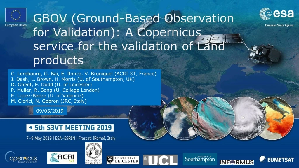
GBOV (Ground-Based Observation for Validation): A Copernicus service for the validation of Land products C. Lerebourg, G. Bai, E. Ronco, V. Bruniquel (ACRI-ST, France) J. Dash, L. Brown, H. Morris (U. of Southampton, UK) D. Ghent, E. Dodd (U. of Leicester) P. Muller, R. Song (U. College London) E. Lopez-Baeza (U. of Valencia) M. Clerici, N. Gobron (JRC, Italy) 09/05/2019
GBOV’s objectives • GBOV aims at facilitating the use of observations from operational ground-based monitoring networks and their comparison to Earth Observation products • Component 1 • Collection of multi-year ground-based observations of high relevance for the understanding of land surface processes from existing global networks. • Component 2 • Upgrade of existing sites with new instrumentation or establishing entirely new monitoring sites to close thematic or geographic gaps. • Component 3 • Implementation and maintenance of a database for the distribution of Reference Measurements (RMs) and the corresponding Land Products (LPs ; match-ups) • LP are derived to match CGLS products • LP only should be used for EO products validation
Ground-Based Observations for Validation (GBOV) • Land Monitoring Service • https://land.copernicus.eu • GBOV is attached to the GLOBAL land monitoring service • https://land.copernicus.eu/global • And is accessible under the “Groundbased” tab • https://land.copernicus.eu/global/gbov • https://gbov.acri.fr @CopernicusGBOV
Component 1 • Collection of ground data fromexisting sites
Data base summary • 53 sites • 20 short wave sites (LP1 & LP2) • 20 vegetation sites (LP3, 4 & 5) • 10 soil moisture sites (LP6) • 13 LST sites (LP7) • 2 <= time series <= 4years • To be extended in phase 2
GBOV short wave radiometry • 2 Reference Measurements (RMs) and 2 Land Products (LPs) • https://land.copernicus.eu/global/gbov/public/docs/products/GBOV-ATBD-RM1-LP1-LP2_v1.2-Energy.pdf SurfRad
GBOV short wave radiometry • 20 sites in total: • FLUXNET (10 sites) • SURFRAD (7 sites) • BSRN (3 sites)
GBOV short wave radiometry • Reference Measurements • Land Products (1km) 3km
Status and plan for 2019 • Status • LP1 960 (macropixels) • LP2 960 (macropixels) • Plan • Extension of the data base up to December 2018
GBOV VEGETATION • 4 Reference Measurements (RMs) and 3 Land Products (LPs) • https://land.copernicus.eu/global/gbov/public/docs/products/GBOV-ATBD-RM4-RM6-RM7_v1.2-Vegetation.pdf • https://land.copernicus.eu/global/gbov/public/docs/products/GBOV-ATBD-LP3-LP4-LP5_v1.2-Vegetation.pdf DHP
GBOV VEGETATION • 20 NEON sites
GBOV VEGETATION • Reference Measurements • Land Products • including quality indicators and uncertainties 20m res 300m res 300m res WGS84 3km
Exemple of GBOV LAI time series • Bartlett Experimental Forest • IGBP : Mixed Forest • Biome: Temperate broadleaf and mixed forests • LandCoverClass: Tree cover, mixed leaf type • Disney Wilderness Preserve • IGBP : Woody Savanna • Biome: Temperate conifer forests • LandCoverClass: Grassland
Status and plan for 2019 • 50673 DHP images processed to generate 7755 RMs (2585 each) • RMs upscaled to generate 2,232 LPs between 2013 and 2017 • LP-3 (LAI) 744LP-4 (FAPAR) 744LP-5 (FCOVER) 744 • In comparison, the existing CEOS LPVvalidation database for vegetation (DIRECT 2.0) contains just 242 samples • Plan • Extension of the data base up to December 2018 • Improvements of uncertainties
GBOV Soil Moisture • 2 Reference Measurements (RMs) + 1 Land Product (LP) • https://land.copernicus.eu/global/gbov/public/docs/products/GBOV-ATBD-RM10-RM11-LP6_v1.2_SoilMoisture.pdf
Soil Moisture • 10 sites over Europe, North America and Australia
Soil Moisture • Reference Measurements • Land Products • 3 SSM (recommended to use TDVI) • 8 SWI (1, 5, 10, 15, 20, 40, 60 &100cm)
Exemple of SSM time series Comparison of the three proposed methods over the Valencia Anchor Station (2014)
Status and plan for 2019 • Status • LP6 480 matchups • Plan • Extension of the data base up to December 2018 • 2 new sites • Tumbarumba • Hainich
GBOV Land Surface Temperature • 3 Reference Measurements (RMs) and 1 Land Product (LP) • https://land.copernicus.eu/global/gbov/public/docs/products/GBOV-ATBD-RM2-RM8-RM9_v1.3-LST.pdf • https://land.copernicus.eu/global/gbov/public/docs/products/GBOV-ATBD-LP7_v1.1-LST.pdf SurfRad
GBOV Land Surface Temperature • 13 sites
Land Surface Temperature • Reference Measurements • Land Products (5km) • 1 daily • 1 night time • Including uncertainties
Status and plan for 2019 • Status • 614 daily matchups • 614 night time matchups • Plan • Extension of the data base up to December 2018 • 2 new sites: Manhatan, Gobabeb
Component 2 • Installation of new instrumentation on existing sites
Status and plan for 2019 - 2020 • Upgrade of existing sites with new instrumentation • Reduce geographical gap (Europe and Australia) • 3 new vegetation sites • Hainich national park - Broadleaved Deciduous (CEOS LPV supersite) • Valencia Anchor station - Mediterranean crop • Tumbarumba - Broadleaved Evergreen (CEOS LPV supersite)
GBOV Vegetation • Reference Measurements • Continuous • PAR network (all sites) Apogee SI121 • Automated Hemispherical camera (on Hainich site) • Field visits (all sites, at least 12 times during year) • LAI (LiCor) • Digital Hemispherical Photographs Unique Setup!
GBOV LST • Reference Measurements • Continuous LST on Tumbarumba and Hainich • LW_in (Apogee SI121) and • LW_out (Heitronics KT15.85) • Field visit (at least 12 times during year) • LSE & LST Cimel 312
GBOV aerosol • Reference Measurements • Continuous on Hainich and Tumbarumba • AOT + VSF (Cimel 318 ; to be attached to AERONET)
Valencia Anchor station • PI Ernesto Lopez Baeza (UVEG) • Long term monitored site (IGBP: crop land ; wine yard) • Infrastructure • 15m height tower + small radiometry tower + Eddy convariance station (New) • Internet connection for communication to be improved • Powered through solar panels • Field trips are routinely performed by UVEG • Once a month during winter • Every two weeks during the growing season • Operational infrastructure used in GBOV includes • Meteo and Soil moisture data
27/07/17 VINE 1 27/07/17 VINE 2 27/07/17 VINE 3 10/03/17 VINE 1 10/03/17 VINE 2 10/03/17 VINE 3 Valencia Anchor 28/03/18 FRUIT TREE 10/05/18 VINE 1 10/05/18 VINE 2 10/05/18 VINE 3
Tumbarumba station • PI William Woodgates (CSIRO) • Long term monitored site (IGBP: EvergreenBroadleaf) • Infrastructure • 70m height tower with two platforms • 40m height canopy • Internet connection on top of the tower data transfer facilitated • Power through diesel generator and batteries no power limitation • Regular field trips are routinely performed • CEOS super site • Operational infrastructure used in GBOV includes • TOC-R and Albedo • Soil Moisture in 2019
Hainich • PI Alexander Knohl & Lukas Siebicke, Uni of Goettingen • Long term monitored site (IGBP: Mixed Forest) • infrastructure • Flux tower (scaffolding type) height above canopy • Shed with main power (2° power line available) • Internet connection • Main species • Fagus sylvatica (hêtrecommun/Beech • Fraxinus excelsior (Frêneélevé/ Ash) • Regular field trips are routinely performed • Lidar airborncampains organized every three years • CEOS super site • Operational infrastructure used in GBOV includes • TOC-R and Albedo • Soil Moisture in 2019
Component 3 • Data access and documentation
https://land.copernicus.eu/global/gbov @CopernicusGBOV Web portal overview
Eight tabs (1) • Fancy images • GBOV news (data release, project events • Conferences • Publications … • Project overview • Site description (country, coordinates, PIs IGBP, Biome, network …
Eight tabs (2) • Product User Manual, ATBDs, RM and LP definition • Data access page (select variables, sites and time frame • FAQ and link to contact us • GBOV service activity statistics
GBOV Data Policy • Free and open access • BUT • Required to acknowledge Copernicus and GBOV service partners • Offer co-authorship to site captains if their data are used in peer reviewed papers