Download
1 / 39

E N D
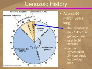
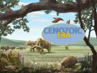
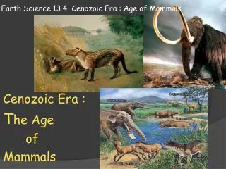
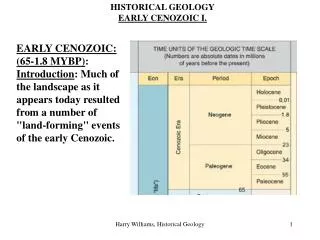
The Cenozoic Era Spans the 65.5 Ma, from the end of the Mesozoic to today.There is not agreement in the Earth science community about whether the Cenozoic should be sub-divided into Tertiary and Quaternary or into Paleogene, Neogene and Quaternary. Both classifications are used.
The Cenozoic Era The Tejas transgression began and ended during the Paleogene. Starting at about the middle of the period, cooling at both poles led to a long period of global cooling and sea level fall. The fall in sea level led to the development of many of the Atlantic Coastal Plain’s interesting geologic features like a stair-step series of scarps (paleo-shorelines) and terraces (wave-scoured sea floor). By the Neogene, the Earth’s polar climate had cooled to the point that both sea ice and continental glaciers began to grow. By the Neogene, Earth’s climate was locked into “Icehouse Earth” – the Earth’s climate was (and still is) cold enough that minor changes in the shape of the planet’s orbit causes extensive ice ages.
The flat-lying Atlantic Coastal Plain (ACP) contains a thick sequence of sediments weathered from the Appalachians and deposited during the Zuni (Cretaceous) and Tejas (Eocene) transgressions. The ACP strata at the surface are progressively younger, with Cretaceous and Eocene strata cropping out farthest inland. The ACP sedimentary wedge thickens toward the ocean, reaching a thickness of several kilometers in offshore canyons. The Atlantic Coastal Plain
The Atlantic Coastal Plain Scarps and Terraces The scarps mark places where coastal erosion occurred in the past. In other words, they mark the positions of shorelines in the past. The terraces were formed by slightly offshore erosion and deposition in the shallow ocean. Dorchester Scarp
Geologic Provinces of the Southern Appalachians Appalachian Plateau Relatively flat lying sedimentary rocks deposited during the major transgressions and orogenies of the Paleozoic. The hilly topography is controlled by river drainage. Coal in the Appalachian Plateau strata are targets for strip mining and mountaintop removal mining because it is relatively flat lying seams.
Geologic Provinces of the Southern Appalachians Valley and Ridge The deformed and faulted sedimentary rocks of this province were deposited at the same time as the flat lying rocks of the Appalachian Plateau. These strata were deformed and faulted by the great Alleghanian Orogeny, which shoved giant blocks westward for dozens of miles. These blocks are bounded by very large thrust faults.
Geologic Provinces of the Southern Appalachians Blue Ridge This province contains primarily Proterozoic aged plutonic and metamorphic rocks, including parts of the Grenville orogen. The amount of uplift necessary to expose these deep crustal rocks is on the kilometer scale. All three Paleozoic orogenies contributed to this massive uplift.
Geologic Provinces of the Southern Appalachians Peidmont Usually heavily weathered igneous and metamorphic rock similar to the Blue Ridge as well as rocks that formed during the rifting of Pangaea (rift basin sediments and igneous dikes). Piedmont Province rocks underlie the sedimentary deposits of the Atlantic Coastal Plain.
Geologic Provinces of the Southern Appalachians Atlantic Coastal Plain Lightly lithified and unconsolidated sediment deposited during marine transgressions in the Cretaceous Period and Cenozoic Era. The province extends into the Atlantic Ocean to the edge of the continental shelf. Fall Zone This sedimentary material is more easily eroded than crystalline rock, so the eastern boundary is a “fall zone”, where the gradients of rivers steepen suddenly as they dig into the softer material of the coastal plain.
Atlantic Coastal Plain Arches and Embayments The eastern margin of North America has been folded into a series of arches and embayments by tectonism associated with formation of the Caribbean plate and persistent northward movement of Cuba. The bays fill with thick packages of sediment when sea level is high. Fall Zone Fall Zone
Eastern North America is presently a passive continental margin Ultimately oceanic crust will break along the continental margin and subduction of Atlantic basin crust will begin, just as it did with the Iapetus Ocean during the Paleozoic.
The Western Margin of North America The FarallonPlate continued to subduct under North America until today only the Juan de Fuca and Cocosplates remain. Along the way, many, many terranes that were originally embedded in the Farallon Plate became part of North America. The subduction of the Farallon-Pacific spreading center caused many geologic changes, including the establishment of the San Andreas fault system
An eastward-advancing wave of hot mantle caused... Extension that formed the Basin and Range Wind River Range, a Laramide uplift Cretaceous-Tertiary Laramide uplift of Archean crust that formed the Rocky Mountains Uplift of the Colorado Plateau
E-dipping Permian (left), Triassic (red) and Jurassic (tan) sandstone beds (right) on the E Flank of the Wind River Range (a Laramide Archean basement uplift). View toward the NW from Red Canyon Overlook near Lander, Wyoming Oregon Trail
Centers of Cenozoic Cordilleran Volcanism Columbia plateau flood basalts Cascade Range Yellowstone hot spot Snake River Plain San Juan volcanic field Arizona volcanic field
Columbia River Plateau Columbia Plateau, Snake River Plain, and Yellowstone: Products of the Yellowstone Mantle Plume Hot Spot Northwestward movement of N. A. over the hot spot in the Mid Tertiary caused eruption of the Columbia Plateau flood basalts. Then N. A. began moving toward the SW, forming the hook-like shape of the Snake River Plain flood basalts
Yellowstone Calderas Island Park Caldera Erupted the Huckleberry Ridge tuff 2 Ma Henry’s Fork Caldera Erupted the Mesa Falls tuff 1.3 Ma Yellowstone Caldera Erupted the Lava Creek tuff 0.6 Ma
Subduction of the Juan de Fuca plate along the Cascadia subduction zone is responsible for the Late Tertiary to recent volcanism of the Cascade Range volcanoes Cenozoic Volcanism in the Cascade Range
San Francisco Mountains, Arizona Late Cenozoic volcanism formed the San Francisco Mountains Volcanism ceased ~ 1200 years ago They are remnants of a stratovolcano that blew its top
The Circum-Pacific and Alpine-Himalayan orogenic belts, Earth’s present-day major mountain building belts Earth’s Major Orogenic Belts
Volcanism, seismicity, and deformation in the Alpine-Himalayan orogenic belt extends eastward from Spain through the Mediterranean region into Southeast Asia The tectonism, due to collision of the Arabian, African and Indo-Australian plates with the Eurasian plate, The Alpine-Himalayan Orogenic Belt Eocene (50–40 Ma Miocene (25–15 Ma caused closure of the Tethys sea
Is occurring in response to northward movement of the African and Arabian plates toward southern Europe The convergence is causing deformation along a linear zone from Spain eastward through Greece and Turkey and along Africa's northwest coast The Alpine Orogeny The Alps in Southern Germany Products of the Alpine Orogeny Alps (France, Germany, Switzerland) Pyrenees (Spain and France) Apennines (Italy)
Subduction of Mediterranean crust under Italy, Greece, and Turkey continues to cause volcanism and seismicity In 1999 an earthquake killed 17,000 people in Turkey Italy and Greece Mount Vesuvius, Italy, has erupted 80 times since it destroyed Pompeii in A.D. 79 Mount Etna, Sicily, is Earth’s most active volcano
The Mediterranean Basin Most of the water flows into the Mediterranean Sea from the Atlantic Ocean through the Strait of Gibraltar Northward advance of the African plate ~ 6 Ma closed the Strait of Gibraltar, caused the Sea to dry up When the dam broke, a colossal flood from the Atlantic ocean rushed into the basin and re-filled the sea
Subduction of the Cocos plate under western Central America is causing mountain-building and volcanism Subduction of the Nazca plate under western South America is causing mountain-building and volcanism Subduction of the Pacific plate under western Asia is causing mountain-building and volcanism in Japan and the Philippians The Circum-Pacific Orogenic Belt
Global Cooling and Warming Since the Archean Paleogeography during the Permian Ice Age
Changes in Sea Surface Temperatures Since the Eocene High The Pleistocene “Ice Age”
Pleistocene Ice Ages and Interglacial Intervals The Pleistocene began 1.6 Ma, ended 10,000 years ago Four major periods of widespread glaciation occurred, were separated by warmer interglacial periods
Two Notable Pleistocene Terminal Moraines Cape Cod Long Island End moraines
Glacial and Pluvial Lakes Glacial Lake Missoula Wave-cut shore lines cut by Glacial Lake Missoula Great Salt Lake Pluvial Lake Bonneville Channeled Scablands formed by the Missoula flood
Pleistocene Glaciation of the Northern Hemisphere Climate Belts Maximum Extent of glaciation in the Northern Hemisphere
Sea Level Change during the Past 20,000 Years Global warming has been occurring for 17,000 years
Positions of the coastline of North America during the Ice Age and if the ice sheets melt
What is thought to... • ...have caused the Pleistocene Ice Age? • Formation of Central America deflected the Gulf Stream and moist air northward, produce more snow • Northward movement of North America and Eurasia provided more surface for snow accumulation • ...also cause/contribute to occurrence of ice ages? • Milankovitch cycles, natural periodic changes in • Earth’s orbital eccentricity • Tilt of Earth’s axis • Precession of Earth’s axis, of the equinoxes • Cause periodic changes in the amount of sunlight at high latitudes • Lead to natural periods of global cooling and warming • Excessive volcanism, etc.
Milankovitch Cycles A change in Earth’s orbital eccentricity occurs every 100,000 years A 2° change in tilt of Earth’s axis occurs every 41,000 years A precession of Earth’s axis occurs every 23,000 years