Download
1 / 14
140 likes | 268 Vues
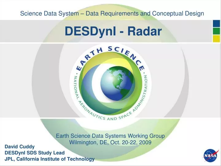
Science Data System – Data Requirements and Conceptual Design DESDynI - Radar. Earth Science Data Systems Working Group. Wilmington, DE, Oct. 20-22, 2009. David Cuddy DESDynI SDS Study Lead JPL, California Institute of Technology. Overview of Presentation. Mission Overview

E N D
Science Data System – Data Requirements and Conceptual DesignDESDynI - Radar Earth Science Data Systems Working Group Wilmington, DE, Oct. 20-22, 2009 David Cuddy DESDynI SDS Study Lead JPL, California Institute of Technology
Overview of Presentation Mission Overview End-to-End Data Flow Diagram Key Driving SDS Design Requirements Science Data Product Suite – Radar SDS Architecture & Functional Diagram Algorithm-to-Production Software Process Data Storage and Archive Strategy Data Distribution Challenge to DAACs
Science • Recommended by the NRC Decadal Survey for near-term launch to address important scientific questions of high societal impact: • How do we manage the changing landscape caused by the massive release of energy of earthquakes and volcanoes? • How are Earth’s carbon cycle and ecosystems changing, and what are the consequences? • What drives the changes in ice masses and how does it relate to the climate? • Planned by NASA as one of the following 4 Decadal Survey TIER 1 Missions • SMAP • ICESat-II • DESDynI • CLARREO • Extreme events, including earthquakes and volcanic eruptions • Are major fault systems nearing release of stress via strong earthquakes • Eruptive state of volcanoes? • Shifts in ecosystem structure and function in response to climate change • How will coastal and ocean ecosystems respond to changes in physical forcing, particularly those subject to intense human harvesting? • How will the boreal forest shift as temperature and precipitation change at high latitudes? • What will be the impacts on animal migration patterns and invasive species? • Ice sheets and sea level • Will there be catastrophic collapse of the major ice sheets, including Greenland and West Antarctic and, if so, how rapidly will this occur? • What will be the time patterns of sea level rise as a result? Deformation Biomass Ice Dynamics
Science (cont’d) Observation Targets (Colored) • DESDynI Mission Sciences • Deformation of Solid Earth for improving forecasts of seismic and volcanic events • Ecosystem Structure for improving carbon budget and carbon cycle modeling • Dynamics of Ice for improving understanding of changes in ice masses and climate • Instrumentation • Multi-beam Profiling Lidar • Fully-polarimetric Multi-mode L-band Radar • GPS receivers for precision orbit determination and reconstructions Repeat Pass InSAR Polarimetric SAR Multibeam LIDAR Pass 1: Before Motion Pass 2: After Motion Ground or ice motion Vegetation structure
DESDynI Mission/Study Highlights • SCOPE • Baseline: One Radar S/C and one Lidar S/C • Radar S/C (JPL): 761km. 8-day, sun-synchronous, frozen with precise repeat control • Lidar S/C (GSFC): 400km, 91-day, sun-synchronous, frozen • Launched within one year with seasonal co-observations • Tandem-L Option (JPL & DLR): Add one more Radar S/C to Baseline for formation flying • Collaboration with DLR • Classification (tentative) • Category I, P/L Risk B–/C+, L/V Risk 2-3 • TIMELINE • FY10 (Pre-Phase A) • Mission Concept Review (Feb ‘10) • KDP-A (May ’10) • (Earliest) Life Cycle [NASA budget + 2 years] • Phase A/B (20M): Oct ‘10 – May ’12 • Phase C (31M): Jun ‘12 – Dec ’14 • Phase D (15M, incl. 3M OOCO): Jan ‘15 – Mar ’16 • Phase E Norm. (36M): Apr ‘16 – Mar ’19 • Phase E Ext. (24M): Apr ‘19 – Mar ’21 • Phase F (6M): Apr ‘21 – Sep ’21 • Tandem-L Option may add more time Lidar S/C w/ Fixed 1.0m Lidar Radar S/C w/ 15m (D) 1 F/D reflector arrayed feed antenna DESDynI Baseline DESDynI w/ Tandem-L
DESDynI End-to-End Data Flow – Radar Legend NASA-Supplied Project-supplied Lidar Data Products Provider External Data Archive & Distribution (DAAC) DESDynI-Radar S-Band, Ka-Band MOS/GDS SDS Validated Science Data Products Lidar Data Products NASA TDRSS Station L0 b / L1 Data Products Information Management Life-of-Mission Data Storage Project & Instrument Team Data Access Radar Telemetry Radar Instrument Data Processing Science Data Analysis Comm Cloud Cmds Plb HK RT HK RT & Plb HK Plb HK Flight Ops Monitoring & Control L2/3, L3/4 Science Data Products S/C Provider L0b, L1, L2/3 Data Products S/C Cmds L2 / 3 / 4 Science Data Processing Instrument Cmds Instrument Monitoring Science Data Processing Realtime (RT) & Playback (Plb) HK
Key Driving SDS Design Requirements • Total Mission Data Volume: 44 TB/day, 34 PB over 3-yr or 51 PB over 5 years 3) • Processing Loading: Sized to meet respective product availability (latency) requirements with no backlog and with margin to include TBD reprocessing Notes: 1) Acquisition volume is assumed fixed at 1 GB/sec over Ka band for 45 min/orbit 2) Assumed Operational User data products less than 1% of the total data product volume 3) 1-year rolling storage is assumed for SLC products • Data Acquisition Volumes:Radar – 4.9 TB per day1) • Data Product Types:31 standard products (1 L0b, 10 Level 1’s, 13 Level 2/3’s, 6 L3/4’s) • Data Product Availability: • Provisional Products For Science Team Use - • Level 0b No backlog on daily basis • Level 1 15 hours from availability of all requisite Level 0b data product and GPS; No backlog on daily basis • Level 3 6 hours from availability of all requisite Level 1 data product • Level 4 6 hours from availability of all requisite Level 3 data product and LIDAR • Operational Users 2) - • Level 1 4 hours from availability of the relevant Level 0a • Level 3 4 hours from availability of the relevant Level 1 data product
SDS Architecture & Functional Diagram • Modular SDS Architecture: • SDS Central Node - • manages information and resources (info on data, computing, services, etc) across SDS • provides a web-based portal for discovery and access to data and services • SDS Instrument Product (Radar) & Expert (‘Solid Earth Deformation’, ‘Ecosystem Structure’, and ‘Dynamics of Ice’) Nodes - • provide catalog, testbed, processing (L0b & up), ‘Life-of-Mission’ storage, and distribution functions Real-time Access to Catalog, L0b and higher products, Ancillary Data, Science Analysis Software Notes: DAAC – Distributed Active Archive Center Pipeline data flow
SDS Node Architecture – Instrument & Expert Nodes Data and Services Registration @ SDS-Central Receipt/Delivery of Data Products Query/Receipt of Metadata Processing Control System Profile/ Registry Server Product Receipt/Delivery Server File Mgmt Resource Mgmt Product Catalog Product Repository Workflow Mgmt PGEs (Computational processing with product-specific PGEs): L0b, L1, L2, .... PGEs (Computational processing with product-specific PGEs): L0b, L1, L2, .... Algorithm Testbed PGEs (Computational processing with product-specific PGEs): L0b, L1, L2, .... Notes: Processing Control System provides a pipeline for cataloging, process management, computational processing, and workflow management Profile/Registry server allows for distributed queries of data within the node Product/Delivery Server allows for on-the-fly processing and delivery of data products from the node. Algorithm testbed/PGE supports instrument or science algorithm development, science product generation, and data analysis functions Product Repository includes Life-of-Mission storage and data product staging area
Algorithm-to-Production Software Process Algorithm Software Formulation & Prototyping ATBDs * Algorithm Software Delivery Review Production Software Development - Single Executable Testing - Multiple Executable Pipeline Testing - System I&T Production Software Release Review SDS Testbed SDS Operational System Production Software Deployment * ATBD: Algorithm Theoretical Basis Document
Data Storage and Archive Strategy • Distributed Storage Strategy • Data resides where it is generated • Data exists for project use • Centralized Information Management • Manages information and resources across SDS • Provides a web-based portal for discovery and access to data and services • Delivers validated* products to DAAC’s for long term archive • DAAC’s to provide archive and distribution to the public • DAAC’s are TBD • Investigate trade off of data storage vs data re-generation • Rolling archive/storage for high volume products * Could be preliminary validated through enhanced validated
Data Distribution Challenge to DAACs • Data volume: • Multi-terabytes per day • Total number of data sets: 31 • DESDynI addresses three major disciplines • Solid Earth Deformation • Ecosystem Structure • Dynamics of Ice • Interest in DESDynI data will include scientific investigators, government agencies, corporate and public users • DESDynI data may have much greater public interest • We have a formidable job ahead for DESDynI data