Download
1 / 15
150 likes | 269 Vues
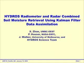
HYDROS Radiometer and Radar Combined Soil Moisture Retrieval Using Kalman Filter Data Assimilation X. Zhan, UMBC-GEST P. Houser, NASA-GSFC, J. Walker, University of Melbourne, and HYDROS Science Team. Spinning 6m dish. HYDROS: Hydrosphere States Mission.

E N D
HYDROS Radiometer and Radar Combined Soil Moisture Retrieval Using Kalman Filter Data Assimilation X. Zhan, UMBC-GEST P. Houser, NASA-GSFC, J. Walker, University of Melbourne, and HYDROS Science Team
Spinning 6m dish HYDROS: Hydrosphere States Mission • NASA Earth System Science Pathfinder mission; • Surface soil moisture w/ 4%vol. accuracy and Freeze/Thaw state transitions; • Revisit time: Global 3 days, boreal area 2 days • L-band Radiometer sensing 40km brightness temp. with H & V polarization; • L-band Radar measuring 3km backscatters with hh, vv, hv polarization; • Soil moisture products: 3km radar retrievals, 40km radiometer retrievals and 10km radar and radiometer combined retrievals.
HYDROS OSSE: Observing System Simulation Experiment To access the potential accuracy of HYDROS instruments in soil moisture retrievals using a set of 1km land surface states simulation data SM retrieval approaches: 1)Fine scale radar; 2)Coarse scale radiometer; 3)Median scale combined; Why combined method? 1) Account for missing data. 2) Use noisy high-res radar to downscale coarse radiometer. 3)Use information in overlapped observations. Assimilation approach: Assimilate radar backscatter and radiometer brightness observations into a combined soil moisture retrieval. 1 2 3 1 2 3 4 4 5 6 7 8 9 9 km Soil moisture product 8 5 6 7 11 12 9 10 3 km Radar footprint 16 13 14 15 36 km – Radiometer footprint
OSSE Simulation Data Set • TOPLATS 1km hydrological model input and output from Crow [2001] (SM, vegetation, soil, Tsoil, Tskin, Precip(Rf )) for the Red-Arkansas River Basin for 34 days from May 26 to June 28, 1994. • AVHRR NDVI composite from June 1995; • Vegetation and Soil parameters derived by HYDROS Science Team; Data Domain Land Cover
Extended Kalman Filter Data Assimilation • Data Assimilationmerges observations & model predictions to provide a superior state estimate: Xa= Xb+K(O -Ô) Ô = h(Xb,0) • Extended Kalman Filter (EKF)tracks the conditional mean of a statistically optimal estimate of a state vectorXthrough a series of forecast and update steps Update steps: Compute theKalman gain: Forecast steps: Project the State ahead: Project the errorCovariance ahead: Update State estimate with observation: Update the errorCovariance:
EKF DA Retrieval Data Flow Chart Aggregate forcing Radar forward model Radiometer forward model 1 km SM, LC, ST, Tsoil, Tskin, NDVI, rf 3/36 km Precipitation 1 km Tbs 1 km Sigmas aggregate aggregate 3/36 km Sigmas LSM 36 km Tbs Resample or aggregate Gaussian Noise Gaussian Noise 3/36 km Sigmas 3/9/36 km SM “Truth” 3/36 km SM Estimate 36 km Tbs EKF Data Assimilation Algorithms 3/9/36 km SM Retrieval Errors 3/9/36 km SM Retrievals
EKF Data Assimilation Retrieval Experiments • 1. Do DA retrievals only at 3km scale and aggregate them up to 9km scale, use a former instrument error rate setup to compare the DA retrievalaccuracy with mathematical inversion method: tb1: Use Tbv & Tbh only ts1: Combine Tbv & Tbh with vv, hh & vh Tbv & Tbh: 36km obs having 1.0K noise vv, hh & vh: 3km obs having 0.5dB noise 2. Retrieve SM by using 36km Tb inversed SM rather than a LSM as Xb and assimilating sigmas into Xb with reproduced OSSE data: Kp = 0.15 and 3x3 moving average smoothing; 3. Retrieve SM by using 36km Tb inversed SM rather than a LSM as Xb and assimilating sigmas into Xb with various sigma noise levels: Kp = 0.05, 0.10, or 0.15
RMSD of EKF DA SM Retrievals ___ EKF DA Retrieval, ___ Math Inversion Previous OSSE data set with sigma noise = 0.5dB tb1 ts1
RMSE of Different SM Retrievals Reproduced OSSE data set with sigma noise Kp = 0.15 Sigma Inversion: Mathematically inverse sigmas EKF Assimilation: 2D EKF 144 elements of X and 434 element Z Tb Inversion: Mathematically inverse Tbh or Tbv
Spatial Comparison of Different SM Retrievals Reproduced OSSE data set with sigma noise Kp = 0.15 Sigma Inversion EKF Assimilation RMSE = 10.5% Tb Inversion RMSE = 6.5% -50 -20 -10 -4 4 10 20 50 %VMS RMSE = 6.7%
Impact of Sigma Noise on SM Retrievals Kp = 0.05 Dry area Kp = 0.15 Kp = 0.10
Impact of Sigma Noise on SM Retrievals Kp = 0.05 Wet area Kp = 0.15 Kp = 0.10
Impact of Sigma Noise on SM Retrievals Kp = 0.15 RMSE = 10.3% Kp = 0.10 RMSE = 9.2% Kp = 0.05 RMSE = 6.3% -50 -20 -10 -4 4 10 20 50 %VMS
Summary and Discussions • Using Kalman Filter data assimilation algorithm may combineHYDROS passive and active observations to produce useful median resolution soil moisture data; • KF DA can also be used for SM retrieval with a more physically detailed land surface model for the background estimate Xb; • With EKF DA retrieving SM, VWC and Ts simultaneously may be possible by using all radar and radiometer observations.