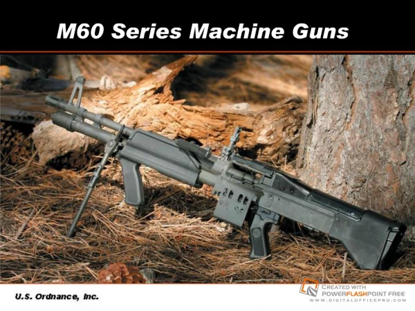
Download
1 / 22
220 likes | 313 Vues
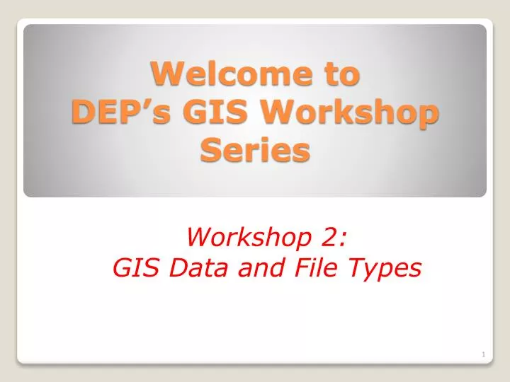
Welcome to DEP’s GIS Workshop Series. Workshop 2: GIS Data and File Types. Explanation of Some GIS Terms Spatial Data – any data that can be represented as a location on the face of the Earth.

E N D
Welcome to DEP’s GIS Workshop Series Workshop 2: GIS Data and File Types
Explanation of Some GIS Terms Spatial Data – any data that can be represented as a location on the face of the Earth. GIS – Geographic Information System - is any system for capturing, storing, analyzing and managing data and associated attributes which are spatially referenced to Earth. GIS File Types in DEP
Explanation of Some GIS Terms Vector Data – Data that contains individual features such as rivers, lakes, roads, soils, aquifer protection areas, dam sites. Also known as feature data. Raster Data – Data that is just a “picture” and contains no information about individual features. For example, the topo maps are raster data. There is no information about individual features such as rivers, lakes, etc. other than what is viewed in the “picture”. Also known as image data. GIS File Types in DEP
Explanation of Some GIS Terms Points – That spatial data type that consists only of points, or locations, on a map. An example is dam locations in Connecticut. Lines – That spatial data type that consists only of lines on a map. An example is roads. Polygons – That spatial data type that consists only of areas on a map. An example is DEP state parks parcels. GIS File Types in DEP
Explanation of Some GIS Terms Feature Class, Dataset, Datalayer – These are all terms that refer to one “layer” of data on a map. For example, the feature class “Named Waterbodies” contains only waterbodies. The feature class “Soils” contains only soil areas. The feature class “Dams” contains only points on the map where dams are located. Rasters or images are also considered datalayers. For example, the USGS Topographic Quadrangle Maps is a datalayer. GIS File Types in DEP
GIS File Types • Coverages • Shapefiles (.shp) • Raster or Image Data (.tif, .sid, .jpg, .bmp, etc.) • Personal Geodatabases (.mdb – same as an Access database) • File Geodatabases (.gdb) • ArcSDE Databases (best accessed through layer files) GIS File Types in DEP
Coverages • Old format • Used in ArcView 3 and earlier versions • No longer editable in ArcGIS 9.3, but can be displayed • Cumbersome File Storage • Can include export files (.e00 file extension) GIS File Types in DEP
Coverages Coverage Files Export Files GIS File Types in DEP
Shapefiles • Has become a worldwide standard for GIS data • Can be displayed and edited in ArcGIS 9.3 and in all earlier versions of ArcView. • Has multiple files for storage; can be cumbersome. For example, all of these files as viewed in Windows Explorer make up one shapefile: Town.shp, Town.shx, Town.sbx, Town.sbn, Town.prj, Town.dbf Using the Desktop Administrator and GIS File Types in DEP
Aquifer Protection Area Shapefiles Using the Desktop Administrator and GIS File Types in DEP
Raster or Image Files • Raster Files do not have identifiable or editable features • Many types of raster (image) files can be used in ArcGIS: • .tif, .jpg, .png, .gif, .bmp, .sid, .dwg Using the Desktop Administrator and GIS File Types in DEP
Personal Geodatabases • Is an Access Database (.mdb file) • All spatial data and tables reside in one file • Easy storage format • Topology can be used for spatial accuracy • Can contain multiple types of data (tables, feature classes, layers, rasters, etc.) • Maximum file size: 2 gb Using the Desktop Administrator and GIS File Types in DEP
File Geodatabases • Data stored in a folder with an extension of “.gdb”. • Contains a number of files • Is meant for large amounts of data • Is very fast at data retrieval • Is more efficient than a personal geodatabase • Is a new file type, not yet well known or used. GIS File Types in DEP
ArcSDE Data • Stands for Spatial Data Engine • Managing spatial data and relational databases with large amounts of data • Is the future of GIS data in DEP • Most efficient for large organizations • Can support multi-user editing • Works with SQL, Oracle GIS File Types in DEP
Example of ArcSDE Files GIS File Types in DEP
What are Layer Files? • Characterized by “.lyr”. • Does not contain actual spatial or attribute data, only “points to” data • Determines symbology, scale levels, table view, data view • Can have multiple datasets in one layer • Easy to use – just add one .lyr file GIS File Types in DEP
Example of Layer Files GIS File Types in DEP
What is the R: Drive? • Central repository for all GIS data • Contains all file types that exist for a datalayer • Will soon be replaced by a different GIS storage area on the Y: Drive GIS File Types in DEP
Chart of R: Drive Files Vs. ArcSDE Files Navigate to C:\ArcGIS_Training\Class2\ Open the following file: Rdrive_and_SDE_Layers.pdf This is a list of the old R: drive files and their corresponding files in SDE GIS File Types in DEP
Class Exercise • Open ArcCatalog • Navigate to the following folder: • \My Documents\Class2\GISFiles\ • What types of GIS files do you see in this folder, i.e. shapefiles, SDE files, coverages, layer files, file/personal geodatabases, etc.? • ____________________________________ • ____________________________________ • ____________________________________ • ____________________________________ GIS File Types in DEP
Class Exercise - Answers • File geodatabase “Habitat.gdb” • Personal geodatabase “Statewide_Trails.mdb” • Layer file “Connecticut_Town.lyr” • Shapefile “Dam.shp” GIS File Types in DEP