Download
1 / 39
400 likes | 623 Vues
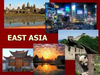
East Asia. Physical Geography. Countries of East Asia. China North Korea South Korea Mongolia Japan. Comparing Data. A Human Perspective. The Great Wall remains one of the largest building feats in history— Keep out invaders from Mongolia, Central Asia invaders

E N D
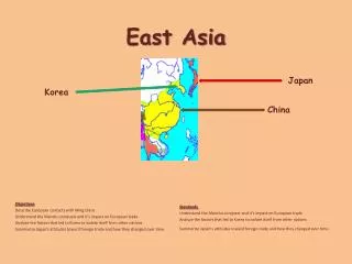
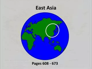
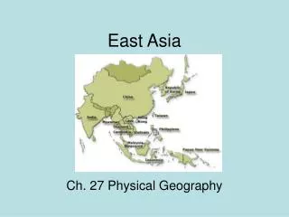
East Asia Physical Geography
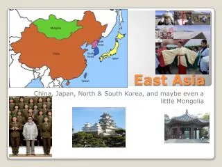
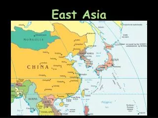
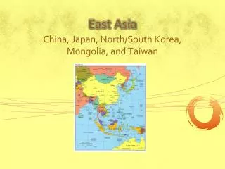
Countries of East Asia • China • North Korea • South Korea • Mongolia • Japan
A Human Perspective • The Great Wall remains one of the largest building feats in history— • Keep out invaders from Mongolia, Central Asia invaders • From the Yellow Sea to the Gobi Desert. • Hundreds of thousands of peasant workers, of which many died from the backbreaking labor or the severe weather.
Landform: Mountains & Plateaus • High mts. has limited contact between people and their isolation. • 1. Kunlun Mountains in western China, QinlingShandimts. in east central and southeastern China. • The Kunlun are the source of two of China’s great rivers, the Huang He (Yellow) and the Chang Jiang (Yangtze). • The QinlingShandi divided the northern part of China from the south. • 2. Plateau of Tibet, the TarimPendi Basin in Western China, and the Taklimakan Desert in western China. Gobi Desert. • This area is under populated and has restricted movement. • Few flat areas exist, it has some low basins & barren deserts. • The Gobi Desert cover about 500,000 square miles, larger then Texas and California.
Peninsulas and Islands • East Asia includes a number of important peninsulas; one peninsula contains independent nations, Macao was owned by Portugal until 1999, it was return to the Chinese control. • 3. Features several peninsulas including the Shandong Peninsula, the Leizhou Peninsula, and the Macao Peninsula; long coastline permitted development of several major port cities, such as Shanghai. • The isolation of the islands has permitted them to develop in greater security and peace than parts of the mainland. • 4. Japan, Taiwan, Hainan, and part of Hong Kong • In 1997, Hong Kong when back to China (British colony); Japan, enormous economic power; Taiwan at one time belonged to mainland China, is still claimed by China.
River Systems • The sea and the river get their names from the yellow silt (soil) carries to its delta. Another name is “China Sorrow” because of the floods its has caused. • 5. Huang He (Yellow River) in northern China, runs 3,000 miles from the Kunlun Mountains to the Yellow Sea • Longest river in all of Asia. Its name mean “long river”. It has been a major trade route since ancient time. Still carries most goods shipped on China waterways. It floods frequently. • 6. Chang Jiang (Yangtze River) flows 3,450 miles from Tibet to the China Sea
Runs in south of China. Meet with three other rivers to form an estuary. • 7. Xi Jiang (West River) runs eastward, joins Pearl River (Zhu Jiang), and runs into the China Sea • It is important also because in 1950, Chinese troops entered the Korean War by crossing the river and attacking United Nations forces. • 8. Yalu River forms borders between China and North Korea
Resources of East Asia • Unevenly distributed throughout East Asia. • China is rich in natural resources • Mongolia and North Korea has substantial mineral resources • Japan, South Korea, & Taiwan have limited resources, but they have grown into major economic power.
Land and forests • Mountains means less land available for agriculture. Valleys are highly productive, allowing for the growths of rice and many other crops. • 1. Land for agriculture is limited and in river basins. Forest are abundant throughout the region except Mongolia. • Mountains less populated. • Forests are also in abundant; China, Japan, Taiwan and both North & South Korea have forest resources. Japan has been able to keep most of its forest by importing it.
Mineral and Energy Resources • China’s resources have enabled it to be self-sufficient for much of its history. • Japan’s shortage of resources has forced it to trade for what it needs. • 2. China has abundant petroleum, coal, and natural gas; Korea and Japan have coal. China’s minerals include iron ore, tungsten, manganese, molybdenum, magnetite, lead, zinc, and copper. North and South Korea have tungsten, gold, and sliver. Japan has lead, silver, and coal.
Water Resources • China’s long river systems are important to the country’s economy. • 3. China’s rivers supply irrigation, hydroelectric power, and transportation; sea is source of food in East Asia. • To control flooding on the Chang Jiang and produce electricity, China is building the Three Gorges Dam. • The Huang He & Xi Jiang also provide hydroelectricity and transportation.
1. along Mongolia’s and China northern border with Russia • 2. cool to cold summers and brutally cold winters; dry • 3. evergreen forests, mosses, and lichens • 4. western China • 5. variable temperatures • 6. variable vegetation includes forests and tundra • 7. northeastern China, North Korea, northern South Korea, and northern Japan • 8. moderate
9. temperate grasslands • 10. Southeastern China, southern South Korea, southern Japan, and northern Taiwan • 11. moderate • 12. deciduous and coniferous forests • 13. parts of the Mongolian plateau • 14. dry • 15. short grasses • 16. western China, northern China, and southeast Mongolia
17. dry • 18. little vegetation • 19. small strip of land along China’s southeastern coast, Hainan, southern tip of Taiwan • 20. high temperatures, heavy rainfall, high humidity • 21. tall, dense forests of broadleaf trees
Human-Environment Interaction • 1. will be the world’s largest dam, built on Chang Jiang • 2. control flooding • When completed, the dam will tower more than one mile wide and 400 miles wide. • At least 1,000 towns and villages will disappear under the water.
Arguments have come about, if the dam should have been built, but the reason listed before and now; was enough for the Chinese government in 1993. • 3. Generate huge amounts of electrical power • 4. increase movement of goods by ship in China through locks. • Negative effects: • Human cost, up to two millions and historical sites • Cost more than it originally anticipated. 11 billion and could go up to 75 billion • Environment concerns: animals habitats areas removed
Use of Space in Urban Japan • Japan has a different problems than those facing China. Japan is made of mts. Islands & most cities cannot expand to absorb any more of the population. • 1. no more room for some cities, like Tokyo, to grow; more than 60 percent of the Japanese live on only about 3 percent of the land; air and noise pollution in cities
Problems Related to Crowding and it solutions • 2. small homes; apartment living; landfill used to reclaim land • Houses are small compare to Americans standards. • Sparsely furnished • People sleep on thin mattresses & are rolled up during the day. • Not uncommon for family of four to live in a one bedroom apartment. • Some move to the suburbs, but they have to drive from 2 to 3 hours back & forth.