Download
1 / 34

E N D
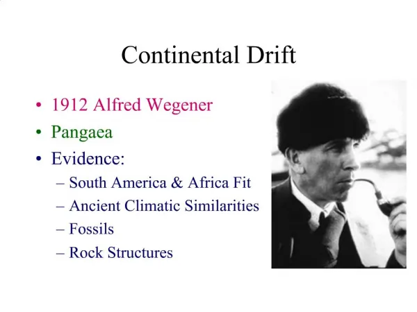
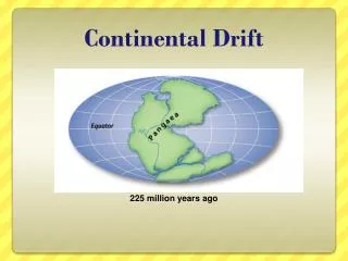
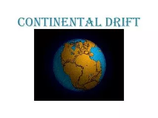
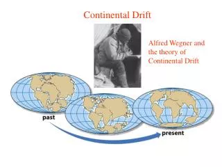
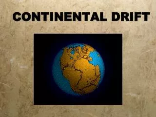
History of geological science: Continental Drift is not plate tectonics.Jigsaw fit of continents was noted by Alfred Wegener, a german meteorologisthe proposed “Continental Drift” in 1915 saying the continents once fit together as one and naming the supercontinent Pangaeathe idea was considered absurd->no mechanism for moving continents
Wegener’s evidence1. fit of continents2. matching up past glaciations3. distribution of equatorial climate belts4. distribution of fossils/ fauna across continents5. matching up of rocks/geologic unitsCriticism: explanation for how it could happen did not make sense---continental crust can’t plow through the ocean crust
Wegener-Continental Drift This animation presents a view of the continents at the level of map precision available to Alfred Wegener, who proposed that the continents once existed as a vast supercontinent, Pangea, that later fragmented. Test the fit of the continents for yourself by clicking and dragging a continent to a new location; then, using the arrow keys on your keyboard, rotate the continent into position. PC versionMac version
03_03a.jpg 2. Matching up of past glaciations
03_04.jpg 3. Equatorial climate belts
03_05.jpg 4. Matching up of fauna
03_06.jpg 5. Matching up of rocks, geological units
The story unfolds: paleomagnetismAs we talked about earlier, Earth has a magnetic field.It is due to convection of the molten Fe in the outer core (geodynamo)magnetic north pole is not the geographic north pole- the difference for a given location is the declinationthe Earth’s magnetic field has a component of direction (N-S) and a dip angle (magnetic inclination):both can be recorded in magnetic minerals
the direction of the field is easily recorded in some minerals, especially magnetitejust like a compass needles, tiny grains of magnetite (or a few other Fe bearing minerals) crystallize in rocks at the surface. The little magnetic domains in these minerals align with the magnetic field (once they are below the curie Temperature)this gives:1) direction to magnetic N pole2) the dip of the field which depends on latitude.
More trouble…Paleomagnetic analysis along with radiometric dating indicated the magnetic N pole was moving all over the place with time-worse yet, different continents gave different polar paths -> this was called apparent polar wanderWait! If the same data were interpreted to reflect a fixed pole but wandering continents, everything worked. YIKES!But still, how do continents drift???
More info: ocean depth Hard to know the shape of the ocean floor-not until WWII did sonar develop to measure bathymetry (shape of seafloor surface). Right in the middle of the Atlantic Ocean, there was a big mountain range! There was also high heat flow, a particular type of earthquake (reflecting tensional forces) and sediment thickness increased away from the mountain range… Seafloor bathymetry showed flat seafloor but big mountain range in middle of the Atlantic...and there was high heatflow in these mountains... and these mountain ranges were locations of particular type of earthquakes....
One last piece of info:maps of earth quake locations was not random--rather EQ found along distinct belts including the mountain range in the Atlantic
Harry Hess’s hypothesis • Proposed the idea of sea-floor spreading: • Seafloor spreads and cracks • Magma ascends and forms new oceanic crust made of volcanic rock • Crust must be consumed somewhere--said it descends in ocean trenches. Testable as will be shown -> got the big picture right but in detail more than just crust that is created and destroyed
How to test the hypothesis Paleo magnetics gets used again: Geologists working on volcanic rocks on land noticed that the magnetic field of the Earth flipped directions on an irregular basis (this has to do with the geodynamo, and yes it could happen today or tomorrow…) These are called polarity reversals Magnetometers towed across the Mid-Atlantic Ridge revealed stripes of alternating magnetic direction recorded in the ocean crust--and it was symmetrical across the ridge!
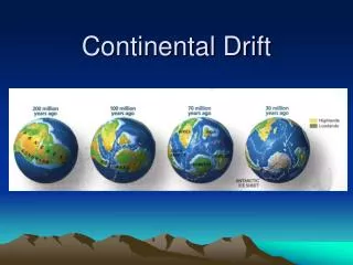
Sea Floor Spreading This animation shows progressive stages in the opening of the Atlantic Ocean. The youngest rocks (in red) clearly outline the mid-ocean ridge system, complete with transform faults. The oldest ocean crust (in blue), is confined to offshore regions adjacent to the United States, Canada and western Africa. This distribution demonstrates that the North Atlantic began to open before the South Atlantic. PC versionMac version
Magnetic Reversals The polarity of Earth's magnetic field reverses with time. The main figure demonstrates how sea-floor anomalies, also known as magnetic stripes, develop during sea-floor spreading. The inset image records the reversal of Earth's dipole. PC versionMac version
Zoomable Art PC Mac 03_Featured_Art.jpg
Finally, radiometric dating of the volcanic rock away from the ridge was the final proofThe rocks got older away from the ridge confirming that Hess’s basic idea, that ocean crust was created and destroyed allowing the continents to move, was indeed correct.Next: How Plate Tectonics works