Download

1 / 6
0 likes | 22 Vues
Introducing mapping drones is currently a prominent trend worldwide, particularly in countries like Oman, known for its extensive geographical expanses that demand significant time for surveying tasks. Customized Dronesu2122, a leading drone manufacturer based in Dubai, is gearing up to introduce their latest advanced mapping drone to the Oman market, featuring advanced customizations.<br>

E N D
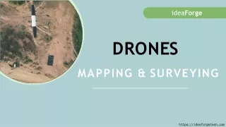
Advantages Using Mapping Drones in Oman
Introducing mapping drones is currently a prominent trend worldwide, particularly in countries like Oman, known for its extensive geographical expanses that demand significant time for surveying tasks. Customized Drones™, a leading drone manufacturer based in Dubai, is gearing up to introduce their latest advanced mapping drone to the Oman market, featuring advanced customizations. Customized Drones™– Advantages Using Mapping Drones in Oman
Aerial Perspective: Aerial Perspective: Mapping drones provide an elevated viewpoint, allowing for the collection of data and images from angles and heights that are often inaccessible using traditional methods. This perspective can result in more comprehensive and accurate mapping. Cost Cost- -Effective: Effective: Drones are generally more cost-effective than manned aerial surveying or mapping methods. They require fewer resources, such as personnel and equipment, and can cover large areas efficiently, reducing operational costs. Customized Drones™– Advantages Using Mapping Drones in Oman
Rapid Data Collection: Rapid Data Collection: Drones can quickly capture data over vast areas, significantly reducing the time required for data collection and processing. This is crucial for time-sensitive projects, emergency response, and monitoring applications. High Precision: High Precision: Newly Introducing Mapping drones in Oman are equipped with advanced GPS and sensor technology, allowing for highly accurate data collection. This precision is valuable in fields such as agriculture, construction, mining, and environmental monitoring. Customized Drones™– Advantages Using Mapping Drones in Oman
Scalability: Scalability: Whether you need to map a small area or an extensive region, drones can be scaled to meet the specific requirements of your project, ensuring flexibility and adaptability. Documentation and Monitoring: Documentation and Monitoring: Drones can capture visual data over time, allowing for documentation and monitoring of changes and developments in a given area, which is valuable for ongoing projects or environmental studies. Customized Drones™– Advantages Using Mapping Drones in Oman
Contact Customized Drones™ for more information Location: Maktoum Road, Golden Business Centre, Offices 203-204 – Dubai UAE Email: info@c-drones.com Website: https://c-drones.com/shop/uav-mapping-drones/ Contact : +971 4 295 8013