Download

1 / 3
0 likes | 0 Vues
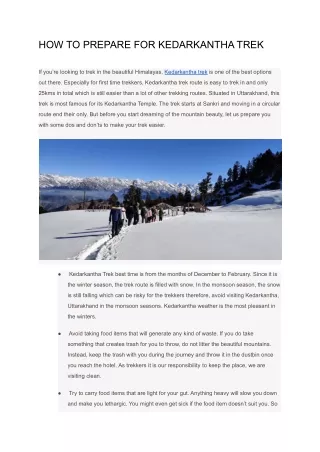
A detailed Goechala Trek Map includes routes, campsites and elevation shifts throughout the trail. The map's knowledge can help you prepare as well as navigational confidence. Trek knowing the correct route as well as expert assistance through Glacier Treks And Adventure.

E N D
Goechala Trek Guide by Glacier Treks & Adventure The Goechala Trek is one of the most iconic high-altitude treks in India, offering breathtaking views of Mount Kanchenjunga, pristine alpine landscapes, and a deep connection with the raw beauty of the Eastern Himalayas. Organized and guided expertly by Glacier Treks & Adventure, this trek is perfect for adventure lovers who want a mix of challenge, nature, and cultural richness. In this guide, we’ll cover the Best Time for Goechala Trek, a detailed Goechala Trek Itinerary, and a clear understanding of the Goechala Trek Map to help you plan your journey with confidence. Why Choose the Goechala Trek? The Goechala Trek takes you through the heart of the Kanchenjunga National Park, a UNESCO World Heritage Site. From dense rhododendron forests to vast meadows and dramatic mountain views, every day on this trek feels like stepping into a postcard. What makes it special is the close-up view of Kanchenjunga, the world’s third-highest mountain, especially during sunrise from Goechala View Point. With Glacier Treks & Adventure, trekkers benefit from experienced guides, well-planned logistics, and a strong focus on safety and sustainability, ensuring a memorable Himalayan experience. Best Time for Goechala Trek Choosing the Best Time for Goechala Trek can completely shape your experience. The trek is best done in two main seasons:
Spring (March to May) Spring is one of the most popular times for the Goechala Trek. The trails come alive with blooming rhododendrons, magnolias, and other alpine flowers. The weather is relatively stable, and the mountain views are crystal clear, especially in the mornings. Daytime temperatures are comfortable, while nights can be cold at higher camps. Autumn (September to November) Autumn is considered the absolute best season by many trekkers. Post-monsoon skies are clear, visibility is excellent, and the trails are less muddy. The crisp air and golden landscapes make this season perfect for photography and long trekking days. Winter treks are extremely challenging due to heavy snowfall, and the monsoon season is usually avoided because of landslides and poor visibility. Goechala Trek Itinerary (Overview) A well-structured Goechala Trek Itinerary usually spans 8 to 10 days, allowing proper acclimatization and a safe ascent. Day 1: Arrival at Yuksom – the historic starting point of the trek Day 2: Yuksom to Sachen – gradual walk through dense forests Day 3: Sachen to Tshoka – steep climbs with beautiful forest trails Day 4: Tshoka to Dzongri – panoramic views begin to open up Day 5: Acclimatization day at Dzongri – short hikes and rest Day 6: Dzongri to Thansing via Kokchurang Day 7: Thansing to Lamuney Day 8: Early morning hike to Goechala View Point and return Day 9–10: Descend back to Yuksom This itinerary, followed by Glacier Treks & Adventure, ensures gradual altitude gain and minimizes the risk of altitude sickness. Understanding the Goechala Trek Map
The Goechala Trek Map is an essential tool for visualizing the route and understanding elevation changes. The trek starts from Yuksom in West Sikkim and moves through key camps like Tshoka, Dzongri, Thansing, and Lamuney before reaching the Goechala View Point. The map highlights: Trail routes and forest sections Campsites and water sources Altitude profiles for acclimatization planning Having a clear understanding of the Goechala Trek Map helps trekkers mentally prepare for long walking days and steep ascents. Conclusion The Goechala Trek is more than just a trek—it’s a journey into the soul of the Himalayas. From choosing the Best Time for Goechala Trek to following a well-paced Goechala Trek Itinerary and understanding the Goechala Trek Map, proper planning makes all the difference. With Glacier Treks & Adventure, you’re not just trekking—you’re experiencing the mountains with care, expertise, and passion. If Kanchenjunga has ever called out to you, the Goechala Trek is the answer. Visit Us : -https://trekinsikkim.in/


![DOWNLOAD [PDF EPUB] Star Trek: Discovery: The Way to the Stars By Una McCormack [EBOOK KINDLE]](https://cdn4.slideserve.com/8145496/slide1-dt.jpg)