Download
1 / 6
60 likes | 812 Vues
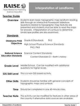
Interpretation of Landforms Teacher Guide

E N D
Interpretation of Landforms Teacher Guide Students learn basic topographic map landform reading skills through an interactive Powerpoint slideshow. Questions related to topographic map features are presented and students must be able to read the maps for answers. Interpretation of contours to determine landscape profiles are also examined. Overview Standards P4.2 Grade 8 Standards: Oklahoma PASS Objectives High School Physical Science Standards: P4.2, P4.8 National Science Education Standards Science Content Standards: Content Standard D – Earth’s history Middle School. Can be modified with additional questions for higher levels. Grade Level This is a non-GIS based activity. GIS Skill Level Other Skills Students should be familiar with general concepts of topographic maps and symbols. Time Should be completed in one 45-minute class. Teacher Note This activity can be modified for features in other areas of the country if alternative data sources are available. Interpretation of Landforms Teacher Guide 1
Interpretation of Landforms Teacher Guide Materials This is not a GIS activity. Students will need computers loaded with Microsoft Office Powerpoint or a compatible program able to display the slideshow. If desired, hard copies of topographic maps can be substituted for the topographic profile portions. Sources • Glendale Community College – www.gc.maricopa.edu/earthsci/imagearchive/ • Stan Celestian – Online Course Documents; Powerpoint Lesson Preparation The activity is based on a Powerpoint-based lesson developed at Glendale (AZ) Community College. The original program was modified to 8th Grade concept and level. Students follow the slideshow on their own computers and answer questions on the attached sheets. Topographic profiles are created based on maps in the slideshow. Additional profiles can be made from locally available quad sheets. Adapted by Steve O’Connell geographilia@hotmail.com Interpretation of Landforms Teacher Guide 2
Interpretation of Landforms A map is a fountain of information. It can tell you important things about what is at a location and what it looks like. But to be able to know those things, you must be able to interpret the symbols on the map itself. Once you know what to look for on a map you will have a better sense of what a place looks like in real life. In this activity, you will learn how to examine a topographic map to reveal information about the landscape. You will utilize an interactive presentation in Powerpoint to answer questions related to maps from several parts of the country. You will also learn how to create a visual profile of a landscape using the information on a topographic map.
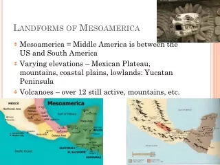
Landform Interpretation with Topographic Maps Brownsville, Texas 1. What type of feature is Fort Brown Resaca? 2. What cycle of stream evolution is the Rio Grande River displaying? 3. Why is this river a poor choice for a boundary? Salt River Canyon, Arizona 4. What is the cycle of stream erosion of the Salt River in this area? ***Complete the profile for Promontory Butte, Arizona, on the provided sheet.*** ***Complete the profile for Cumberland, Pennsylvania/Maryland, on the provided sheet.*** Mammoth Cave, Kentucky 5. Why aren’t the depressions full of water? Lake Wales, Florida 5. Which way does the groundwater flow in this area? Interpretation of Landforms 1
A B The contour interval of this map is 40 feet. Every index contour would then be 200 feet. 8000 7800 7600 7400 7200 7000 6800 6600 6400 Draw the profile yourself before you advance to the answer. Remember that every time the black profile line crosses one of the index contour lines, draw a line down to the appropriate level on the scale below. Ready ? (*)
A B 1100 1000 900 800 700 600 Draw the profile on the sheet provided. The next slide goes through the process. READY ? (*) Using every INDEX CONTOUR – 100 foot interval … (*)