Download
1 / 36
360 likes | 949 Vues
25 th IIPS 15.5. WSR-88D Dual Polarization Initial Operational Capabilities. 25th AMS Conference on International Interactive Information and Processing Systems (IIPS) for Meteorology, Oceanography, and Hydrology 15 January 2009. Michael J. Istok

E N D
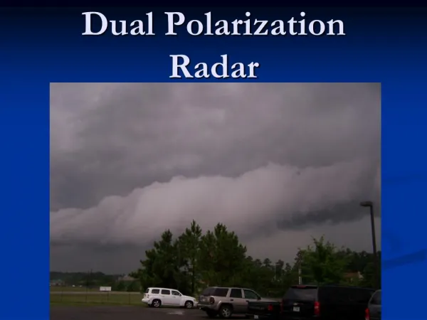
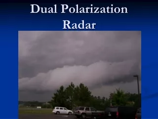
25th IIPS 15.5 WSR-88D Dual Polarization Initial Operational Capabilities 25th AMS Conference on International Interactive Information and Processing Systems (IIPS) for Meteorology, Oceanography, and Hydrology 15 January 2009 Michael J. Istok NOAA/NWS/Office of Science and Technology Systems Engineering Center, Silver Spring, MDMichael.Istok@NOAA.GOV
WSR-88D Dual PolarizationInitial Operational Capabilities Coauthors: • Mark Fresch, NOAA/NWS/Office of Hydrologic Development • Zack Jing, Steven Smith, Richard Murnan, NOAA/NWS/OOS/Radar Operations Center • Alexander Ryzhkov, John Krause, and Michael Jain, NOAA/OAR/National Severe Storms Laboratory • Paul Schlatter (Training Division), John Ferree (Meteorological Services Division), NOAA/NWS/OCWWS • Brian R. Klein, Daniel Stein III, Wyle Information Systems • Gregory Cate, NOAA/NWS/Office of Science and Technology/Programs and Plans Division • Robert E. Saffle, Noblis, Inc. Acknowledgments: • Ning Shen, Yukuan Song, Zihou Wang, James Ward, Jihong Lui, Zhan J Zhang, Wyle Information Systems • Cham Pham, NOAA/NWS/Office of Hydrologic Development • Jim Ramer, Joanne Edwards, Xiangbao Jing, NOAA/OAR/ESRL/Global Systems Division
Introduction • Mission benefits by adding dual polarization capability to the WSR-88D • Improved hail detection for severe thunderstorm warnings, • Improved rainfall estimation for flood and flash flood warnings, • Rain/snow discrimination for winter weather warnings and advisories, • Data retrieval from areas of partial beam blockage to improve services in mountainous terrain, and • Removal of non-weather artifacts such as birds and ground clutter to improve overall data quality for algorithms and numerical model input. • Dual Polarization program lead by NWS OST • Contract awarded September 2007 to develop and deploy changes to the RDA. • Begin System and Beta test in October 2009 and June 2010 • 2-year deployment starts in October 2010 • RPG and AWIPS changes implemented through NOAA collaboration • RPG Build 12: NWS OST, OHD, ROC, OCWWS, and OAR NSSL. • Test and deploy with RDA upgrade • AWIPS OB 8.3 & 9: NWS OST, OHD, OCWWS, and OAR ESRL GSD. • Deploy in early 2009 to support WSR-88D testing and AWIPS-2 program. • NWS OCWWS involved in product requirements & WDTB has begun training development
WSR-88D RDA • Simultaneous transmission of horizontal and vertically polarized pulses to acquire dual polarization data. • Minimizes dwell time, therefore will not lengthen volume scans • Splitting the power results in a return signal with reduced sensitivity • Scientific analysis and WFO usage reports indicated no significant operational impact • Hardware design and signal processing techniques should recover some of the reduced sensitivity • Differential Reflectivity (Zdr), Correlation Coefficient (CC), and Differential Phase (Phi) will be added to the base data fields • At range resolution of 250 m, up to maximum range of 300 km • On low elevation split cuts, radials will be provided at 0.5 deg azimuth. • The other two data enhancements introduced in WSR-88D Build 10 will be extended to all the remaining elevations of all VCP’s • 250 m range resolution for reflectivity data • 300 km maximum range for Doppler moments
WSR-88D RPG: Algorithms • Recombination Algorithm • Creates 1 degree azimuth data from 0.5 degree data on split cuts • Dual Polarization Preprocessing Algorithm • Inputs recombined base data (1 degree by 250m) • Unwrap PHI • Estimate specific differential phase (Kdp) • Correct reflectivity and differential reflectivity with differential phase • Calculate signal-to-noise ratio and the spatial variability (the texture) of both the reflectivity and the differential phase • Smooth dual polarization fields and base moments along the radial to reduce the variances from noise and ground clutter contamination • Output to the dual polarization initial operational capability (IOC) algorithms and products
WSR-88D RPG: Algorithms - continued • Hydrometeor Classification (HC) Algorithms • Quality Index Algorithm (QIA) • Calculate quality index for six of HCAs input data fields • Estimate of the impact from the following five factors: • Attenuation, non-uniform beam filling effects, magnitude of the correlation coefficient, signal-to-noise ratio and partial beam blockage. • Data with a quality index value less than 1.0 indicates the data is degraded by one or more of the five factors. • HC Algorithm (HCA) • Fuzzy logic to classify each sample bin to one of 12 categories • Proximity to Melting Layer constrains classification possibilities • Weighting factors control influence of data variables on classification • Hard Rules (e.g., HA > 30 dBZ, BI < 0.97 CC) • Computes aggregate score for each allowable hydrometeor classification • Melting Layer Detection Algorithm (MLDA) • HCA output is used to eliminate bins of GC, BI, UK, ND • Reflectivity and CC of remaining bins are used to search for ML signatures • Elevation angles 4.5 to 10 degrees; Altitude below 6km; SNR > 5 dB • If data is sparse, uses 0 deg C altitude from RUC model or manually entered
HCA Categories GC Ground clutter / anomalous propagation BI Biological DS Dry snow WS Wet snow IC Ice crystals BD Big drops RA Rain (light and moderate) HR Heavy rain GR Graupel HA Hail (mixed with rain) UK Unknown ND No data (less than threshold) Melting Layer Constrains HCA Completely below: GC, BI, BD, RA, HR, HA, UK, ND Partly below: GC, BI, WS, BD, RA, GR, HR, HA, UK, ND Mostly within: GC, BI, DS, WS, BD, GR, HA, UK, ND Partly above: GC, BI, DS, WS, IC, BD, GR, HA, UK, ND Completely above: DS, IC, GR, HA, UK, ND WSR-88D RPG: Algorithms - continued
WSR-88D RPG: Algorithms - Continued • Quantitative Precipitation Estimation (QPE) Algorithm • Constructs hybrid scan of precipitation rate based on terrain data, hydrometeor classes, MLDA, and Dual Polarization data fields • Smoothes elevations of HCA data with 9 point Mode Filter • Reject GC or UK bins and look to next elevation • Rate of zero is assigned to BI or ND bins • Reject data if CC < 0.85, or blocked by 70%, and look to next elevation • Compute rate based on hydrometeor class & height relative to melting layer • 0 [mm hr-1] nonmeteorological echo (BI, ND) • R(Z, ZDR) Light/Moderate Rain (RA) • R(Z, ZDR) Heavy Rain or Big Drops (HR, BD) • R(KDP) Hail, mixed with rain (HA) below the top of the melting layer • 0.6 * R(Z) Wet Snow (WS) • 0.8 * R(Z) Graupel (GR) • 0.8 * R(Z) Hail, mixed with rain above the top of the melting layer • R(Z) Dry Snow (DS) below the top of the melting layer • 2.8 * R(Z) Dry Snow (DS) above the top of the melting layer • 2.8 * R(Z) Ice Crystals (IC) • Begins and ends storm total accumulation based on rate and area thresholds
WSR-88D RPG: Algorithms - Concluded • The QPE algorithm should improve precipitation estimation in the following situations: • Where the radar beam is partially blocked • For nearly all hydrometeor classes • By greatly reducing contamination from non-precipitation echoes • By identifying the bright-band (melting layer) • By discriminating between rain and snow • By identifying hail and mitigating hail contamination
WSR-88D RPG: Products • Elevation Based Products • Base Products (Zdr, CC, Kdp) • Built from output of preprocessor algorithm • Hydrometeor Classification • Melting Layer • Precipitation • Hybrid Scan Hydrometeor Classification • Precipitation Rate • One-Hour Accumulation • Storm-Total Accumulation • User Selectable Accumulation Period • Specify (hh:mm) end time and span within previous 24 hour period • Difference Products: Dual Pol QPE minus Legacy PPS • One-Hour Difference • Storm-Total Difference
Marginally Severe Supercell What about the rest? All > 0.97 Precip Insects
SOO-DOH Images\kcri_0.5_HC_20080408_0638.png 20000 ft MSL
AWIPS Enhancements • Reorganized radar menus • Four-Panel display operations • All-Tilts • Panel/Combo Rotate • All-Panel Sample • Four Dimensional Storm Cell Investigator • State scale mosaics • Volume Browser CAPPI’s of radar products • Height above radar level • Height above mean sea level • At a temperature level
Future Development • Optimize HCA for transitional and winter weather • Adjust MLDA for cold season storms when melting level is low • Add classes by splitting Hail/Rain Mixture into small hail, large hail and adding freezing rain. • Improving accuracy of precipitation at longer distances and in the presence of partial beam blockage • Quantitative estimate of snow • Identifying location of convective cells in projecting areas with higher melting layers and different hydrometeor characteristics • Rain gage bias correction • Improve data quality and automatically identify & assess features • Include dual polarization data in AP and clutter mitigation schemes • Bird-specific data and/or data with bird returns removed • Liquid water equivalent and In-flight icing • Tornado debris cloud
For Additional Information • Michael Istok • National Weather Service Office of Science and Technology Systems Engineering Center, Silver Spring, MD • 301-713-0763 x103 • Michael.Istok@noaa.gov
Data and Product Distribution and Archive • Level II Data (Top Tier Sites, NCDC) • Message 31 introduced for super-res, also supports dual-pol data • Changes to Metadata include VCP, Alarms, P/M data messages • Currently, 10 to 180 kbps per radar, depending on VCP & weather, and resulting in a network max hourly load near 7 mbps • Worst case dual pol increase by factor of 2.1 (per radar & network) • Version numbers will be expanded for new data characteristics • Resource constraints cause a mixture of Level II data versions • Full resolution, recombined, and dual pol removed • Exploring options to overcome constraints to provide additional data • Level III Products (RPCCDS, NOAAPORT, NCDC) • Currently, 3 to 21 kbps per radar, depending on VCP & weather, and resulting in network max hourly load near 1.6 mbps. • Dual pol product types, elevations, and resolution will drive increase • Requirements formulation in progress • Dual pol to increase product load by at least a factor of 2