Download
1 / 21
210 likes | 374 Vues
An Objective Criteria for Ranking Extreme Cold Waves and their Relationship with the Polar Vortex. Mike Cellitti University of Illinois 17 November 2003. Acknowledgements. Bob Rauber John Walsh Diane Portis. Outline. Motivation and Goals Cold Wave Characteristics

E N D
An Objective Criteria for Ranking Extreme Cold Waves and their Relationship with the Polar Vortex Mike Cellitti University of Illinois 17 November 2003
Acknowledgements • Bob Rauber • John Walsh • Diane Portis
Outline • Motivation and Goals • Cold Wave Characteristics • Cold Wave Ranking Process • Cold Wave Climatological Trends • Polar Vortex Characteristics • Case Studies • Summary
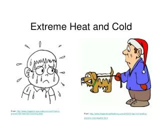
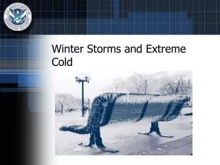
Why Do We Care about Extreme Cold Waves? • On average, 35 deaths per year directly related to the extreme cold. • Economic losses can be in the billions • Heating costs increase considerably • Transportation related issues
Goals • Examine the role of the Polar Vortex for extreme cold air events • How does the location and intensity of the vortex affect the characteristics of a cold wave? • Do multiple polar vortices affect a cold wave? • Use this information to more accurately predict the onset of an extreme cold air event. • But first, need to identify the top extreme cold wave events!
Cold wave Characteristics • Highly amplified upper level ridge-trough system over North America. • Positive surface pressure anomalies due to an anticyclone that propagates southward from western Canada to the Gulf Coast. • Extensive snow cover over northern and central North America to keep the arctic airmass insulated. • Intensity of CAO most related to strength of anticyclone or its associated cold air advection.
Typical Upper-Level Pattern (Severe and Hazardous Weather. Rauber, Walsh, Charlevoix, 2002)
Objective Cold Wave Ranking Criteria • Rank cold waves quantitatively based on: • Duration • Intensity • Coverage area
Data Acquisition • Surface Airways Hourly from NCDC • Data range: 1948-2001 • November 1 – March 31 • Temperatures every six hours • Separation criteria: A cold wave event will be defined as the time period between temperatures decreasing below average and re-emerging above average
Decadal Frequency of Top 30 5-day CAOs from the 17 Station Composite
How does the Polar Vortex relate to these extreme CAO Events? • Lets first ask, what is the Polar Vortex and how does it form?
Vortex Characteristics • Forced planetary standing wave caused by westerlies impinging on the Rocky Mountains. • Nearly stationary over Hudson Bay during the winter. • Contains high values of isentropic potential vorticity (air parcels do not cross IPV gradients). • Contains relatively colder and drier air than its surroundings. • Acts as a barrier to transient weather systems – weather systems are steered around the vortex.
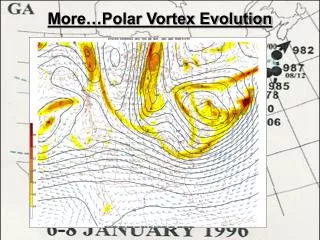
1994 and 1996 Vortex Comparison • Deep 500 mb vortex 15 days prior to CAO onset. • 1996 vortex was consistently deep prior to CAO unlike the 1994 vortex • Both CAO’s began when southern extension of the vortex infiltrated lower latitudes. • Most extreme cold air directly underneath and to the west side of both vortices.
Summary • No apparent trend in frequency of CAO’s. • Trend toward slightly greater intensity of CAO’s in Midwest and weaker intensity on the East Coast. • Deep polar vortex prior to onset of 1994 and 1996 CAO’s. • CAO onset when southern extension of the polar vortex penetrated southward.
References • R. Rauber, Charlevoix, D., Walsh, J. Severe and Hazardous Weather. Kendall/ Hunt Publishing Company, 2002. • J. Overland, J.M. Adams, N.A. Bond, 1997: Regional Variation of Winter Temperatures in the Arctic. J Climate, 10, 821-837. • J.E. Walsh, A.S. Phillips, D.H. Portis, W.L. Chapman, 2001: Extreme Cold Outbreaks in the United States and Europe, 1948-1999. J. Climate, 14, 2642-2657. • C.E. Konrad II, S.J. Colucci: An Examination of Extreme Cold Air Outbreaks over Eastern North America. Bull. Amer. Meteor. Soc., 117, 2687-2700.