Download
1 / 39
400 likes | 859 Vues
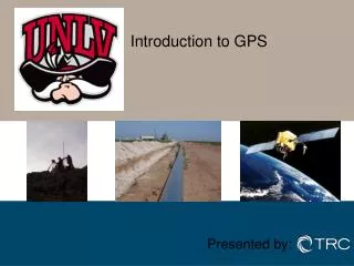
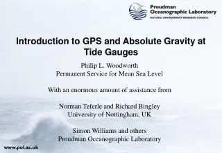
Introduction to GPS and Absolute Gravity at Tide Gauges. Philip L. Woodworth Permanent Service for Mean Sea Level With an enormous amount of assistance from Norman Teferle and Richard Bingley University of Nottingham, UK Simon Williams and others Proudman Oceanographic Laboratory.

E N D
Introduction to GPS and Absolute Gravity at Tide Gauges Philip L. Woodworth Permanent Service for Mean Sea Level With an enormous amount of assistance from Norman Teferle and Richard Bingley University of Nottingham, UK Simon Williams and others Proudman Oceanographic Laboratory
GPS at Tide Gauges: Contents • Sea level and vertical land movements • Meetings • Initiatives • Recommendations • Projects
Global Sea Level • IPCC (1990, 1995) estimated rise in global sea level of 10 to 20 cm over the last century IPCC (2001) predicted rise in global sea level of 9 to 88 cm over the period for 1990 to 2100 Sea Level Rise (IPCC 2001)
European Mean Sea Level Data Measured by Tide Gauges [Woodworth et al, 1990]
Tide Gauge Vertical Land Movement ‘Absolute MSL’ ‘Relative MSL’ ‘Absolute’/’Relative’ Mean Sea Level
Relative Sea Level Rise British Geological Survey
Tide Gauge GPS Vertical Land Movement ‘Absolute MSL’ ‘Relative MSL’ Using GPS at Tide Gauges
‘Woods Hole Meeting’ • IAPSO Commission on Mean Sea Level and Tides • Woods Hole Oceanographic Institute, USA, 1988 • Carter et al (1989) report“TGBM’s should be connected to the International Terrestrial Reference Frame (ITRF) and monitored using GPS”
Tide Gauge Benchmark Fixing GPS satellite Tide Gauge Precise Level GPS Station close to Tide Gauge (TGGS) GPS Station co-located with ITRF Station TGBM MSL
Advances in GPS Technology • Cheaper and more reliable GPS receivers • Completion of the GPS satellite constellation • Establishment of the International GPS Service
‘Surrey Meeting’ • IAPSO Commission on Mean Sea Level and Tides • Institute of Oceanographic Sciences, UK, 1993 • Carter (1993) report“Continuous GPS (CGPS) stations should be installed at about 100 tide gauges world-wide to form a ‘core network’ of a global absolute sea level monitoring system”
The Development of CGPS • Essential to the success of the IGS • Improved orbit determination • Automated processing on a daily basis • Delivery of products within reasonable time scales • Demonstrated on a regional scale, eg BIFROST in Fennoscandia
‘JPL Meeting’ • IGS and PSMSL • Jet Propulsion Laboratory, USA, 1997 • Neilan et al (1997) report“tide gauge benchmark monitoring”and“altimeter calibration”
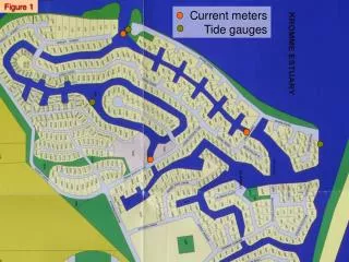
First experiences • Solomons Island in the Chesapeake Bay • Operational since April 1994 • Part of the BAYONET project • Nerem et al (1997) • Porto Corsini in the Mediterranean • Operational since July 1996 • Part of the SELF II project • Zerbini et al (1997) • Sheerness in the UK • Operational since March 1997 • Part of the UKGAUGE project • Ashkenazi et al (1997)
CGPS@TG Working Group • Site the CGPS station as close as possible to the tide gauge • vertical land movements included in the relative MSL trends are exactly those that are measured by GPS • Periodically measure the vertical tie between the CGPS station, the tide gauge sensor and a series of TGBM’s using precise spirit levelling • Monumentation • Instrumentation
EOSS Working Group 1 • Dual-CGPS station concept • First CPS station located as close as possible to the tide gauge • vertical land movements included in the relative MSL trends are exactly those that are measured by GPS • vertical tie between CGPS station and tide gauge = constant • Second CGPS station located on ‘stable rock’ within a few kilometres of the tide gauge • underlying geophysical land movements measured by GPS • vertical tie between the 2nd and 1st CGPS stations (and tide gauge) measured continuously
Example CGPS Coordinate Time Series JPL, 2003 (http://sideshow.jpl.nasa.gov/mbh/series.html)
Research Questions being Addressed by TIGA etc • How good are CGPS time series and vertical station velocities ? • CGPS data processing • CGPS coordinate time series analysis • CGPS station velocity estimation • CGPS station velocity uncertainties • How well do CGPS time series represent vertical land movements ? • Regional, local or very local movements • Long term or short term movements
GPS Conclusions • CGPS@TG is more feasible now than a few years ago thanks to reduction in cost of receivers • A community of CGPS@TG people exists which is ready to share experiences. Regular (typically every 2 years) meetings take place within the CGPS@TG group. • An international IGS-sponsored programme exists (TIGA) within which GPS from Chile (for example) can be processed and analysed and lessons learned collaboratively.
Introduction to a Second Technique: Absolute Gravity • The “Carter reports” on sea level monitoring recommended the use of Absolute Gravity (AG) as a complimentary technique to CGPS for VLM monitoring. • Here results from AG measurements at UK tide gauges are presented • For this work it was decided to concentrate on 3 UK tide gauges, considered to be the core UK gauges, Newlyn, Lerwick and Aberdeen
Absolute Gravity How do we Measure “g”? Using free fall methods. G = Gravitational Constant = 6.67x10⁻¹¹ m3kg-1 s-2 Me = Mass of the Earth Re = Radius of the Earth Measure x and t of a mass in free fall (in a vacuum) and use the above equation to get g.
Absolute Gravity This machine has a precision and accuracy of about 1-2mgal(1mgal=10-8 ms-2)
Absolute Gravity So how does measuring g give us changes in vertical land movement? If additional mass is involved then This assumes there is no additional mass : “Free Air Model” This is the “Bouger Model”
Methodology • Measure for at least 3 days at each site, at least once per year (hopefully!) • Data from each day are processed separately and correction made for solid-earth tides, ocean-loading effects, atmospheric pressure, polar motion and comparator response. • Single admittance factor and local pressure data are used to correct for atmospheric pressure. • Gravity gradients for Newlyn and Aberdeen determined using a relative spring gravimeter
Conclusions • AG measurement spanning 5-6 years can be used to measure vertical land movements at tide gauges. • Absolute Gravity is a useful complimentary technique to CGPS. • Good site selection is essential to AG measurement success. • Given a few more years of measurement, results can be used to test competing GIA models.