Download
1 / 54
540 likes | 907 Vues
San Luis Rey River Watershed Management Guideline. Prepared by the San Luis Rey Watershed Council October, 2001. San Luis Rey Watershed Council Acknowledgements:. Mission Resource Conservation District Upper San Luis Rey Resource Conservation District

E N D
San Luis Rey RiverWatershed Management Guideline Prepared by the San Luis Rey Watershed Council October, 2001
San Luis Rey Watershed CouncilAcknowledgements: • Mission Resource Conservation District • Upper San Luis Rey Resource Conservation District • University of California Cooperative Extension • U.S. Environmental Protection Agency, Region 9 • California Coastal Conservancy • Fallbrook Public Utilities District • USDA, Natural Resources Conservation Service
Preface: The San Luis Rey River Watershed Management Guideline 2000 - Identifies General Considerations for the Watershed: • Land Use Issues • Status of the Watershed • Recommendations for research and data collection • Recommendations for future management • Educational Considerations
San Luis Rey Watershed Located in the Northwest Corner of San Diego County • 558 Square Miles • Drains to the Pacific Ocean
San Luis Rey Watershed Base Map N Riverside County San Diego County Camp Pendleton Vista Oceanside 0 10 10 20 Map assembled by: Thomas Share USDA Natural Resources Conservation Service Davis, CA. Data Sources: NRCS, WPS, Madalene M. Ransom, using ArcInfo SANDAG, San Diego Association of Governments
San Luis Rey WatershedManagement Project Major Concerns • Water Quality • Invasive Plant Species • Wildlife Habitat Condition • Floodplain Management • Sand Mining • Other Watershed Issues
San Luis ReyManagement Project Key Elements of the Program • Hired a Watershed Coordinator • Compiled and Reviewed Existing Information • Established a Watershed Council (1997) • Meetings Held Monthly • Prioritized Issues • Developed Watershed Management Guidelines • Beginning Implementation of Guidelines
San Luis ReyWatershed Council • Started in 1997 • Focused on Development of the Watershed Management Guideline • Council Meetings are the Fourth Monday each Month at 1:00 p.m. - and are Open to the Public. • Meeting Location: • Fallbrook Public Utilities District Building990 Mission Rd. Fallbrook, CA
Watershed History • 1791- Mission San Luis Rey established in Oceanside • 1850 - California became the 31st state • 1875 - First Reservations established: • La Jolla and Pala Reservations - 1875 • Rincon Reservation - 1881 • San Pasqual and Pauma Reservations - 1891 • 1891 - Mission Indian Relief Act signed
Watershed History • 1895 - Escondido Canal completed • 1922 - Henshaw Dam completed • 1920’s - Citrus orchards and avocados irrigated from locally developed water supplies • 1940’s - Irrigated agricultural enterprises expanded
Current Status of the San Luis Rey Watershed Current population: Approximately 150,000 Land area: 558 Square miles Average rainfall: 11” to 40” (Ocean to Mountains) Land use estimates: Undeveloped: 50% Agricultural: 37% Residential: 5% Parks/Recreation: 5% Water: 2% Commercial/Office <1% Military: <1%
Land Uses Residential Industrial / Transportation Commercial / Office Military Public Services / Hospital Parks / Recreation Agriculture Undeveloped Generalized Land Use Map N Data Source: SANDAG, San Diego Association of Governments
Current Status of the San Luis Rey Watershed San Luis Rey Watershed: 558 sq. miles Land ownership: Private: 48% Special District: 14% Indian Reservation: 14% National Forest: 12% State: 5% Military: 5% Local Government: 2%
Generalized Ownership Map N Ownership City County State Freeways Military Indian Reservation National Forest BLM Private Special District / Schools / Misc. Federal Data Source: SANDAG, San Diego Association of Governments
Projected Population Growth • Areas With Greatest Projected Growth: • Fallbrook • Valley Center • Bonsall • Pala/Pauma Valley • Areas With Less Projected Growth: • Oceanside • Vista
Agricultural Uses • High Cash Value Crops • Citrus Orchards • Avocados • Truck Crops • Flowers • Nurseries • Land and Water is Expensive • Intensive irrigation • Steep Slopes • Marginal Soils
Watershed Council’s Role • Minimize the Impact of Agriculture on Water Quality in the San Luis Rey Watershed • Use the publication titled - “Management Options for Nonpoint Source Pollution” • Recommends solutions for minimizing ground and surface water problems resulting from agricultural operations.
Heavy Industrial Uses Current Uses Within the Watershed: • Proposed Gregory Canyon Landfill • Concerns: Location is poor, with respect to the aquifer of the San Luis Rey River. • Watershed Council’s Role: If constructed, the Watershed Council will monitor river for watershed health.
Heavy Industrial Uses Current Uses Within the Watershed: • Rosemary’s Mountain Quarry: • Concerns: • Inadequate environmental review • Water Quality Problems • Air Quality Problems • Watershed Council’s Role: If constructed, the Watershed Council will monitor for watershed health.
Heavy Industrial Uses Current Uses Within the Watershed: • Sand Mining Operations • Recognized need for sand mining • One of the few good sand sources in San Diego County • Concerns: • Beach sand replenishment Impacted • Need for a detailed study of sand mining impacts on the San Luis Rey River • Increased erosion and scouring of riverbed, especially during flood events
Fire Management The Watershed Council will: • Assist with coordination of agencies involved in fire management in the watershed. • Conduct research on flame resistant plants available and suitable for the watershed. • Provide maps showing fire susceptibility in the San Luis Rey Watershed on the Watershed Council website
Fire Fuel Rank Moderate High Very High Fire Susceptibility Map N Map assembled by: Madalene M. Ransom USDA Natural Resources Conservation Service Davis, CA. Data Source: CA Department of Forestry and Fire Protection Sierra South Region Office
Fire Management The Watershed Council will assist in or provide information on: • Causes of Wildfire • Methods of Reducing Wildfire Incidence • Development of a Fire Management Plan • Public Outreach: • Website • Handout Materials • Presentations to community groups
Wildlife Management Major Issues: • Wildlife Habitat Management and Protection • Reduction in suitable habitat • Wildlife species decline • Several species listed as threatened or endangered • Multiple Species Conservation Program • Provide sufficient habitat • Provide corridors and linkages • Provide mitigation easements for private landowners
Invasive Plant Species Management Exotic, Invasive Plant Species Found in the San Luis Rey River Watershed: • Arundo • Tamarisk • Pampas grass • Castor bean Problems: • Cause Erosion and Flood Problems • Out-Competes Native Species in Riparian Habitat
Invasive Plant Species Programs Eradication Efforts: • GIS mapping of invasive plant species. • Developed a Weed Management Area (WMA) to help fund eradication efforts. • Use WMA to mitigate Native Habitat loss. • USDA Environmental Incentives Program (EQUIP) education program: • Landowner/Manager Awareness Program • Field Visits and Community Presentations
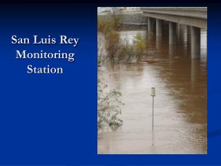
Flood Management Historical Conditions: Major Floods: Highest Flows (Oceanside) • 1916 95,600 cubic feet / second • 1980 (Flow data missing) • 1993 25,700 cubic feet / second Current Conditions: • Much more development now present in Watershed than in 1916. • Potential still exists for great floods. • Large portions of the Watershed are not mapped for 100-year floodplain.
Water Quality and Quantity Protection of Beneficial Uses • Status: • State Water Resources Control Board Water Quality Assessment: • River listed as having “intermediate” water quality. • 1996 Assessment - Recreational uses in lower watershed are threatened by coliform contamination. • The San Luis Rey River and the 1998 303(d) List: • No Total Maximum Daily Loads (TMDL) established yet. • But - the coastal shoreline is listed as having a high coliform count from unidentified point and nonpoint sources. • County and City of Oceanside Now Required to Perform Water Quality Monitoring in Watershed.
Water Quality and Quantity Runoff Concerns From Land Uses: • Unpaved roads and Burn areas can be sources of: • High levels of erosion • Accompanying sediment
Water Quality and Quantity Agriculture: • Runoff from Dairies and Grazing land, if improperly managed, may contribute: • Nutrients • Fecal coliforms • Seepage or runoff contaminated with the above into ground and/or surface water bodies.
Water Quality and Quantity Run off from urban streets may contain: • Bacteria • Oil / Phenols • Nitrogen / Phospates • Suspended solids • First Hour of moderate to heavy storm - Contributes more pollution than most city sewer systems during same time period.
Water Quality and Quantity Conclusion: Water Quality Beneficial Uses are not currently significantly impaired. Possible exception - Fecal Coliform Bacteria
Water Quality and Quantity Guideline to Address This Issue: All land uses potentially contributing contamination to the San Luis Rey River Watershed can implement conservation practices to reduce pollution.
Recreational and Open Space Management There are many plans and jurisdictions that will influence open space management now and in the future.
Recreational and Open Space Management There is considerable public land ownership in the Watershed
Recreational and Open Space Management • Recreational Uses • Parks • Camping • Fishing • Swimming
Recommendations On Parks: • Support Recreational Activities at Current Public Locations. • Promote use of Best Management Practices (BMP’s) to reduce water quality problems.
Fishing Opportunities: • Provide greater fishing opportunities by building: • Docks • Piers • Other Facilities
Educational Opportunities Develop Educational Materials and Workshops for Adults and Youth: Adult Programs: • Watershed Owners Manual • Invasive Plant Identification and Removal • Integrated Pest Management • Water Quality for Homeowners
Educational Opportunities Youth Programs: • History of San Luis Rey River Watershed • Agricultural Literacy • Information and Hands-on Experience inAgricultural Production • Water Quality Programs • Water Sampling and Analysis • Ambient Stream Bioassesment • Watershed Management