Download
1 / 16
190 likes | 749 Vues
Modeling Soil Erosion: RUSLE2 and WEPP. By Sarah Sauter June 6, 2006. How are these models used?. Developed to guide conservation planning, inventory erosion rates, and estimate sediment delivery Examines how farming and land use affect soil erosion and sediment deliver

E N D
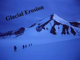
Modeling Soil Erosion:RUSLE2 and WEPP By Sarah Sauter June 6, 2006
How are these models used? • Developed to guide conservation planning, inventory erosion rates, and estimate sediment delivery • Examines how farming and land use affect soil erosion and sediment deliver • Aid in better planning and in resource assessment • Help users select the best erosion control practices, chose optimum locations, and evaluate erosion in certain areas
RUSLE2 An advanced empirical model that predicts long-term, average-annual soil erosion by water Runs on a Windows program Relies on climate, soil, vegetation, and cropping management databases Land use independent USDA policy to use for erosion estimates on cropland and pastureland WEPP Process-oriented, simulated soil erosion prediction model Runs on a Windows program Relies on climate, soil, vegetation, and cropping management databases Applicable to small watersheds (640 acres) Can simulate small profiles up to large fields RUSLE2 vs. WEPP
Revised Universal Soil Loss Equation 2 • First developed in 1965 • Estimates soil loss from empirical coefficients which must be accurately evaluated • Net Detachment (soil loss) Equation: a = r*k*l*S*c*p • a = net detachment • r = erosivity factor • k = soil erodibilty factor • l = slope length factor • S = slope steepness factor • c = cover-management factor • p = supporting practices factor
Downloadable at: http://fargo.nserl.purdue.edu/rusle2_dataweb/
Water Erosion Prediction Project (WEPP) • Developed in 1987 • Physically based model that simulates the entire erosion process • Can predict spatial and temporal distributions of net soil loss and deposition
Hillslope A direct replacement of USLE Can predict soil loss and deposition on a slope Watershed Sediment detachment, transport, and deposition in channel systems, in addition to hillslope WEPP Applications
GeoWEPP • ESRI ArcView extension that uses DEM data to derive topography inputs
US Forest Service WEPP Interfaces • Cross Drain • Rock:Clime • WEPP: Road • WEPP: Road Batch • Disturbed WEPP • ERMiT • WEPP FuME (Fuel Management)
Downloadable at: http://topsoil.nserl.purdue.edu/nserlweb/weppmain/
![Data Modeling [Comparison of data modeling techniques ]](https://cdn0.slideserve.com/205866/data-modeling-comparison-of-data-modeling-techniques-dt.jpg)