Download
1 / 30
300 likes | 503 Vues
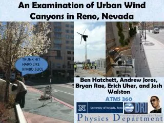
An Examination of Urban Wind Canyons in Reno, Nevada. TRUNK HIT HARD LIKE KIMBO SLICE. Ben Hatchett, Andrew Joros, Bryan Rae, Erich Uher, and Josh Walston ATMS 360. Outline. Statement of Purpose Measurement Technique and Challenges Site Overviews

E N D
An Examination of Urban Wind Canyons in Reno, Nevada TRUNK HIT HARD LIKE KIMBO SLICE Ben Hatchett, Andrew Joros, Bryan Rae, Erich Uher, and Josh Walston ATMS 360
Outline • Statement of Purpose • Measurement Technique and Challenges • Site Overviews • Data: Comparison of Measurements to Synoptic Environment • Data: Evaluation of TKE • Analysis and Discussion • Concluding Remarks and Suggestions for Future Work
The Theory: The Question: Can urban canyons be used to funnel wind kinetic energy to allow for smaller, high output urban wind power generators? The “Urban Canyon” and the associated airflow processes (Nunez and Oke 1977, J.Apl. Met. and Oke 1988, Boundary Layer Climates) Bernoulli’s Principle: Energy is conserved, higher velocitieslower pressure THUS: If wind is channeled into canyons created by buildings, velocity must increase. BUT! Turbulent dissipation of KE may dominate…
Measurement Technique: Sonic Anemometry • Wind velocity (U,V,W) measured based on transit time of ultrasonic signals sent between sensors. • Orientation and magnitude of flow alters signal transit time. • Speed of sound allows sonic temperature to be derived.
Challenges with Measurement • Proximity to power source (power draw too extreme with unit, need lots of batteries) • Private property (Can we measure here?) • Busy streets (Would be nice to measure in center of urban canyon, not along wall) • Unit falling over
Measurement Analysis • Labview Package to record 3-D Winds (U,V,W, direction) and total wind vector (magnitude and direction) from 20Hz incoming data • MATLAB Package used for data analysis and calculation of turbulent fluxes and plotting • Unisys Weather Server provided historical synoptic weather data
Site Overviews: Sierra Street • Construction complete • Street Oriented NNW-SSE GOTTA HOUSE BY THE BAYSIDE
Site Overviews: El Dorado @Sierra • Street Oriented NNW-SSE • Deep Canyon
Site Overviews: Silver Peak • Street Oriented WSW-ENE
Calibration Procedure: Via UNR Ag Field • Reduced Vanem possibly due to reduced height vs. Vunr (1.2m vs. 3m) and increased Fr? • Same reasoning for direction change? Increased Fr?
Data Part 1: Site Measurements Versus Synoptic Setting (Sierra St.) • Zonal Flow at 300mb ahead of NW jet max • Weak Ridge at 850mb with SW’erly flow • Weak regional sfc pressure gradient • Dry Adiabatic lapse rate from sfc to 650mb, strong shearing at 650mb with associated inversion
Comparison of Reno SFC Stations to S.A. at Sierra St. • Flow is parallel to canyon • NNW-SSE (~160° -190°) • SFC flow adjusts to canyon
Comparison of Reno SFC Stations to S.A. at Sierra St. Velocity at Sierra was decreased by factor of 2 compared to nearby sites Friction and uneven surfaces, canyon is too small to force enhancement of velocity?
Data Part 1: Site Measurements Versus Synoptic Setting (El Dorado) • Weak zonal flow, jet max east of Reno • Shortwave trough approaching, indicated by SW flow regime • Moderate southwesterly flow at surface • Deep unstable boundary layer, nearly dry adiabatic to 450mb • Dry atmosphere
Comparison of Reno SFC Stations to S.A. at El Dorado • Flow direction perpendicular to canyon and consistent with synoptic scale flow • Proximity to intersection and wide streets (small H/W ratio) reduces canyon effect? • Not enough canyon to channel flow?
Comparison of Reno SFC Stations to S.A. at El Dorado • Roughness of downtown decreases velocity by factor of 4!
Data Part 1: Site Measurements Versus Synoptic Setting (Silver Peak) • Upper level trough located East of Reno • Light northerly flow at surface • Unstable at surface, indicated by dry adiabatic lapse rate to 700mb
Comparison of Reno SFC Stations to S.A. at Silver Peak • Flow at SP was 180° to larger scale flow • Intersection overturning caused by large buildings upwind and downwind intersection open space?
Comparison of Reno SFC Stations to S.A. at Silver Peak • Once again, roughness decreases site velocity by factor of 2 (Lower velocities overallless roughness effect)
Data Part 1: Site Measurements Versus Synoptic Setting (UNR AB) • Reno under influence of longwave ridge • Shortwave trough approaching, indicated by SW flow regime, jet max offshore and to the south • Weak easterly flow at surface • Speed and direction shear at 650mb • Dry, unstable atmosphere.
Comparison of Reno SFC Stations to S.A. at UNR Business Bldg • Flow around building • 90° to synoptic scale flow
Comparison of Reno SFC Stations to S.A. at UNR Business Bldg • Roughness decreased flow velocity by factor of 4
Data Part 2: Turbulent Fluxes (Sierra St.) • Typical diurnal pattern of increasing TKE until afternoon (sun behind building), then decreasing as insolation decreases • Fric Vel indicates shearing at surface, governed by roughness, convection, and stability (Stull 2000) • Results seem consistent with observed diurnal pattern and roughness
Data Part 2: Turbulent Fluxes (El Dorado) • TKE trend indicates presence of sun and decreasing stability increased convection • Fric Vel consistent with TKE trend and insolation
Data Part 2: Turbulent Fluxes (Silver Peak) • Buildings influenced insolation, after 1530, sun behind buildings, decreased boundary layer convection
Data Part 2: Turbulent Fluxes (UNR AB) • Slight diurnal trend • Post-crash data may be skewed • Low TKE/FV values but highly variable
Analysis and Discussion • Original hypothesis cannot be rejected, too many variables (sites, synoptic conditions) • Sierra canyon channeled flow to parallel (urban canyon!) • Silver Peak upwind buildings overturned flow • El Dorado showed consistent TKE trend with relation to diurnal insolation, wind direction not consistent with channeling into canyon • Location of anemometer should be in middle of street to decrease building frictional effects on velocity and direction
Concluding Remarks • Wake interference flow regimes (figure B below) observed at Silver Peak • Sierra St. only true urban canyon (by definition of channelling) • Surface roughness decreases mean flow in all cases, probably not sufficient to power wind turbines unless above building height • Downtown landscape often too complex to channel flow
Suggestions For Future Work • Multiple anemometers setup at fixed locations for long duration field experiment (days-weeks) • Must attempt to capture multiple synoptic conditions at same location • Identify more well-defined urban canyons • Rooftop measurements for comparison to ground level measurements • Partition sources of TKE to detect effects of various source terms (advection, buoyancy, shear) to identify dominant terms (sources/sinks) and relate to canyon influence • 3-D CFD modeling of location for comparison to data