Finding GIS Data
Map Library. Reference & research help. maplib@colorado.edu. 303-492 ... image of a USGS 1:24,000 topographic map, including all map collar information. ...


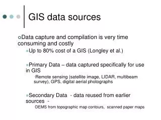
Finding GIS Data
E N D
Presentation Transcript
Slide 1:Finding GIS Data
Jerry Crail Johnson Earth Sciences & Map Library Katie Lage, Map Librarian GEOL 3050 2/13/07
Slide 2:Map Library
Reference & research help maplib@colorado.edu 303-492-7578 GIS computer & 11� x 17� color printer GIS reference books: ES Stacks & Map Library stacks GIS Data
Slide 3:GIS Resources in the Map Library
http://ucblibraries.colorado.edu/map/gis/gis.htm
Slide 4:Selected Datasets�Raster Data
DRGs (Topography): Scanned & georeferenced image of a USGS 1:24,000 topographic map, including all map collar information. http://topomaps.usgs.gov/drg/ DOQQs (Orthoimagery): The DOQ combines the image characteristics of the original photograph with the georeferenced qualities of a map. (Search/print/download with Terraserver Toolbar at http://www.terraserver-usa.com/) Digital Elevation Models National Elevation Dataset: http://ned.usgs.gov/ Shuttle Radar Topography Mission: http://www2.jpl.nasa.gov/srtm/northAmerica.htm Tactical Pilotage Charts (TPCs) Scanned & georeferenced images of 1:500,000 aeronatautical charts, showing topography, principal roads, major landmarks, etc. (Samples: http://www.omnimap.com/catalog/int/tpc-list.htm)
Slide 5:Selected Datasets�Vector Data
VMAP0 http://earth-info.nga.mil/publications/vmap0.html World Vector Shoreline Plus http://www.csc.noaa.gov/shoreline/nga_wvsplus.html Global GIS Database (from USGS) ESRI Data & Maps
Slide 6:GIS Data Portals
Seamless Data Distribution Center: http://seamless.usgs.gov/ Geodata.gov: U.S. Maps & Data http://geodata.gov GIS Data Depot: http://data.geocomm.com/ Geography Network, from ESRI: http://www.geographynetwork.com
Slide 7:Searching for GIS Data
Chinook Library Catalog �digital spatial data� Map Library webpages: http://ucblibraries.colorado.edu/map Ask for help!