Download

1 / 56
580 likes | 965 Vues
What Your Town Needs to Know About the National Flood Insurance Program. Presented by: Margaret Torizzo VT Agency of Natural Resources Department of Environmental Conservation. Purpose of Workshop. Awareness of principles of Floodplain Management National Flood Insurance Program (NFIP)

E N D
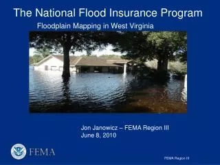
What Your Town Needs to Know About the National Flood Insurance Program Presented by: Margaret Torizzo VT Agency of Natural Resources Department of Environmental Conservation
Purpose of Workshop • Awareness of principles of Floodplain Management • National Flood Insurance Program (NFIP) • Interpretation of NFIP flood maps and Flood Insurance Studies • Understanding of minimum NFIP Regulations • Flood Hazard Area Administration, Regulation, and Enforcement • Additional Regulatory Measures
Floodplain The area adjacent to a river that is periodically inundated when water flows over banks
Flooding • Flooding can be caused by: • Rain • Melting Snow • Ice Jams • Debris jams
Functions/Values of Floodplains • Flood Storage and Conveyance (storage of flood waters, slowing of flood waters) • Water Quality Maintenance (vegetation reduces sediment load into waters) • Groundwater Recharge and Discharge (slowing of runoff and regulates flow) • Biologic Resources and Functions (habitat supports diverse populations of plants and animals) • Community Resources (greenways, parks, trails, recreation, aesthetics) • Economic Resources (agricultural, forest production)
Effects of Floodplain Encroachment • Floodplain filling reduces floodplain’s ability to store water • Floodwaters rise to higher levels causing properties that were once flood-free to now be flood-prone • Rise in floodwaters increases velocity of flood waters and therefore increases the potential to erode stream banks
Damage from flooding can occur due to: • Inundation • Erosion Kate Brook, Hardwick
Channel adjustments during floods can have devastating consequences Tyler Branch, Fairfield Great Brook, Plainfield
Many risks to investments and infrastructure are NOT identified by NFIP floodway delineations • NFIP maps do not consider erosion hazards • Most flood damage in Vermont due to erosion associated with flooding Mad River,Waitsfield
1968 Congress passed National Flood Insurance Reform Act whichcreated the NFIP Goals of NFIP: • Guide future development away from flood hazard areas • Require new and substantially improved buildings be constructed to minimize or eliminate flood damage • Provide floodplain owners and residents with financial assistance after floods • Transfer costs of private property flood losses from the taxpayers to floodplain property owners through flood insurance premiums
How the NFIP Works • Insurance • Flood insurance required as a condition of receiving loans from Federally insured or regulated lenders, Federal financial assistance, and Federal disaster assistance • Premiums vary on the flood protection buildings are provided (elevation) and date of construction (pre-existing buildings do not pay actuarial rates) • Regulations • Flood insurance available only to participating communities • Communities agree to adopt and enforce floodplain regulations • Mapping • Communities use maps to regulate development in flood prone areas • Insurance agents use maps to rate flood insurance policies • Lending institutions use maps to determine when mandatory flood insurance purchase requirement applies
Community Participation in NFIP • Voluntary participation • Enables citizens to purchase flood insurance • Ability to apply for Federal grants or loans • Availability of Federal disaster assistance not dependent upon declaration of major disaster (declaration made <50%, assistance provided mostly through loans) • Requirements of participation • Adopt resolution of intent to participate • Adopt and enforce minimum NFIP regulations
Roles and Responsibilities The Community has the statutory authority to regulate and enforce floodplain regulations • Issues or denies floodplain development permits • Inspects development to ensure compliance • Maintains records of floodplain development • Assists in floodplain map revision process • Provides residents information on flood hazards, flood map data, flood insurance information, and proper construction methods
Flood Insurance Rate Maps (FIRM) andFlood Insurance Studies (FIS)
Base Flood The flood that has a 1% chance of occurring in any year. • The Base flood is a statistical concept used to ensure that all properties subject to the NFIP are protected to the same degree against flooding. • Chosen as a compromise between a more frequent flood, which would permit excessive exposure to flood risk and a more infrequent flood, which would be considered an excessive and unreasonable standard • Also referred as: • 100-year Flood (1 out of a 100 chance) • 1% chance annual flood • Regulatory Flood
Special Flood Hazard Area (SFHA) andBase Flood Elevation (BFE) • SFHA: The land area covered by the base flood where community’s flood hazard area regulations must be enforced. • BFE: The computed elevation to which floodwater is anticipated to rise during the base flood (100-year flood). • Elevation determined through hydrologic (watershed) and hydraulic (channel/floodplain) modeling
Flood Fringe vs. Floodway • Floodway: The stream channel and the portion of the floodplain that must remain open to permit the passage of the base flood (deepest and swiftest flood waters and area of greatest danger during a flood). • Flood fringe: The area of the floodplain between the floodway and the boundary of the 100-year floodplain (shallower and slower floodwaters).
Flood Insurance Rate Map (FIRM)(Old Flood Hazard Boundary Map) Approximate Study Methods
Flood Insurance Rate Map (FIRM)(Old Format) Floodway map Floodplain Boundary Map
Flood Insurance Rate Map (FIRM)(Newer Format) Floodplain and Floodway map
Special Flood Hazard Area Delineations Floodway Delineation Cross Section Locations Base Flood Elevations Insurance Rate Zones Flood Insurance Rate Map
Zone A: Areas of the 100-year floodplain or SFHA (A, A1-30, AE, AO, AH, A99, AR) Zone B and X: Areas between the limits of the 100-year and 500-year floods (moderate flood hazard) Zone C and X: Areas above the 500-year flood level (minimal flood hazard) FIRM Zones
Comprised of: Community’s flood risk narrative (historic floods, principle flooding problems, engineering methods used) Flood hazard data tables and profiles Flood hazard maps Flood Insurance Studies (FIS)
Approximate location Flood Zone = AE BFE = 525.5 feet NVGD
When FIRM and Ground Data Disagree - Map Revisions • Letter of Map Amendment (LOMA) • To remove single lot/structure from SFHA • FEMA MT-EZ form • Requires Professional Engineer/Licensed Surveyor certification • Letter of Map Revision Based on Fill (LOMR-F) • To remove multiple lots/structures from SFHA or when fill has been placed to raise elevation of property • FEMA MT-1 form • Requires Professional Engineer/Licensed Surveyor certification • Community Acknowledgement Form • Letter of Map Revision • To change floodway or floodplain delineation • FEMA MT-2 form • Requires Professional Engineer/Licensed Surveyor certification • Requires hydrologic/hydraulic engineering analysis
Map Modernization • FEMA has begun national program to modernize outdated and inaccurate FIRMs • Updated FIRMs will be produced on a county-wide level and will be available in a digital format. • FEMA’s goals for the updated maps are: • to provide communities with much more accurate information about flood inundation hazard areas • to allow for quicker and easier flood plain determinations. • Community involvement is essential • Attend Scoping meetings • Provide information on areas prone to development, that have known flooding problems, and where flooding problems are currently understated or overstated on the existing maps
Vermont Model Flood Hazard Area Regulations • The minimum standards that a community needs to adopt and implement in order to participate in the National Flood Insurance Program (NFIP). • Minimum NFIP regulations do not ensure that properties are not subject to other flood hazards. Properties can be: • Inundated by a flood with a magnitude greater than the base flood • Inundated by localized flooding not shown on the effective FEMA flood map • Damaged by erosion or physical adjustment of the stream channel • FEMA and VT DEC encourage communities to adopt regulations that exceed the minimum NFIP requirements
Development Permit Required • Development includes buildings or other structures, mining, dredging, filling, grading, paving, excavation or drilling operations or storage of equipment or materials • Conditional use approval required for: • New buildings • Substantial improvement of existing buildings • Development in floodway
Substantial Improvements • Includes any reconstruction, rehabilitation, addition, or other improvement of a structure, the costof which equals or exceeds 50 percent of the market value of the structure before the “start of construction” of the improvement. • Cost includes things such as materials (both exterior structural and interior finishing), actual cost of labor, and utility and service equipment (plumbing, electrical) • Market value pertains only to the structure in question and should not include such things as land or detached accessory structures.
Development in the Floodway Development within the regulatory floodway is prohibited unless it has been demonstrated through hydrologic and hydraulic analyses performed in accordance with standard engineering practice by a registered professional engineer certifying that the proposed development will result in no increase in flood levels during the occurrence of the base flood.
All Development • Designed (or modified) and adequately anchored to prevent flotation, collapse, or lateral movement of the structure during the occurrence of the base flood • Constructed with materials resistant to flood damage • Constructed by methods and practices that minimize flood damage • Constructed with electrical, heating, ventilation, plumbing and air conditioning equipment and other service facilities that are designed and/or located so as to prevent water from entering or accumulating within the components during conditions of flooding
Residential Development • New construction and existing buildings to be substantially improved shall have the lowest floor, including basement, elevated to or above the base flood elevation. • Fill • Piles, Posts, Columns • Walls or crawlspace - must meet enclosure requirements
Commercial Development • New construction shall have the lowest floor, including basement, elevated to or above the base flood elevation • Existing buildings to be substantially improved located shall have the lowest floor, including basement, elevated to or above the base flood elevation or together with attendant utility and sanitary facilities be designed so that below the base flood elevation the structure is floodproofed. • Note: the building must be floodproofed to an elevation at least one foot above the base flood elevation to receive credit for base flood protection for flood insurance rating purposes • Floodproofing certificate certified by Professional Engineer required
Enclosed Areas Below the Lowest Floor • Can only be used for building access, vehicle parking, storage of materials • Designed to automatically equalize hydrostatic flood forces on exterior walls by allowing for the entry and exit of floodwaters\ • DESIGNED TO FLOOD • Specific openings requirements • Not recommended because hard to enforce
Accessory Structures Small accessory building that represents a minimal investment need not be elevated to the base flood elevation provided the building: • shall not be used for human habitation, • shall be designed to have low flood damage potential, • shall be constructed and placed on the building site so as to offer the minimum resistance to the flow of floodwaters, • shall be firmly anchored to prevent flotation, and • shall have service facilities such as electrical and heating equipment elevated or floodproofed.
Variances • Should be avoided • Variances shall be granted by the appropriate municipal panel only in accordance with 24 V.S.A. § 4469 and in accordance with the criteria for granting variances found in 44 CFR, Section 60.6, of the National Flood Insurance Program regulations. • May be considered for Historic Structures
Flood Hazard Area Administration, Regulation, and Enforcement
Responsibilities of Community • Adopt, implement, and enforce flood hazard area regulations • Require permit for ALL development in SFHA • State Agency Referral Requirement – permit can not be issued until after comments have been received from NFIP Coordinator or 30 days have elapsed • The administrative officer shall maintain a record of: • All permits issued for development in areas of special flood hazard • The elevation (consistent with the datum of the elevation on the NFIP maps for the community) of the lowest floor, including basement, of all new or substantially improved buildings • The elevation (consistent with the datum of the elevation on the NFIP maps for the community) to which commercial buildings have been floodproofed • All floodproofing certifications required under this regulation • All variance actions, including justification for their issuance.
Enforcement • Inspections • Voluntary Compliance • Notify the person in writing of nature of violations and how to correct them • Legal Recourses • Action in accordance with the Enforcement and Penalties provisions of 24 V.S.A. §1974a or pursuant to 24 V.S.A. § 4451 or 24 V.S.A. § 4452 to correct the violation (requires 7-day warning notice) • Section 1316 of the National Flood Insurance Act of 1968 authorizes FEMA to deny flood insurance to a property
Community Compliance • Probation • Community non-compliant with NFIP minimum criteria • All flood insurance policy holders in community notified and receive $50 surcharge on all policies sold or renewed • Suspension • Community no longer in NFIP • Sanctions apply for non-participation (no new flood insurance available, existing flood insurance policies can not be renewed, Federal grants and loans not available, Federal disaster assistance limited)