Download
1 / 18
180 likes | 304 Vues
Fine-scale Meteorological Simulation of Cold Pools in Salt Lake City. Chris Misenis, Kirk Baker, Pat Dolwick. Image courtesy of Erik Crosman, University of Utah. Overview & Air Quality Implications.

E N D
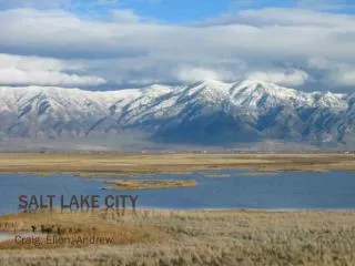
Fine-scale Meteorological Simulation of Cold Pools in Salt Lake City Chris Misenis, Kirk Baker, Pat Dolwick Image courtesy of Erik Crosman, University of Utah
Overview & Air Quality Implications • Cold-air pool (CAP) formation occurs due to strong inversions within topographical deformations. • Persistent CAPs are due to restricted ventilation (deeply stable) and lack of horizontal displacement (orographic forcing). • CAPs in dense urban locations can lead to significant stagnation and a build-up of local emissions (vehicles, industrial, home heating). • Current meteorological models tend to be too diffusive, leading to chemical models failing to capture pollution (PM2.5 in SLV, O3 in Upper Green River Basin) buildup.
PCAPS • Persistent Cold-Air Pool Study • Intensive field campaign ran from December 2010 through early February 2011, centered over the Salt Lake Valley • Will focus on early January 2011 period. • Strongest, most polluted period during PCAPS (1/1-1/9)
Modeling Setup • WRF v3.3 • 12/4/1km (only 4 & 1km shown) • 12/6/2010 – 3/15/2011 • NAM-12 Initialization • USGS landuse • Noah land-surface • Mellor-Yamada-Janjic PBL • Goddard SW, RRTM LW • Thompson microphysics • 35 layers up to 50 mb, 20-m lowest layer • Nudging of T, Q and winds above PBL
Runs to be evaluated against 7 ISFS stations (temperature, winds, shortwave radiation)
Temperature – 4km CAP ends Playa River
Wind Speed – 4km Playa River
Temperature – 1km Playa River
Wind Speed – 1km Playa River
Summary Statistics • While having overall low biases, simulations using NARR initialization had worse model performance per RMSE. • In terms of model error, performance improves when increasing resolution from 1 to 4-km. • Initialization dataset has greater impact than model physics.
Vertical Profile NAM1KM PX1KM
Vertical Profile NAM1KM PX1KM
Vertical Profile NAM1KM PX1KM
Thoughts and Future Work • During periods of cold pool formation, WRF: • tends to overestimate surface temperature and wind speeds, with slight improvements as resolution is increased. • overestimates incoming shortwave radiation • typically erodes the deeply stable layers too soon, per vertical profiles. • Further analysis of initialization datasets required to better understand biases and possible corrections • Broad community working to better understand current issues • Lareau et al., 2013 • Silcox et al., 2012