Download
1 / 23
230 likes | 468 Vues
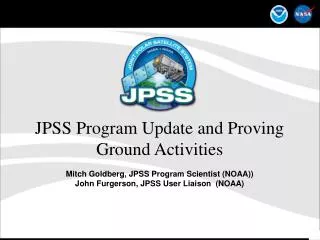
JPSS Proving Ground and Risk Reduction Mitch Goldberg, JPSS Program Scientist (NOAA) John Furgerson , JPSS User Liaison (NOAA) Ingrid Guch , STAR JPSS PGRR Co-Chair. TOPICS. Scope of JPSS PGRR Program Call for New Proposals Selection Process. GOAL.

E N D
JPSS Proving Ground and Risk Reduction Mitch Goldberg, JPSS Program Scientist (NOAA) John Furgerson, JPSS User Liaison (NOAA) Ingrid Guch, STAR JPSS PGRR Co-Chair
TOPICS Scope of JPSS PGRR Program Call for New Proposals Selection Process Joint Polar Satellite System
GOAL • The JPSS Proving Ground and Risk Reduction program’s primary objective is to maximize the benefits and performance of NPP/JPSS data, algorithms, and products for downstream operational and research users (gateways to the public) through: • Detailed characterization of data attributes such as uncertainty (accuracy and precision) and long-term stability • Engaging users to enhance their applications (and develop new ones) by working together to facilitate optimal utilization of JPSS data, algorithms and products in combination with other data sources through onsite/offsite testbeds, experimental data streams, and intercomparisons of enhancements with baselines • Education, Training and Outreach • Facilitating transition of improvements (new algorithms/applications) to operations.
Call for proposals due Jan 20, 2012 • Introduction • Identify and describe end user application(s) and importance, and the benefit JPSS data can provide • Identify and describe any current limitation(s), requiring additional research and/or feedback to further realize this benefit. • Identify a user that will be engaged, and describe how you will engage the user, regularly, to understand JPSS products, provide test datasets and to obtain feedback. • Proposed Work and Technical Approach • Describe methodology to use JPSS data (and other data sources, if necessary) to improve the identified user application. • Milestones and deliverables
Application Areas • Cal/Val Applications • Tropical Cyclone Applications • Cryosphere Applications • Severe Weather/Aviation Applications • Ocean/Coastal Applications (Coral Bleaching, Harmful Algle Bloom alerts) • Land Applications (Agriculture, Droughts) • Hazards Applications (Smoke, Fire, Aerosols, Air Quality, Flash Floods) • Data Assimilation Applications • Imagery/Visualization Applications • Climate Applications
Developer - User Application Teams (DUAPs) NWP Team Tropical Cyclone Team Fire Weather & Air Quality Team Severe Weather and Transportation Hazard Team Ocean Ecosystems Team Land Ecosystems Team Cryosphere Team Hydrology Team Testbed Team Joint Polar Satellite System
Proposal Selection Process • Review board consisting of NOAA representatives knowledgeable of NOAA priorities and operational activities • Board: JPSS Program Scientist (PGRR Chair) JPSS User Liaison JPSS STAR JPSS PGRR Co-Chair JPSS STAR EDR Chair GOES-R Program Scientist NESDIS OSPO Representative NWS representatives (Data Assimilation /Nowcasting) NOS representative OAR representative Climate representative Joint Polar Satellite System
Current Projects Joint Polar Satellite System
JPSS Current Portfolio of User Engagement activities • JCSDA CrIS/ATMS Radiance Assimilation Experiments • POCs – Sid Boukabara (NOAA), Nancy Baker(NRL) • Outcome - Impact assessments and improved utilization of radiances • Alaska High Latitude Proving Ground • POC – Gary Hufford/Tom Heinrich • Outcome - Upgrade X-band receiver, generate NPP products, forecaster training, product evaluation and feedback, compare operational products with alternative products using CSPP. • Community Satellite Processing Package (CSPP) • POC – Allen Huang/Liam Gumley • Outcome - Software package/testbed containing IDPS algorithms and capability of alternative algorithms for intercomparisons Joint Polar Satellite System
JPSS Current Portfolio of User Engagement activities • Utility of NPP/JPSS Data to Improve Situational Awareness and Short-term Forecasts in WFO Operations • POC – Gary Jedlovec, SPORT • Outcome - AWIPS/AWIPSII plug-ins for VIIRS SDRs/EDRs, RGB products, training of selected WFOs by adapting current MODIS and AIRS modules, feedback, close coordination with Alaska Proving Ground, and with NRL, CIRA and CIMSS. • SPoRT will use established collaborative partnerships to disseminate VIIRS data and products to various WFOs to engage forecasters in an evaluation of selected products to address specific forecast challenges. Joint Polar Satellite System
JPSS Current Portfolio of User Engagement activities • Application of JPSS Imagers and Sounders to Tropical Cyclone Track & Intensity Forecasting • POC – Mark DeMaria, John Knaff, Steve Miller • Users – Brennan, Beven (NHC), Fukada (JTWC) • Outcome - VIIRS will improve center location, Soundings from CrIS and ATMS to improve intensity forecasting. Information used in existing operational statistical-dynamical intensity forecast model. Strong user engagement with forecasters at NHC and JTWC. • NRL/CIRA NEXSAT VIIRS Imagery Demonstrations Joint Polar Satellite System
First Global VIIRS Image VIIRS
VIIRS has a very large cross track and near constant spatial resolution
NPP VIIRS True Color Examples Colorado 11.24.2011 1845 Z, Near Edge of Scan 11.24.2011 2028 UTC, Near Nadir VIIRS maintains similar spatial resolution quality at edge of 3000 km swath
NPP VIIRS True Color Examples Edge of Scan Intercomparisons NPP VIIRS 11-24-11 1845Z NOAA-19 AVHRR 11-24-11 2000Z NOAA-19 AVHRR 11-24-11 2000Z Aqua MODIS 11-24-11 1840Z NPP VIIRS 11-24-11 1845Z
NPP VIIRS DNB Examples Agriculture “hole” in Salinas (dark spot in right image)
First global ATMS image showing the channel 18-microwave antenna temperature at 183.3 GHz on November 8, 2011 The ATMS data were processed at the NOAA Satellite Operations Facility (NSOF) in Suitland, MD and the image was generated by STAR Quality of the image is superb, no indication of instrument artifacts, and by design no orbital gaps This channel measures atmospheric water vapor; note that Tropical Storm Sean is visible in the data, as the blue patch due to heavy precipitation, in the Atlantic off the coast of the Southeastern United States. ATMS provides critical water vapor information for weather forecasting and storm intensity assessments
ATMS Preliminary Assessment Total Precipitable Water MiRS/ATMS ECMWF MiRS/N18
ATMS Preliminary Assessment (Rainfall Rate) MiRS/ATMS MiRS/N19 AMSU-MHS MiRS ATMS Rainfall rate (left) and MiRS N19 Rainfall rate (right) screened out over snow cover and sea-ice.
ATMS Preliminary Assessment (Temperature Soundings Using ECMWF as a reference) MiRS ATMS 500 mb T MiRS ATMS Temperature Profile Bias ECMWF 500 mb T MiRS ATMS Temperature Profile StdDev