Download
1 / 32
320 likes | 421 Vues
Discover insights on weather forecasting lessons learned from verification procedures, analysis of precipitation types, snow totals, and severe winds using various data sources like Mesonet and ASOS. Understand verification techniques, interpretation of sounding data, and observations to improve forecast accuracy.

E N D
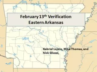
Lessons Learned Gabriel Lojero, Mike Thomas, and Nick Gliozzi,
Eliminated all Zero Categories • - Easy: Dust (14), smoke (16), Wind Chill(18,19), Flood Categories (21-24), Big Snows (5,6,7,8), and Severe Weather(27), and IceStorm (11) • - Lightning (25) was ruled out based on PSU lightining data on ewall • - Visibilities from ASOS reports were > 0.5 mile (17) Verification Procedure
Verification Procedure The Search for High and Severe Winds - used Mesonet and ASOS reports and none reported winds greater than 15 kts so Snow Squall (3), High Winds (12), and Severe Winds (13) were neglected. - Even though there were 50-60kt winds at 850 mb, the layer between the surface and 850 mb was stable, not conducive for mixing to the surface.
Verifying Snow Totals • Flurries: 18z 13th – 12z 14th using NOHRSC interactive snow information and metars • Snow Shower and Light Snow 12z 13th – 12z 14th with same method • Were there moderate snow totals? • Eliminated Snow Squall, Heavy Snow, Very Heavy Snow, and Blizzard based on snow totals and other criteria
Verifying Snow Totals • 12z 13th – 12z 14th • NOHRSC interactive snow information
Flurries • All zones that received measurable snowfall and zones that traced snow after 18z using NOHRSC and metars
Snow Shower • Verified using NOHRSC 12z-12z
Light Snow • Verified using NOHRSC 12z-12z
Where was there sleet? Trained spotter reports sleet. KPOF, just across border, reported ice pellets. KLRF reported ice pellets.
Confirming Sleet: Theory KSRC KARG KHKA
Where was there sleet? Theory Confirmed
Where was there Freezing Rain? Trained spotter reports FR. KPOF, just across border, reported FR. KRUE in zone 22 reported FR. KMEM reported FR KLIT reported FR.
Where was there Freezing Rain? Theory Confirmed
Freeze/Frost • Verified using METARS
Verification Procedure • Searching for Precipitation >= 0.5 inches
Verification Procedure Precip >= 0.50 Inches Verification • Zones 23-24, 32-33, 44, 63-64, 68-69, and 73-75
T>40 F 39 40 39 41 39 41 41 39 43 40
Lessons Learned • Always look at a sounding to analyze stability parameter to determine if strong winds from aloft can mix down to the surface. • Always look at observations first to determine the most likely precipitation type during a future time period. • Verifying Precipitation amount: Mesonet and Cocorahs • ASOS stations do not have a brain (UP = Unknown Precipitation) . Our job to go through the data to determine what actually happened. • You can use soundings and visibilities to get a good idea of the type of precipitation. • GARP = Confusing interface...but great data.