Elena Mauri
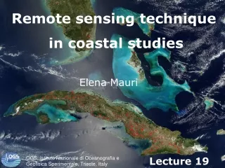
Remote sensing technique in coastal studies. Elena Mauri. OGS, Istituto Nazionale di Oceanografia e Geofisica Sperimentale, Trieste, Italy. Lecture 19. OUTLINE. Electromagnetic spectrum and black body emission Satellite orbits and sampling PASSIVE REMOTE SENSING :


Elena Mauri
E N D
Presentation Transcript
Remote sensing technique in coastal studies Elena Mauri OGS, Istituto Nazionale di Oceanografia e Geofisica Sperimentale, Trieste, Italy Lecture 19
OUTLINE • Electromagnetic spectrum and black body emission • Satellite orbits and sampling • PASSIVE REMOTE SENSING: in the visible bands (Ocean Color), principles, atmospheric contamination, algorithms to retrieve chlorophyll concentration pan-spectral, multi-spectral and hyper-spectral sensors and applications (MODIS, Landsat7) in the thermal infrared bands(Sea Surface Temperature) principles, atmospheric effects, algorithms to retrieve SST applications (AVHRR and MODIS) • ACTIVE REMOTE SENSING: in the microwave bands (Satellite Altimetry and Synthetic Aperture Radar) principles applications (geostrophic surface circulation oil spill detection, etc.)
Remote Sensing is the science and art of obtaining information about an object, area, or phenomenon through the analysis of data acquired by a device that is not in contact with the object, area, or phenomenon under investigation. Satellite Remote Sensing uses electromagnetic radiation to measure near-surface ocean properties
Electromagnetic spectrum Visible (400 nm - 1000 nm, VIS) Infrared (~ 10,000 nm, IR) Microwave (MW) active (3-30 GHz) Links: http://www.biogeorecon.com/remote.htm http://www.eeb.ucla.edu/test/faculty/nezlin/SatellitesAndSensors.htm
Plank’s Law & Blackbody Emission Planck's law describes the spectral radiance of electromagnetic radiation at all wavelength from a black body at temperature T. Black body when is cold no light is reflected or transmitted, the object appears black. When is hot, it will on average emit exactly as much as it absorbs, at every wavelength. As the temperature decreases, the peak of the black-body radiation curve moves to lower intensities and longer wavelengths. Passive remote sensing
Sun emission Earth emission Passive remote sensing
Effects of Atmosphere on the electromagnetic spectrum Links: http://www.gisdevelopment.net/tutorials/tuman008.htm http://www.crisp.nus.edu.sg/~research/tutorial/atmoseff.htm http://earthobservatory.nasa.gov/Library/RemoteSensingAtmosphere/
Satellite orbits Geostationary Near-Polar orbiting Sun-synchronous Links: http://www.rap.ucar.edu/~djohnson/satellite/coverage.html
Satellite orbits Polar-orbiting and geostationary Satellites
Passive and Active Satellite Remote Sensing Passive (VIS, IR, MW) Active (MW) Links: http://www.csc.noaa.gov/products/nchaz/htm/ccap5.htm
Satellite sensors Scanning Pushbroom Instantaneous Field of View (IFOV) Satellite Sampling Links: http://ccrs.nrcan.gc.ca/resource/tutor/fundam/chapter2/08_e.php
Sensor Calibrations and Ground Truth In-situ measurements are needed for ground truthing or validation of remotely sensed data Oceanographic Platform (Ocean color) Surface drifter (SST) Links: http://www.fas.org/irp/imint/docs/rst/Front/tofc.html
Sunlight propagation, refection and absorption by atmosphere and ocean Passive remote sensing: VISIBLE
Passive remote sensing: VISIBLE Remote sensing in the VISIBLE OCEAN COLOR • Ocean color is not the color we normally see, blue/gray due to the reflection of the sky. BUT • Ocean color is the color that would be observed freed from the surface reflection, for instance the color measured beneath the surface of the water.
Passive remote sensing: VISIBLE Remote sensing reflectance (Rrs) Eu (λ) Ed (λ) Is the ratio between the irradiance upwelling just under the surface of the water Eu (λ), to thedownwelling irradiance just penetreting the surface Ed (λ). Rrs=
Passive remote sensing: VISIBLE Remote Sensing Reflectanceand inherent optical properties Rrs(λ)=const bb(λ) bb(λ) + a(λ) Where: a(λ)=aw(λ)+aph(λ)+ad(λ)+acdom(λ) bb(λ)=bbw(λ)+bbp(λ) Absorption is the process by which the enery of a photons is taken up by another entity, for example, by an atom whose valence electrons make transition between two electronic energy levels. The photon is destroyed in the process. Scattering is a general physical process whereby radiation are forced to deviate from a straight trajectory.
Passive remote sensing: VISIBLE Absorption Total absorption spectrum of an idealized, productive (<chl> = 1 mg m-3) oceanic water together with spectra of the individual absorbing components. Relative contribution of absorption by phytoplankton, aph(), and by organic detritus, adet() or ad(), to the total particulate absorption, ap(), from Sargasso Sea waters at 20 m depth
Passive remote sensing: VISIBLE Back-scattering blue green red Clean ocean water (A) has maximum backscatter in short (blue) wavelength and almost zero in yellow and red. Higher is phytoplankton (i.e., chlorophyll and other plant pigments) concentration, more is contribution of green color (B). In coastal zones with high concentration of dead organic and inorganic matter light spectrum has maximum in red (C).
Passive remote sensing: VISIBLE Empirical Chlorophyll algorithms <chl> = 10^(a(1) + a(2)*R + a(3)*R2 + … … a(4)*R3) + a(5)*R4 ) where R = log10Rrs490 Rrs555 a = [0.2974, -2.2429, 0.8358, -0.0077, -0.0929] empirical coefficients ( )
Passive remote sensing: VISIBLE MODIS • Moderate-resolution Imaging Spectroradiometer • is on board of two satellite: Terra (EOS AM) satellite (1999), • AQUA (EOS PM) satellite (2002). • there are 36 spectral bands ranging in wavelength from 0.4 μm to 14.4 µm and at varying spatial resolutions (2 bands at 250 m, 5 bands at 500 m and 29 bands at 1 km). • together the instruments image the entire Earth every 1 to 2 days. • designed to provide measurements in large-scale global dynamics including changes in Earth's cloud cover, radiation budget and processes occurring in the oceans, on land, and in the lower atmosphere.
MODIS spectral bandsand athmospheric effects Passive remote sensing: VISIBLE
Passive remote sensing: VISIBLE Ocean Color Phytoplankton pigment (chlorophyll-a) concentration. The global biosphere!
Passive remote sensing: VISIBLE MODIS chlorophyll concentration around Tanzania
Passive remote sensing: VISIBLE Ocean Color Spatial and seasonal (monsoon) variability of the chlorophyll-a concentration in NW Atlantic and Indian Oceans
Passive remote sensing: VISIBLE Remote sensing in the VISIBLE • Truecolor is a method of representing image (especially in computer processing) in an RGB color space. MODIS res. 250 m • Multispectral is a type of sensor with sensitive to a few specific wavelength and hyperspectral sensitive to many (can reach 200 bands) specific bands • Panchromatic sensor is a type of sensor that is sensitive to all wavelength of visible light. This imagery is of a much higher resolution than the multispetral imagery. For example, the QuickBird satellite produces panchromatic imagery having a pixel equivalent to an area 0.6m x 0.6m, while the multispectral pixels represent an area of 2.4m x 2.4m. QuickBird and IKONOS • Pansharpening is a process of merging high resolution panchromatic and lower resolution multispectral imagery to create a single high resolution color image
The Earth Observing System (EOS) is a program of NASA comprising a series of artificial satellite missions and scientific instruments in Earth orbit designed for long-term global observations of the land surface, biosphere, athmosfere, and oceans of the Earth. The first satellite component of the program was launched in 1997. Passive remote sensing: VISIBLE
Landsat 7 • Landsat 7, launched on April 15, 1999, is the latest satellite of the Landstat program. • Landsat 7's primary goal is to refresh the global archive of satellite photos, providing up-to-date and cloud free images. • Although the Landsat Program is managed by NASA, data from Landsat 7 is collected and distributed by the USGS. • The NASA World Wind project allows 3D images from Landsat 7 and other sources to be freely navigated and viewed from any angle. Landsat 7 data has eight spectral bands with spatial resolutions ranging from 15 to 60 meters. Passive remote sensing: VISIBLE
Passive remote sensing: VISIBLE Landsat 7
Passive remote sensing: VISIBLE Landsat 7
MODIS True color (250 m resolution) Phytoplankton bloom South Atlantic Ocean (off Argentina coast) Coccolotophorids bloom in Bering Sea
True color satellite images of Italian Seas (non-dusty and dusty cases)
IKONOS Passive remote sensing: VISIBLE • is a commercial earth observation satellite and was the first to collect publicly available high-resolution imagery at 1- and 4-meter resolution. It offers multispectral(MS) and panchromatic (PAN) imagery. • Spatial resolution • 0.8 m panchromatic (1-m PAN Panchromatic) • 4-meter multispectral (4-m MS Multispectral) • 1-meter pan-sharpened (1-m PS Pansharpening) • Spectral Resolution: Band1-m PAN4-m MS & 1-m PS1 (Blue)0.45-0.90 µm0.445-0.516 µm2 (Green)*0.506-0.595 µm3 (Red)*0.632-0.698 µm4 (Near IR)*0.757-0.853 µm • Temporal resolution: the revisit rate for IKONOS is 3 to 5 days off-nadir and 144 days for true-nadir
Passive remote sensing: VISIBLE Bahamas
Passive remote sensing: VISIBLE Bora Bora
Passive remote sensing: INFRARED Sea Surface Temperature (SST) NOAA (National Oceanic and Atmospheric Administration)satellites Advanced Very High Resolution Radiometer (AVHRR) data : 5 channels in VIS & IR Cloud masking MCSST algorithm to estimate SST The AVHRR instrument also flies on the METOP series of satellites. The three planned METOP satellites are part of the Eumetsat Polar System (EPS) run by Eumetsat. Link: http://www.eeb.ucla.edu/test/faculty/nezlin/SST.htm
Passive remote sensing: INFRARED Sea Surface Temperature (SST) algorithm Example of an algorthm SST=A*T4+B*(T4-T5)+C*(T4-T5)*(sec(θ)-1)+D A, B, C, D = empirical coefficientsspecific for each satellite
Passive remote sensing: INFRARED Sea surface temperature (SST) - is the temperature of a very thin layer of about 10 micrometres thick or skin of the ocean which leads to the phrase skin temperature (because infared radiation is emitted from this layer). Deviation of the temperature from deep undisturbed water during daylight warming. Notice logarithmic scale. Deviation of the temperature from deep undisturbed water during night. Notice logarithmic scale.