Innovative developments in Geographic information technology
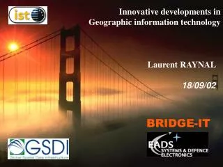
Innovative developments in Geographic information technology . Laurent RAYNAL 18/09/02. BRIDGE-IT. Presentation Outline. EADS S&DE / Geomatics SDI architecture Open issues Geo-data and meta-data management Geographic services : BRIDGE-IT Project Geographic applications (for SDI ?).

Innovative developments in Geographic information technology
E N D
Presentation Transcript
Innovative developments in Geographic information technology Laurent RAYNAL 18/09/02 BRIDGE-IT
Presentation Outline • EADS S&DE / Geomatics • SDI architecture • Open issues • Geo-data and meta-data management • Geographic services : BRIDGE-IT Project • Geographic applications (for SDI ?) 18/09/02 - 2 -
EADS S&DE / Geomatics DCS S & D E Naval & Ground Systems Airborne Systems Intelligence, Surveillance & Reconnaissance Systems C3I Geomatics EADS 18/09/02 - 3 -
EADS S&DE / Geomatics strategy • Image processing • Geometric data models • GIS (vector data mgt) • Information extraction and formatting. • Production management (Workflow, Archiving). • System performance. • Quality control • Content integration • Real-time information access. • Information updating • Metadata collecting (catalogues). • Multi-scale data consistency. Geo. Data Knowledge GIS and EO technologies Geo. Info. Federation Tool Eurosion Raster/Vector Cadastre (France) Military Data Production Systems Mobiles and Vehicles (MOVIES) Map Servers (ANFAS, HYPERCARTA) Geo. Info. dissemination • EADS S&DE / Geomatics develops innovative solutions to make information access and tailoring easier for specific applications. • Geo. Data knowledge • GIS & EO technologies • Geo. Info. dissemination Three issues addressed 18/09/02 - 4 -
SDI Architecture Meta-Data and Geo-Data Management Geo. Info. dissemination Updates Data consistency GIS & EO technologies Geo. Data knowledge 18/09/02 - 5 -
SDI : Geographic data and metadata management • Geographic database updating for a coordinated process Extract SDI Geo-data External GIS Packed Updating Packed data files Packed data Packed data Import • GIFT : Geo. Info. Federation Tool • Inset concept : “Packing” mapping between systems geographical extent access rights 18/09/02 - 6 -
SDI : Geographic data and metadata management Propagate Check Updates • Check and maintain data consistency • Certification of imported data • Consistency between data / metadata • Consistency between data along scale • Consistency indicators • Propagation of updates SDI Geo-data © SGME 2001 acknowledgements to DGA (France) 18/09/02 - 7 -
SDI : Geographic data and metadata management Simple geographic indicators based upon spatial properties (distance comparison, buffer and distance comparison) © SGME 2001 acknowledgements to DGA (France) 18/09/02 - 8 -
SDI : Geographic data and metadata management Propagate • Propagation of updates : 5 steps mechanism Filtering Integration SDI Geo-data Infering Conflicts Mgt Global Check © SGME 2001 (in cooperation with IGN-F) 18/09/02 - 9 -
SDI Architecture Geographic Services In the context of the BRIDGE-IT project 18/09/02 - 10 -
SDI : Geographic services • BRIDGE-IT project IST-2001-34386 (www.bridge-it.info) • 13 partners - leader : EADS S&DE / Geomatics • Data experts : TeleAtlas (Bel) • GIS editors : APIC (Fra), SICAD (Ger), LUCIAD (Bel) • Contributors : EADS Dornier (Ger), JRS (Austria), KU Leuven/SADL (Bel), KU Leuven/ICRI (Bel) • Users : CETIR (Fra), IMR (Nor), MVG (Bel) • 24 months 1/04/02 1/04/04 18/09/02 - 11 -
SDI : Geographic services • BRIDGE-IT innovative services: • Content integration • Dynamic geographic information integration. • Time reference in geographic information exploitation and representation. • Portable devices and access to mobile services. • These services are connected to core services of a SDI Map Server Feature Server Catalog Server 18/09/02 - 12 -
SDI : Geographic services Dynamic information integration • Interfacing with suppliers of traffic information • When building itineraries • During the trip InTripMonitor Itinerary Composer Dyn. Info. integration Suppliers Content integration • Integration of GML into MPEG 7 files • All videos can be georeferenced in a map • Geographical data may be included in the video MPEG 7 GML 18/09/02 - 13 -
SDI : Geographic services Portable devices and access to mobile services • Generic component to address many kind of devices • Notebooks, WebPads, PDA, Smartphone, Mobiles Phones • PDA/Mobile with GPS, GPS receiver with PDA extension Time-varying attributes representation • Toolbox for visualisation • Maps, reports, curves at different dates • 3D map visualization • In specification process 18/09/02 - 14 -
SDI Architecture Applications 18/09/02 - 15 -
Four applications in BRIDGE-IT • Local authorities and e-government application. • Content integration, internet access, new business practices.: APIC / CETIR • Transportation and public works application. • Integration of real-time information, content integration, mobile devices : TeleAtlas / LUCIAD / KU Leuven / MVG • Real estate and location based services application. • GI / socio-economic data integration, B2B Business model and new customers, mobile devices. : SICAD • Environmental application. • Time reference management and representation, statistical analysis. : EADS S&DE / IMR Technical components will be integrated in pilot prototypes using a generic framework. 18/09/02 - 16 -
Local authorities : Hautes-Pyrénées (France) 18/09/02 - 17 -
Transportation : Flemish Region (Belgium) Bus Path B A £ £ Foot Path (1) Foot Path (2) • Multi-Modal Travel Advice System (DIMITRAS) In-Trip Notification and Re-routing by Bus, Car, Train, Foot 18/09/02 - 18 -
Real Estate : City of Horsham (England) • On several kind of devices, • consult available properties close to the user location • consult detailed information : photos, prices, taxes, history... 18/09/02 - 19 -
Environment : Barents Sea (Norway) Bottom 200 Depth 150 100 50 0 Years 1970 80 90 2000 10 2020 • Planning future cruises in fish stock assessment • View and explore the various environmental data available geographically and temporally 18/09/02 - 20 -
Conclusion • Geo. Data knowledge • Importance in data production and certification (GI Federation Tool, multi-scale consistency indicators) • GIS & EO technologies / GeoData Dissemination • BRIDGE-IT Project (brochure available) • Build on SDI core technology (Map Server, ...) • Innovative components (dynamic info. integration, ...) • Various applications (departmental SDI, transportation, real estate, environment) • Opportunity for an IP in the 6th RTD Prog. : ELISE 18/09/02 - 21 -