Download
1 / 23
240 likes | 258 Vues
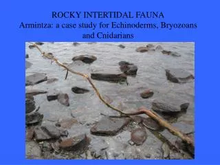
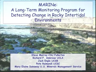
MARINe: A Long-Term Monitoring Program for Detecting Change in Rocky Intertidal Environments. Steve Murray CSU Fullerton Richard F. Ambrose UCLA Jack Engle UCSB Pete Raimondi UCSC Mary Elaine Dunaway U.S. Minerals Management Service. MARINe (33 Unique Partners). MARINe Sites.

E N D
MARINe: A Long-Term Monitoring Program for Detecting Change in Rocky Intertidal Environments Steve Murray CSU Fullerton Richard F. Ambrose UCLA Jack Engle UCSB Pete Raimondi UCSC Mary Elaine Dunaway U.S. Minerals Management Service
MARINe (33 Unique Partners)
MARINe Sites Core Monitoring Sites (n = 80)
MARINe Core Monitoring Sites MARINe South (San Luis Obispo – San Diego Counties) • 57 sites: 34 mainland + 23 island • 3 sites target abalone only • Longest monitoring period = 23 yrs (since 1982) MARINe North (Del Norte – Monterey Counties) • 23 sites • 8 sites target abalone only • Longest monitoring period = 6 yrs
MARINe Core Monitoring Sites Sampling Frequency Semi-Annual (Spring/Fall) * south of San Francisco Annual (Summer) * north of San Francisco
Core Monitoring Program: South 34 mainland sites 23 island sites Point Conception
Species Monitored • Target species (13): Anemones--Anthopleura elegantissima/solaBarnacles--Pollicipes polymerusTetraclita rubescensChthamalus dalli/fissus/Balanus glandulaBlack abalone--Haliotis cracherodiiOwl limpets--Lottia giganteaCalifornia mussels--Mytilus californianusSeastars--Pisaster ochraceusBoa Kelp--Egregia menziesiiRockweed--Hesperophycus californicusSilvetia compressaTurfweed--Endocladia muricataSurfgrass--Phyllospadix scouleri/torreyi • Core species: found in plots and transects in association with Target species • Optional species
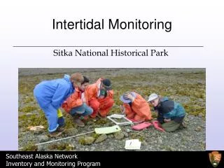
Sampling MethodsSampled Spring and Fall each year Fixed Photoplots Mussels, barnacles, rockweed, anemones, turf algae
Sampling MethodsSampled Spring and Fall each year • Fixed Circular Plots • Owl limpets • Band Transects & Irregular plots • Seastars, abalone • Line Transects • Surfgrass
The Value of Regional Monitoring Programs MARINe is a Regional Monitoring Program
120 100 80 60 COVER 40 20 ALEG BOA 0 1990 1995 2000 2005 CAY DATE GPT HAZ OCC PSN SHB STA Silvetia % Cover Pt. Conception & North
Lottia gigantea (Owl Limpet) • Large and easy to catch and long history of collection by humans • Humans select larger Owl Limpets • Recent studies (Kido & Murray 2003; Roy et. al 2003; Lindberg et. al 1998; Pombo & Escofet 1996) show reduced sizes at local sites where humans are numerous
Legend 33 MARINe Sites Access Category 1 – Open Access San Luis Obispo 2 - Protected 3 - Islands Los Angeles San Diego Mexico
150 0.14 0.12 100 0.10 Count 0.08 Proportion per Bar 0.06 50 0.04 0.02 0 0.00 0.10 80 70 0.08 60 0.06 50 Count 40 Proportion per Bar 0.04 30 0.09 20 0.02 100 0.08 10 0.07 0 0.00 80 0.06 Count 0.05 60 Proportion per Bar 0.04 40 0.03 0.02 20 0.01 0 0.00 0 20 40 60 80 100 120 SIZE 1 Smaller mean, median, and maximum Limpet sizes in open access sites n = 949 2 n = 847 Hypotheses Ho: Humans are taking the large limpets wherever they can Ha1: Oystercatchers Ha2: Visitor (Trampling) impact Ha3: Natural Geographic clines in size 3 n = 1227 Shell Length (mm)
MARINe Database • Microsoft Access database by SCCWRP in 2003-2004 • Relational database for core monitoring data • Currently contains ~ 1 million records • Photo database planned
Biodiversity Surveys Distributions and Abundances Site Comparisons Community data Alegria, S.B. Co.
Stress: 0.19 SC mussel shoals sandhill terrace_2 carpinteria coal oil pt old stairs CC starfish pt terrace arroyo hondo bob creek ano nuevo chilean memorial santa maria creek alegria whites pt shaws cove CI ecola cape arago scott paradise cove burnt hill scripps crystal cove fogarty creek ford pt sri pt fermin government pt fraser pt sci johnsons_2 dana point johnsons lee sri valley sci taylor pt bodega cape mendocino cabrillo zone 3 scott_2 sea ranch cuyler_2 cuyler harbor smi stillwater crook pt smi OR trailer sci boat house sea lion rookery sbi bolinas pt mill creek prisoners sci east pt sri cabrillo zone 1 stairs landing cove pt sierra nevada shelter cove shell beach hazards frenchys cove ai forney sci fossil reef sri willows sci andrew molera middle ai pt lobos little harbor catalina hopkins_2 NC nw talcott sri cannonball island fitzgerald cayucos bird rock pigeon pt hopkins WA cambria Community Surveys This nMDS was constructed using only those species that had a total of at least 25 points across all sites (118 total spp). Data were sq. rt. transformed. Melissa Wilson, Pete Raimondi
Stress 0.09 Corona del Mar MDS Ordinations Mainland Sites 1999-2000 Samples differ from seasonal and annual variation exhibited by 1970s Samples Whites Point Stress 0.09 Steve Murray
State of the Shoreline Report A key goal is making data directly available to managers and decisionmakers
A Key Goal of MARINe is IncreasingPublic Awareness of Tidepools and How They Can Help Protect these Resources
www.MARINe.gov MARINe Partners