Communicating Data: Tools and Strategies for Effective Advocacy
Learn how to effectively communicate data to politicians, regulators, and media using GIS, statistical tools, and information sheets. Focus on the importance of clear data communication in advocacy efforts.

Communicating Data: Tools and Strategies for Effective Advocacy
E N D
Presentation Transcript
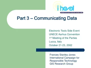
Part 3 – Communicating Data Electronic Tools Side Event UNECE Aarhus Convention 1st Meeting of the Parties Lucca, Italy October 21-23, 2002 Frances Stanley-Jones International Campaign for Responsible Technology GIS Research Group
Outline of this module • Communicating data • Why is it important? • To whom are we communicating? • How can we communicate authoritatively? • Challenges. • Ways to communicate data • GIS/Maps • Raw data and visualizations of data • Statistical communication
Why is this important? • A community monitoring project aims to convince people (often skeptical people) of something based on information collected. • You will be communicating to: politicians regulators international organizations scientists peers media
Communicating to scientists • “The data on the right clearly show concentrations of the chemical are higher in food grown near town A”. • “The data suggest that the river near town A is contaminated with this chemical”.
Communicating to media • Our river water and air are horribly polluted! • Our children are getting sick. • The local authorities are doing little or nothing about it!
Ways to communicate results • Information sheets • survey forms and tallies • Statistical procedures and manipulation • data plots, statistical tests • Web-based communications • submitting to online databases • GIS/mapping tools • Graphical representations
Information sheets • Definition: • Communicating data with a simple tally or in tabular form or fact sheet or press release. • Advantages: • Very simple and cheap to prepare. • Can be very powerful in their straightforwardness. • Disadvantages: • Sometimes not effective at conveying lots of data or complex relationships. • Examples: (see next page)
Why focus on lindane? Lindane is linked with serious health problems including breast cancer and may also disrupt the endocrine (hormonal) system. It is hazardous both to the people who use it and those exposed to it in the environment or in their food (see PAN UK's factsheet on lindane). Cases of human poisoning by lindane have been reported in Europe. Children are significantly more susceptible to its toxic effects. Lindane is a possible human carcinogen according to the International Agency for the Research on Cancer and the US Environmental Protection Agency. Lindane is an endocrine disrupter which is capable of imitating certain hormones in humans. There is a significant body of evidence which suggests that where lindane is used, the incidence of breast cancer is higher. The acceptable daily intake for residues of lindane in the European diet may be exceeded by up to 12 times as suggested by recent data published by the joint Food and Agriculture Organisation/World Health Organisation Codex Committee. Lindane is a persistent organic pollutant (POP) candidate according to the UN Environment Programme. There is concern that heavy usage in tropical zones may allow percolation of residues through the global environment to end up in cold regions such as Scandinavia, Canada and Antarctica. Lindane is highly volatile, and when applied, the pesticide enters the atmosphere and is later deposited by rain. It is also leached into surface waters and even into ground water. Lindane has been found in increasing concentration in the marine environment, and particularly in the North Sea. Lindane is fat soluble and can bioaccumulate through food chains as is common with other organochlorine pesticides. Residues have been detected in the kidneys, livers and adipose tissue of a wide range of wild animals and birds, and in human body fat. It is highly toxic to aquatic invertebrates and fish. Why focus on lindane?(from http://www.pan-uk.org/banlindane/index.htm) Lindane is linked with serious health problems including breast cancer and may also disrupt the endocrine (hormonal) system. It is hazardous both to the people who use it and those exposed to it in the environment or in their food (see PAN UK's factsheet on lindane). Cases of human poisoning by lindane have been reported in Europe. Children are significantly more susceptible to its toxic effects. Lindane is a possible human carcinogen according to the International Agency for the Research on Cancer and the US Environmental Protection Agency. Lindane is an endocrine disrupter which is capable of imitating certain hormones in humans. There is a significant body of evidence which suggests that where lindane is used, the incidence of breast cancer is higher. The acceptable daily intake for residues of lindane in the European diet may be exceeded by up to 12 times as suggested by recent data published by the joint Food and Agriculture Organisation/World Health Organisation Codex Committee. Lindane is a persistent organic pollutant (POP) candidate according to the UN Environment Programme. There is concern that heavy usage in tropical zones may allow percolation of residues through the global environment to end up in cold regions such as Scandinavia, Canada and Antarctica. Lindane is highly volatile, and when applied, the pesticide enters the atmosphere and is later deposited by rain. It is also leached into surface waters and even into ground water. Lindane has been found in increasing concentration in the marine environment, and particularly in the North Sea. Lindane is fat soluble and can bioaccumulate through food chains as is common with other organochlorine pesticides. Residues have been detected in the kidneys, livers and adipose tissue of a wide range of wild animals and birds, and in human body fat. It is highly toxic to aquatic invertebrates and fish.
Statistical graphics • Definition: • Using a plot of data to demonstrate trends or quantitative relationships. • Advantages: • Usually simple to prepare and understand • Effective for emphasizing relationships between numbers • Disadvantages: • They can be confusing and misleading • Examples: • Bar charts, time series, scatter plots, pie charts
A scatter plot can highlight subtle differences and relationships
A pie chart drives home simple comparisons Sources of pesticide pollution
GIS/mapping • Definition: • Geographic Information Systems • Data that has to do with a particular place – a map and database of information linked to the map by location of certain features • Advantages: • VERY powerful way to store and convey lots of information about a region of any size in an understandable fashion. • Can use GIS to quantify risk by combining layers of data • Disadvantages: • Usually requires specialized expertise and software (but this is becoming more and more available) • Examples: (on following pages)
Geographic - Map Water quality sampling points Information - Database associated with the map Rivers and Streams Systems – Context with other GIS layers for decision making County Lines Land Ownership Land Use GIS is a computer system for mapping and analyzing things that happen at specific locations
GIS data = layer/coverage/theme • The “building block” of GIS • Any data which has been grouped thematically and spatially
GIS Data Sets Water quality sampling points, wells, tanks, facilities, diversions, discharges, etc. Facility “Footprints” Rivers and Streams Roads County Lines Stream Crossings Bathymetry Land Ownership Land Use Precipitation Elevation Scanned USGS Quads Satellite Imagery & Aerial Photos
Typical use of GIS to make a map showing locations of certain features or hazards on a basemap – use appropriate colors to draw attention to the feature emphasized
Silicon Valley Toxics Coalition Eco-Maps Series http://www.svtc.org/ecomaps/svtc_ecomaps/index.html Schools, hospitals and parks shown in relation to chemical sites... Notice the various layers of information shown on map
Produced at http://www.esri.com/data/online/index.html An example produced on the web (see ESRI site in resources page). This map shows locations of power plants in a section of the African continent
Another one from the ESRI site – population density in a portion of the African continent
Graphical communication • Definition: • Using pictures to tell a story • Advantages: • Usually an effective way to communicate a lot of information in an understandable fashion • Disadvantages: • They can be misleading at times or focus on the wrong things or try to say too much. • Examples: (on following pages)
You can say a lot with just a cartoon of something! Is this too busy? Adding numbers to the arrows would also be good!
Another effective use of graphics to tell a story! This simpler cartoon is probably easier for the eyes to follow.
Share your experiences! • What sorts of projects have you been involved in where you communicated results? • To whom did you communicate? • What were the challenges in communicating results? • What additional information or technical resources would be helpful to make your projects more successful?