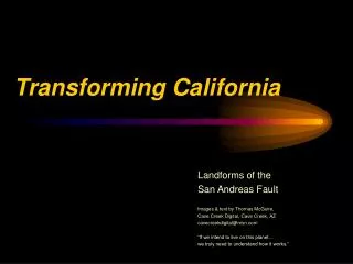
Transforming California
770 likes | 1.08k Vues
Transforming California. Landforms of the San Andreas Fault Images & text by Thomas McGuire, Cave Creek Digital, Cave Creek, AZ cavecreekdigital@msn.com “If we intend to live on this planet… we truly need to understand how it works.”. Exploring ways to find fault….

Transforming California
E N D
Presentation Transcript
Transforming California Landforms of the San Andreas Fault Images & text by Thomas McGuire, Cave Creek Digital, Cave Creek, AZ cavecreekdigital@msn.com “If we intend to live on this planet… we truly need to understand how it works.”
The author at Parkfield CA, site of USGS seismic experiment. “Be here when it happens!”
Fault Issues 1. Fault Scarps & Alignments 2. Sag Ponds 3. Offset Drainages 4. Distortion of Human-Made Structures 5. Infrastructure Vulnerability
San Andreas Fault San Francisco San Joaquin Valley Basic California Geography Death Valley Mojave Desert Los Angeles Imperial Valley
The San Andreas fault is part of the boundary between the North American and Pacific tectonic plates. It is classified as a right lateral transform fault. (To a person facing the fault, the far side shifts to the right.) Our Dynamic Earth, Robert Tilling, USGS, 1996
The Sea of Cortez.. (Known to Gringos as The Gulf of California.)
The US-Mexican Border (fence line) is as impervious to plate processes as it is to immigration.
The All-American Canal brings Colorado River water to the Imperial Valley of California.
The main trace of the fault runs NE of Los Angeles, but numerous splay faults affect the LA Basin.. (So does smog.)
Intersection of the San Andreas & Garlock Faults east of Tejon Pass.
The San Andreas and Garlock Faults John Marquis, USC
Remains of Manzanar Japanese American internment Camp (WWII) and the steep eastern front of the Sierra Nevada Mountains
Columnar jointing in basalt at Devil’s Postpile near Mammoth Lakes, CA
Dante’s View, Death Valley, CA. Badwater, at -282 Ft, the lowest place in the Western Hemisphere, is at the bottom right.
Fence (see last slide) crosses San Andreas Fault near CA 166.
San Andreas Fault ridge, Elkhorn Scarp along the base of the Tremblor Range, Carrizo Plain, CA
Stream offset along the San Andreas Fault, Carrizo Plain, CA
Soda Lake, Carrizo Plain,. A closed drainage (sag pond) feature.
Wallace Creek, USGS aerial view, about 1990 USGS Photo
Wallace Creek fault investigation area on the Carrizo Plain. Numbers show signed posted nature trail features. Next image at #1..
Stream offset along the San Andreas Fault near Wallace Creek, CA
Stream offset north of the Carrizo Plain, on Bitterwater Road.
San Andreas fault scarp & sag pond just east of California Route 25.
Slump structure near the San Andreas Fault, California Route 25.
San Andreas Fault Movement, DeRose Winery, Hollister, CA Note the new building at the top left.
28 years of offset at the Cienga Winery, USGS Photo TMcG
New construction & fault trace, June 2003, DeRose Cienga Winery. The offset ditch runs barely out of sight on the right.