A.R Drone Navigation
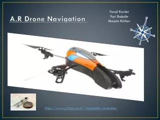
A.R Drone Navigation . Yuval Kovler Yuri Bakulin Maxim Kirilov. http://www.cs.bgu.ac.il/~maximkir/ardrone/. So What is the Project about?. AR Drone – Quadrocopter with 2 video cameras ( front & bottom) and Wi-Fi connectivity.

A.R Drone Navigation
E N D
Presentation Transcript
A.R Drone Navigation Yuval Kovler Yuri Bakulin Maxim Kirilov http://www.cs.bgu.ac.il/~maximkir/ardrone/
So What is the Project about? • AR Drone – Quadrocopter with 2 video cameras (front & bottom) and Wi-Fi connectivity. • We want to give the AR Drone the ability to autonomously navigation in a predefined route and recognize physical landmarks. • Our Goal is to supply a simply, comfortable and a reliable framework.
Introduction • Currently our focus is on agricultural applications such as pollination and/or decease identification in plants but there are many use cases. • We’d like to perform jobs that currently consume a lot of time and manpower in an alternative low cost way.
The Problem Domain • One of the fundamental problems of mobile robotics is to autonomously navigate a given route. • Open Space Navigation.
Stakeholders • The university researchers team and students. • Hard workers that do routine work and all their employees, (e.g. farmers etc…)
Functional Requirements • Image analysis. • Deduction of navigation directions from navigation markers. • Computer calculates the next steps of the AR Drone.
Non Functional Requirements • Speed- at least 0.25 m/sec • Checkpoint detection- at least 90% of check point markers. • The AR Drone path could be set in any open space.
Usage Scenarios Usage Scenario Number 1 • Name: Start-up • Pre-Conditions: • A Path has been marked. • The drone is placed at the starting point. • Steps: • The user starts the program. • The drone takes off. • The drone detects the path markers. • The drone flies along the path. • The drone reaches the end of the path and lands. • Exceptions: • If at any point the drone doesn’t detect the path markers: • The drone turns 360 degrees in attempt to locate the markers. • If the marker is found the drone follows the path, otherwise it lands.
Usage Scenarios Usage Scenario Number 2 • Name: Checkpoint detection • Pre-Conditions: • Use case “Start-up” is on-going. • Steps: • The drone detects a checkpoint marker. • The drone sends a message to the system identifying the checkpoint. • The drone performs the callback operation received from the system in response (currently - the drone hovers above the marker for a few seconds).