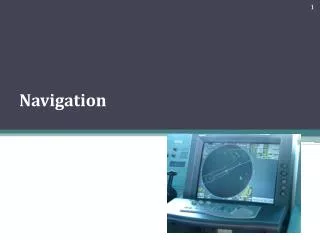
Navigation
Navigation. Done by: Salama alketbi Meera alshamsi. Dead reckoning. Dead reckoning Further information: Dead reckoning The navigator plots his 9am position, indicated by the triangle, and, using his course and speed, estimates his position at 9:30am and 10am.


Navigation
E N D
Presentation Transcript
Navigation Done by: Salama alketbi Meeraalshamsi
Dead reckoning • Dead reckoning • Further information: Dead reckoning • The navigator plots his 9am position, indicated by the triangle, and, using his course and speed, estimates his position at 9:30am and 10am. • Dead reckoning is the process of estimating present position by projecting course and speed from a known past position.[9] It is also used to predict a future position by projecting course and speed from a known present position.[9] The DR position is only an approximate position because it does not allow for the effect of leeway, current, helmsman error, compass error, or any other external influences.[9] • The navigator uses dead reckoning in many ways, such as:[9] • to determine sunrise and sunset, • to predict landfall, sighting lights and arrival times, • to evaluate the accuracy of electronic positioning information, • to predict which celestial bodies will be available for future observation.
Piloting • Further information: Pilotage • Piloting (also called pilotage) involves navigating a vessel in restricted waters and fixing its position as precisely as possible at frequent intervals. More so than in other phases of navigation, proper preparation and attention to detail are important. Procedures vary from vessel to vessel, and between military, commercial, and private vessels. • A military navigation team will nearly always consist of several people. A military navigator might have bearing takers stationed at the gyro repeaters on the bridge wings for taking simultaneous bearings, while the civilian navigator must often take and plot them himself. While the military navigator will have a bearing book and someone to record entries for each fix, the civilian navigator will simply pilot the bearings on the chart as they are taken and not record them at all.
Celestial navigation • Celestial navigation • Main article: Celestial navigation • A celestial fix will be at the intersection of two or more circles. • Celestial navigation systems are based on observation of the positions of the Sun, Moon, Planets and navigational stars. Such systems are in use as well for terrestrial navigating as for interstellar navigating. By knowing which point on the rotating earth a celestial object is above and measuring its height above the observer's horizon, the navigator can determine his distance from that subpoint.
Day's work in navigation • Day's work in navigation • The Day's work in navigation is a minimal set of tasks consistent with prudent navigation. The definition will vary on military and civilian vessels, and from ship to ship, but takes a form resembling:[19] • 1-Maintaincontinuous dead reckoning plot. • 2-Take two or more star observations at morning twilight for a celestial fix. (prudent to observe 6 stars) • 3-Morning sun observation. Can be taken on or near prime vertical for longitude, or at any time for a line of position. • 4-Determine compass error by azimuth observation of the sun.
5- Computation of the interval to noon, watch time of local apparent noon, and constants for meridian or ex-meridian sights. • 6- Noontime meridian or ex-meridian observation of the sun for noon latitude line. Running fix or cross with Venus line for noon fix. • 7- Noontime determination the day's run and day's set and drift. • 8- At least one afternoon sun line, in case the stars are not visible at twilight. • 9- Determine compass error by azimuth observation of the sun. • 10- Take two or more star observations at evening twilight for a celestial fix. (prudent to observe 6 stars)