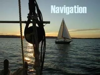
Navigation
180 likes | 279 Vues
Explore the ancient art of celestial navigation, from using stars to GPS technology. Learn about the North Star, sextants, LORAN-C, and GPS receivers for accurate position tracking on land and sea.

Navigation
E N D
Presentation Transcript
SAD JOKE • Dead ahead, through the pitch-black night, the captain sees a light on a collision course with his ship. He sends a signal: "Change your course ten degrees east." "Change yours ten degrees west," comes the reply.The captain responds, "I'm a United States Navy captain! Change your course, sir!" "I'm a seaman second class," the next message reads. "Change your course, sir."The captain is furious. "I'm a battleship! I'm not changing course!""I'm a lighthouse. Your call."
How do we know where we are? X You are here. Huh?
When people first started going out in boats they tended to stay close to shore so they could use landmarks to guide them.
As people ventured further (the Hawaiians 3000BC could travel over 1000km between islands) they needed to find other landmarks so they turned to the stars.
Celestial navigation • The pattern of stars and planets seen from Earth are constant in space. The celestial sphere. • It is useful to be able to precisely specify positions on the celestial sphere.
The North Celestial Pole is the point on the celestial sphere directly above the Earth's North Pole.Similarly, the South Celestial Pole is directly above the Earth's South Pole. • The star Polaris, in the constellation Ursa Minor, is located very close to the North Celestial Pole.Polaris is therefore also called the North Star.
Tools of the trade… • Sexton: measures the angle between celestial bodies and the Earth to determine position. • Compass: Point to magnetic North, so you can follow a course by knowing our position in relation to North. • Loran C: radio transmissions from set positions on the surface of the Earth, that triangulate to give you a position. • GPS: is a worldwide radio-navigation system formed from a constellation of 24 satellites and their ground stations.
Sexton • a device that measures the angle between two objects. It uses the position of stars to find latitude & longitude.
Loran C • LORAN-C was originally developed to provide radio-navigation service for U.S. coastal waters and later all of the continental U.S. • Twenty-four U.S. LORAN-C stations work in partnership with Canadian and Russian stations to provide coverage in Canadian waters and in the Bering Sea. • LORAN-C provides better than 0.25 nautical mile absolute accuracy. • Loran-C is a low frequency/long wave electronic position fixing system using radio signals transmissions @ 100 KHz from 3 or more transmitters, linked in a chain. It gives a latitude and longitude readout position to marine, aero and land receivers.
The Global Positioning System (GPS) • The GPS is a worldwide radio-navigation system formed from a constellation of 24 satellites and their ground stations. • GPS uses these "man-made stars" as reference points to calculate positions accurate to a matter of meters (or better than a centimeter in advanced models)! • GPS receivers are becoming very economical, which makes the technology accessible to virtually everyone. • These days GPS is finding its way into cars, boats, planes, construction equipment, movie making gear, farm machinery, balloons, and even laptop computers.