Download
1 / 36
360 likes | 536 Vues
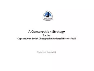
A Conservation Strategy f or the Captain John Smith Chesapeake National Historic Trail Working Draft - March 16, 2012. I. Introduction. Session Objectives To Present: An overview of the conservation s trategy How we identify resource focus areas

E N D
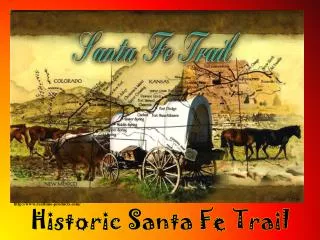
A Conservation Strategy for the Captain John Smith Chesapeake National Historic Trail Working Draft - March 16, 2012
I. Introduction • Session Objectives • To Present: • An overview of the conservation strategy • How we identify resource focus areas • How focus areas would guide conservation initiatives • To Get Your Feedback on: • The overall approach • How the resource focus areas fit with your work • Implementation
Purpose of the Plan The Strategy’s Main Purposes Identify trail resources contributing to desired trail experiences. Provide a consistent approach for assessing trail resources and their conservation needs. Encourage local, state and federal partners to protect trail resources as a core part of broader land conservation efforts. Provide guidelines for when National Park Service could provide financial or technical assistance to its trail partners and participate in acquiring conservation easements or lands in fee-interest.
The Importance of Partnerships Program Goals George Washington Maryland Conservation Program A Joint Venture of George Washington’s Mount Vernon Estate and the Accokeek Foundation • Improving Land Use Plans and Regulations • Participating in the Development Review Process • Assisting Key Landowners • Supporting New Initiatives of the National Park Service • Building the Case for Conservation
Focusing Down to Protection Priorities Entire 3,000 mile route Trail Resources CMP High Potential Segments & Sites Areas for Optimal Visitor Experiences Resource Focus Areas Conservation Priorities Conservation Results
II. Overview of the Draft Strategy What’s in the Plan? Resource Settings and the Trail Experience Trail Resources and Their Protection Status An Approach to Identifying Resource Focus Areas Developing Resource Protection Strategies A Partnership Action Model for Resource Protection Implementing the Plan
Resources Outside Trail Viewshed Indigenous Cultural Landscape Trail Viewshed Archaeological Site Visitor John Smith Trail Water Voyage Stop Access Site Not all locations are equal!
Somewhat Fragmented Relatively Intact – Large Patch Extensively Fragmented Largely Absent
Ch 2. Trail Resources & Protection Status Permanently Protected Conservation Ownership or Conservation Easement Protected to some degree by Current Regulations Examples: regulated wetlands or local zoning Relatively Unprotected Unless by Voluntary stewardship Trail Viewshed
Ch 3. Identifying Resource Focus Areas Associated with Desired Trail Experiences Different Visitor Experience Areas Boater’s Guide Itineraries Water-Based Experiences Other Water-Based Itineraries e.g., Nanticoke River water trails Road and Trail Itineraries e.g., John Smith Adventure Routes Land-Based Experiences *Protection strategies are also needed to protect archeological sites and other trail-related resources which may not be appropriate for public access Individual Site-Based Destinations
Maybe get rid of this chart? Summary chart of itineraries by route segment
A Resource Assessment Scorecard Make colors consistent with scorecard on next slide.
Applying the Scorecard to Trail Itineraries CAT POINT CREEK, RAPPAHANNOCK RIVER TWO-WAY, 12-14 MILES “Cat Point Creek, on the north bank just west of Tappahannock is best explored by skiff or runabout. It is arguably the best place on the river to see more than 10 eagles at once. It is full of life, including primitive-looking longnose garfish that roll on the surface in the channels in summer, gulping air…” John Smith Boater’s Guide RMD-VOF Cat Point Creek Permanently Protected Lands Rappahannock River Valley NWR US FWS RMD-VOF Rappahannock River Valley NWR RMD-VOF Rappahannock River Valley NWR RMD-VOF RMD-VOF RMD-VOF
Ch 4. Developing Conservation Strategies Step 1 Step 2 Step 3 Step 4 Partnership Action Model Elements
Illustration - Powhatan Creek Focus Area POWHATAN CREEK, JAMES RIVER ONE-WAY, ABOUT 4MILES “Launch canoes and kayaks at the James City County soft landing to access the Powhatan Creek Blueway. Be sure to explore above the bridge as well as below. You can launch and return here, but if possible, use two vehicles or a vehicle and a bicycle to set up a shuttle between the bridge and the Jamestown Yacht Basin Marina. Be sure to visit the 400-year old baldcypress tree growing in the middle of creek about 100 yards below the bridge. If you visit in late summer, you’ll see acres of wild rice ripening in the upper marshes.” John Smith Boater’s Guide James City County Park 400-Year Baldcypress Area of Primary Interest Jamestown Yacht Basin
Ch 5. A Partnership Action Model Specific Conservation Strategies Private Land Stewardship Providing Trail Experiences Strategic Conservation Plans Compatible Development Monitoring Progress Promoting the Trail’s Recognition Permanent Protection
Ch 6. Implementing the Plan Will be Covered in More Detail at End
III. Resource Focus Areas • Purpose: Review approach to identifying and evaluating resource focus areas and engage members in a discussion of the draft results • How do these priority focus areas match up with conservation priorities your organization wants to address? • Where are the five most important areas we should focus on first to identify land conservation opportunities? Not worth big investment of time Placeholder
Focusing Down to Protection Priorities Entire 3,000 mile route Trail Resources CMP High Potential Segments & Sites Areas for Optimal Visitor Experiences Resource Focus Areas Conservation Priorities Conservation Results
Quality Visitor Experience = Evocative Landscape + Access + Good Story
Resource Focus Area Categories Still have qualms about this on this chart Needs Formatting
Conservation Investment Guidelines Category 1 Itinerary-related focus areas associated with high potential routes or sites, with relatively intact or somewhat fragmented landscapes, having partial or no permanent protection Conservation Investment Considerations These areas generally represent the highest priority for trail-related conservation investments in that their landscapes have relatively high integrity but lack permanent protection. Category 2 Itinerary-related focus areas associated with high potential routes or sites, with relatively intact or somewhat fragmented landscapes, already relatively protected Conservation Investment Considerations Conservation investments may be warranted in circumstances such as: (1) protecting remaining key parcels and (2) converting lands under conservation easement to conservation ownership. Category 3 Itinerary-related focus areas associated with high potential routes or sites, with extensively fragmented landscapes having partial or no permanent protection Conservation Investment Considerations These areas may warrant selective investments in sites offering relatively specific interpretive opportunities or public access to the trail. Category 4 Itinerary-related areas occurring outside of currently designated high potential routes and sites, which could become recognized as focus areas at such time they meet criteria for high potential designation. Conservation Investment Considerations These areas may warrant initial investments in feasibility studies to determine their suitability for designation as high potential routes or sites. I recommend breaking this into five slides as in the example on the following slide. Still Needs Formatting and Likely Refinement of Investment Guidelines (will require two pages)
Category 1 Itineraries associated with high potential routes or sites, with relatively intact or somewhat fragmented landscapes, having partial or no permanent protection Conservation Investment Considerations: Generally represents highest priority for trail-related conservation investments as landscapes have relatively high integrity but lack permanent protection. Insert Best Example of Category
James River Resource Focus Areas Big Marsh Point Henricus & Farrar’s Island Gordons & Nettle Creek Morris Creek Powhatan Creek Jordan Pt. Herring Creek Jordan Pt. Powells Creek Hampton River Jamestown Island Nansemond Mattanock Nansemond Terracosick
Head of the Bay Resource Focus Areas Garrett Island Turkey Point Susquehanna Flats Bush River Sassafras River
Lower Eastern Shore Resource Focus Areas Janes Island Water Trails Rehobeth to Pocomoke City Smith Island Tangier Island Onancock Creek Kiptopeke State Park
Patapsco River Resource Focus Areas Baltimore Harbor Tanyard Cove
Patuxent River Resource Focus Areas Mattaponi Creek Skiffin’ to Nottingham Magruder’s Ferry & King’s Landing Battle Creek Jefferson Patterson Leonard Creek
Potomac River Resource Focus Areas Dyke Marsh Piscataway Creek and Park Mattawoman Creek Leesylvania State Park Port Tobacco River, Chapel Point Point Lookout State Park Nomini Creek, Currioman Landing Little Wicomico, Kohls Island
Rappahannock River Resource Focus Areas GoatIsland FonesCliffs Horsehead Bluffs Fones Cliffs Mt. Landing Creek Cat Point Creek Belle Isle State Park
York River Resource Focus Areas Pamunkey River West Island Poropotank River Tanyard Landing Taskinas Creek
Resource Focus Areas, Mapped by Categories 4 5 2 3 Head of Bay 1 Patapsco 2 1 Patuxent 7 1 Potomac 1 4 2 1 3 Nansemond 2 8 3 3 2 4 1 5 5 Rappahannock 2 4 3 4 1 6 4 2 5 York 6 Lower Eastern Shore 1 6 2 7 3 3 11 Categories 10 4 1 James 1 5 3 2 8 2 6 9 3 Needs to be Re-Done 4
IV Implementation Steps Anticipated plan implementation steps: Develop next segment plan(s) Identify near-term parcel specific conservation opportunities Assess additional possible focus areas (trail-wide or for specific segments) Encourage counties to recognize trail values in local planning Encourage land trusts to recognize trail resources and values. Encourage recognition of trail values in state ranking systems for acquisitions Work with federal agencies to include CAJO in protection systems/priorities Maintain database of trail-related resources and resource focus areas Further identify optimal visitor experience areas related to the trail (through segment planning , existing and ongoing heritage and conservation corridor planning , etc.)
Discussion questions: • Are there other important steps that should be included? • What is most important to move on first? • What do you need in the plan to support following up on these implementation issues? • Where and how do we get partners involved in carrying out these (and other) steps?